
MyTopo
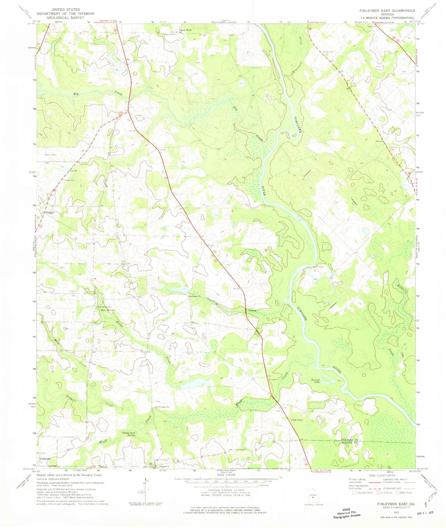
Classic USGS Finleyson East Georgia 7.5'x7.5' Topo Map
Couldn't load pickup availability
Historical USGS topographic quad map of Finleyson East in the state of Georgia. Map scale may vary for some years, but is generally around 1:24,000. Print size is approximately 24" x 27"
This quadrangle is in the following counties: Pulaski, Wilcox.
The map contains contour lines, roads, rivers, towns, and lakes. Printed on high-quality waterproof paper with UV fade-resistant inks, and shipped rolled.
Contains the following named places: Big Creek, Blue Springs, Blue Springs Church, Bluff Creek, Bluff Creek Cemetery, Buchan Family Graveyard, Cedar Creek, Cooks Chapel, Cotton Bluff, Dawson Lake, Dawson Lake Dam, Goose Neck, Hartford Division, Limestone Creek, Mosquito Creek, Pappy Jack Spring, Piney Grove Church, Pulaski County, Reedy Creek, Richland Church, Sandridge Church, Sapp Cemetery, Slade Cemetery, Standley Creek, Tenmile Creek, Treisch Lake, Union Cemetery, Wallace, Wolf Creek


