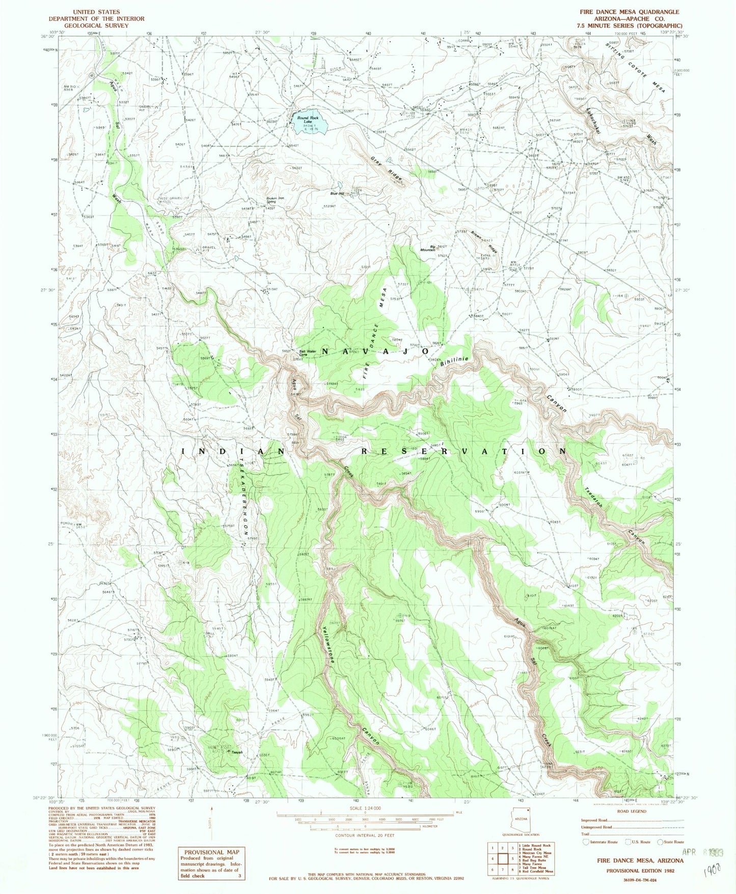
MyTopo
Classic USGS Fire Dance Mesa Arizona 7.5'x7.5' Topo Map
Regular price
$16.95
Regular price
Sale price
$16.95
Unit price
per
Couldn't load pickup availability
Historical USGS topographic quad map of Fire Dance Mesa in the state of Arizona. Map scale may vary for some years, but is generally around 1:24,000. Print size is approximately 24" x 27"
This quadrangle is in the following counties: Apache.
The map contains contour lines, roads, rivers, towns, and lakes. Printed on high-quality waterproof paper with UV fade-resistant inks, and shipped rolled.
Contains the following named places: Agua Sal Creek, Big Mountain, Bihilinie Canyon, Blue Hill, Broken Iron Spring, Brown Ridge, Gray Ridge, Owl Nest Canyon, Round Rock Dam, Round Rock Lake, Round Rock Reservoir, Salt Water Cone, Tsedatoh Canyon, Tsekadebehgon, Tseyah, Yellowstone Canyon