MyTopo
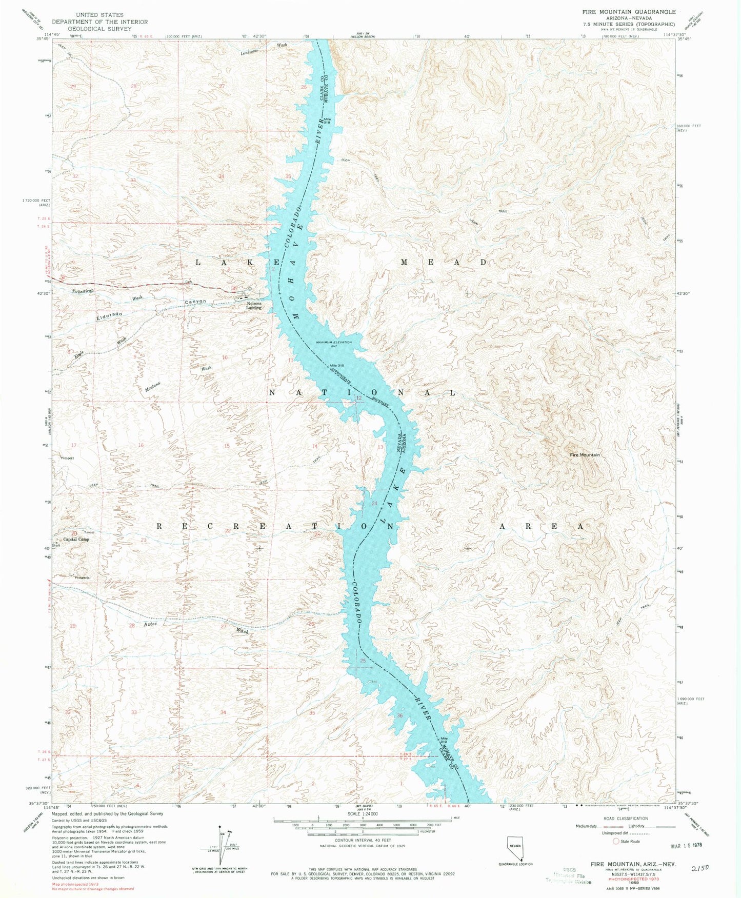
Classic USGS Fire Mountain Arizona 7.5'x7.5' Topo Map
Couldn't load pickup availability
Historical USGS topographic quad map of Fire Mountain in the states of Arizona, Nevada. Map scale may vary for some years, but is generally around 1:24,000. Print size is approximately 24" x 27"
This quadrangle is in the following counties: Clark, Mohave.
The map contains contour lines, roads, rivers, towns, and lakes. Printed on high-quality waterproof paper with UV fade-resistant inks, and shipped rolled.
Contains the following named places: Aurora Wash, Aztec Wash, Aztec Wash Light, Burny Cove, Capital Camp Cove, Capitol Wash, Dixie Cove, Dolly Hill Cove, Eagle Cove, Eagle Wash, Eldorado Canyon, Eldorado Canyon Post Office, Eldorado Ferry, Elephant Hill, Elizabeth J Cove, Fire Mountain, Fire Mountain Cove, Fire Mountain Light, Fortune Cove, Fox Cove, Gold Bug Cove, Lake Mead Recreation Ranger Headquarters, Liberty Cove, Lonesome Wash, Lonesome Wash Cove, Lookout Cove, Millsite Cove, Montana Wash, Morning Star Cove, Nelsons Landing, Oil Pan Cove, One Mile Light, Orion Cove, Oro Cove, Placer Cove, Plateau Cove, Pope Mine Cove, Porter Mine Cove, Power Line Wash, Red Cap Cove, Red Cloud Cove, Red Tail Cove, Roadrunner Cove, Russian Cove, Techatticup Cove, Techatticup Wash, Tornado Cove, Tule Wash Cove, Two Rocks, Waterspout Cove