MyTopo
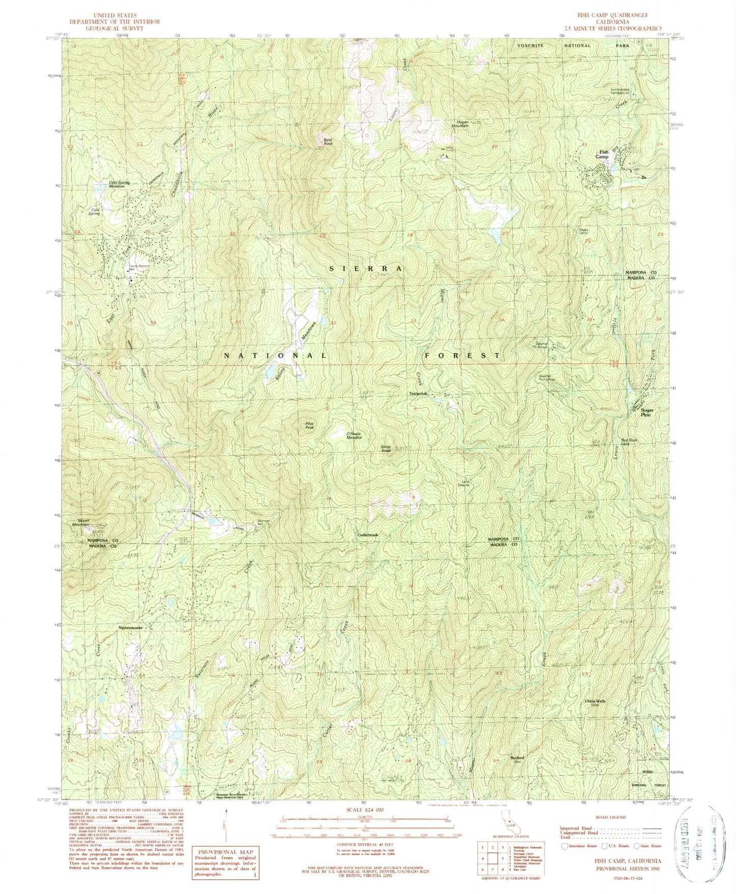
Classic USGS Fish Camp California 7.5'x7.5' Topo Map
Couldn't load pickup availability
Historical USGS topographic quad map of Fish Camp in the state of California. Typical map scale is 1:24,000, but may vary for certain years, if available. Print size: 24" x 27"
This quadrangle is in the following counties: Madera, Mariposa.
The map contains contour lines, roads, rivers, towns, and lakes. Printed on high-quality waterproof paper with UV fade-resistant inks, and shipped rolled.
Contains the following named places: Red Rock Falls, Cedarbrook, Harris Ranch Mill, Worman Mill, Yosemite Mountain Sugar Pine Historical Railroad, Bald Rock, Burford, China Wells, Cold Spring, Cold Spring Meadow, Cunningham School (historical), Fish Camp, Happy Camp, Harris Ranch (historical), Hogan Mountain, Lone Sequoia Campground, Miami Mountain, Pilot Peak, Silver Knob, O'Neals Meadow, Summerdale Campground, Miami Mountain Lookout, Batterson Station, Timberloft, Westfall Picnic Area, Ahwahnee Sanatorium, Nipinnawasee, Sugar Pine, KAAT-FM (Oakhurst), Fish Camp Post Office, Sonny Meadows, Westfall Station, Ponderosa Basin, Fish Camp Census Designated Place, Mariposa County Fire Department Company 33 Fish Camp, Mariposa County Fire Department Company 32 Ponderosa Basin, Nipinnawasee Census Designated Place, Manzanita Airport (historical), Harris Family Cemetery