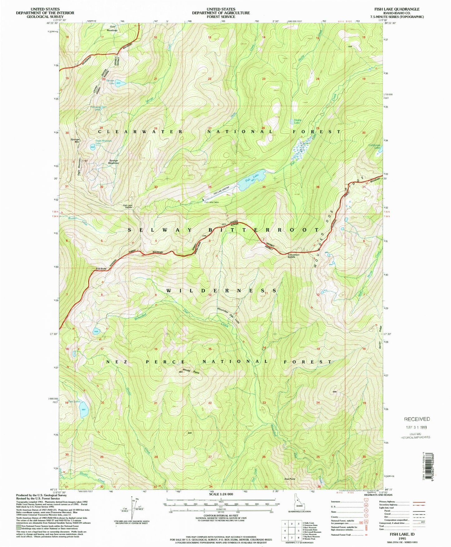
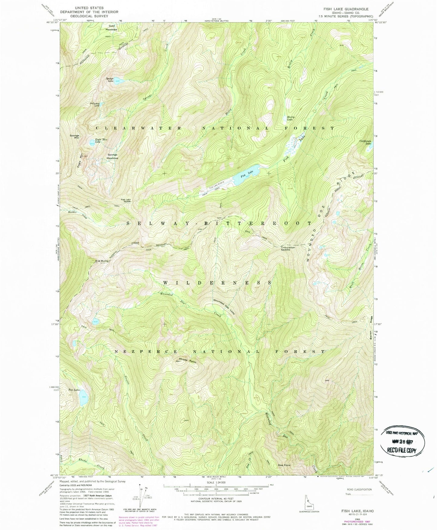
MyTopo
Classic USGS Fish Lake Idaho 7.5'x7.5' Topo Map
Couldn't load pickup availability
Historical USGS topographic quad map of Fish Lake in the state of Idaho. Typical map scale is 1:24,000, but may vary for certain years, if available. Print size: 24" x 27"
This quadrangle is in the following counties: Idaho.
The map contains contour lines, roads, rivers, towns, and lakes. Printed on high-quality waterproof paper with UV fade-resistant inks, and shipped rolled.
Contains the following named places: Fish Lake Saddle, California Lake, Doe Point, Eagle Mountain, Eagle Mountain Lake, End Butte, Fish Lake, Gold Meadows, Heslip Lake, Pollywog Lake, Rhoda Point, Sponge Lake, Sponge Meadows, Sponge Mountain, Tribulation Saddle, Wounded Doe Licks, Wounded Doe Ridge, Two Lakes Cabin, Fish Lake Cabin, Fish Lake /USFS Airport