
MyTopo
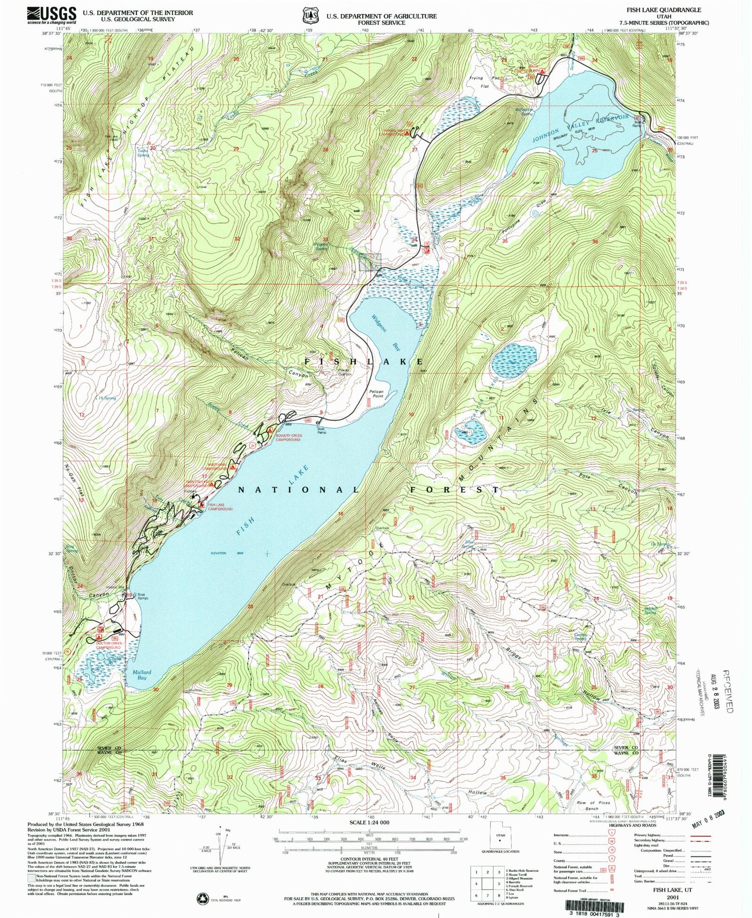
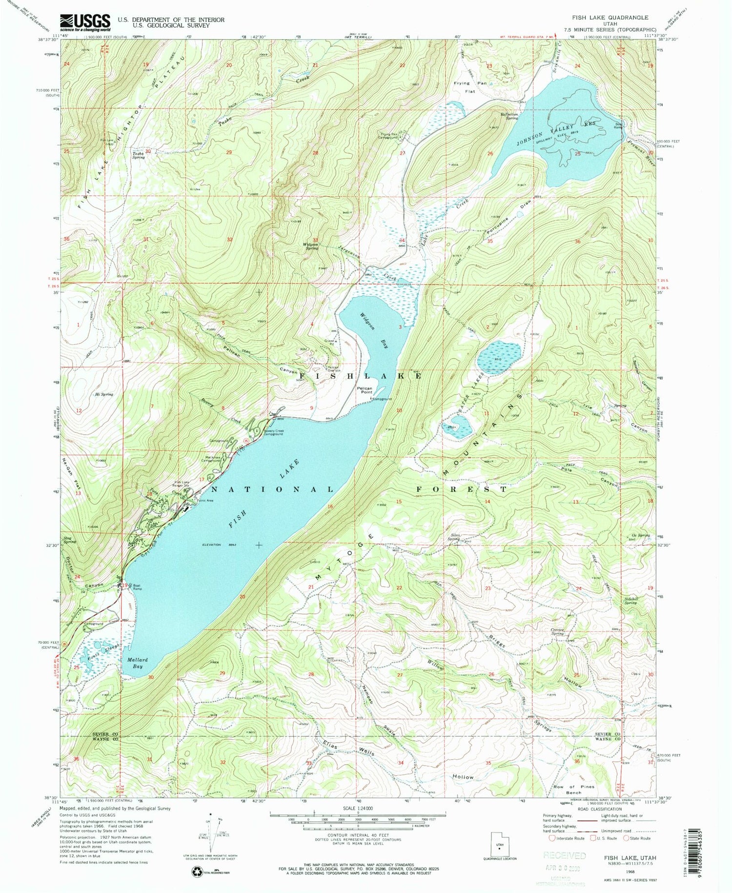
Classic USGS Fish Lake Utah 7.5'x7.5' Topo Map
Couldn't load pickup availability
Historical USGS topographic quad map of Fish Lake in the state of Utah. Typical map scale is 1:24,000, but may vary for certain years, if available. Print size: 24" x 27"
This quadrangle is in the following counties: Sevier, Wayne.
The map contains contour lines, roads, rivers, towns, and lakes. Printed on high-quality waterproof paper with UV fade-resistant inks, and shipped rolled.
Contains the following named places: Anderson Creek, Bowery Creek, Bowery Creek Campground, Briggs Hollow, Coots Slough, Crater Lakes, Crevice Spring, Doctor Canyon, Elias Wells Hollow, Fish Lake, Fish Lake Ranger Station, Frying Pan Campground, Frying Pan Flat, Hi Spring, Johnson Valley Reservoir, Jorgenson Creek, Lake Creek, Mackinaw Campground, Mallard Bay, Mytoge Mountains, Nampab Swale, Ox Spring, Pelican Canyon, Pelican Overlook, Pelican Point, Porcupine Draw, Reflection Spring, Sevenmile Creek, Sidehill Spring, Silas Spring, Tasha Spring, Twin Creek, Widgeon Bay, Widgeon Spring, Willow Springs, Johnson Valley Dam, Fish Lake Hightop Plateau, Bowery Haven Resort, Doctor Creek Campground, Doctor Creek Group Area, Doctor Creek Recreation Residences, Fish Lake Visitor Center, Fishlake Resort, Joe Bush Fisherman Parking, Johnson Reservoir Campground, Lakeside Resort, Pelican Point Campground, Piute Campground, Twin Creek Picnic Area, Aspen Heart and Lakeview Recreation Residences, Tasha Recreation Site, Bowery Group Area Recreation Site, Twin Creek Amphitheater Recreation Site, Fish Lake Lodge


