MyTopo
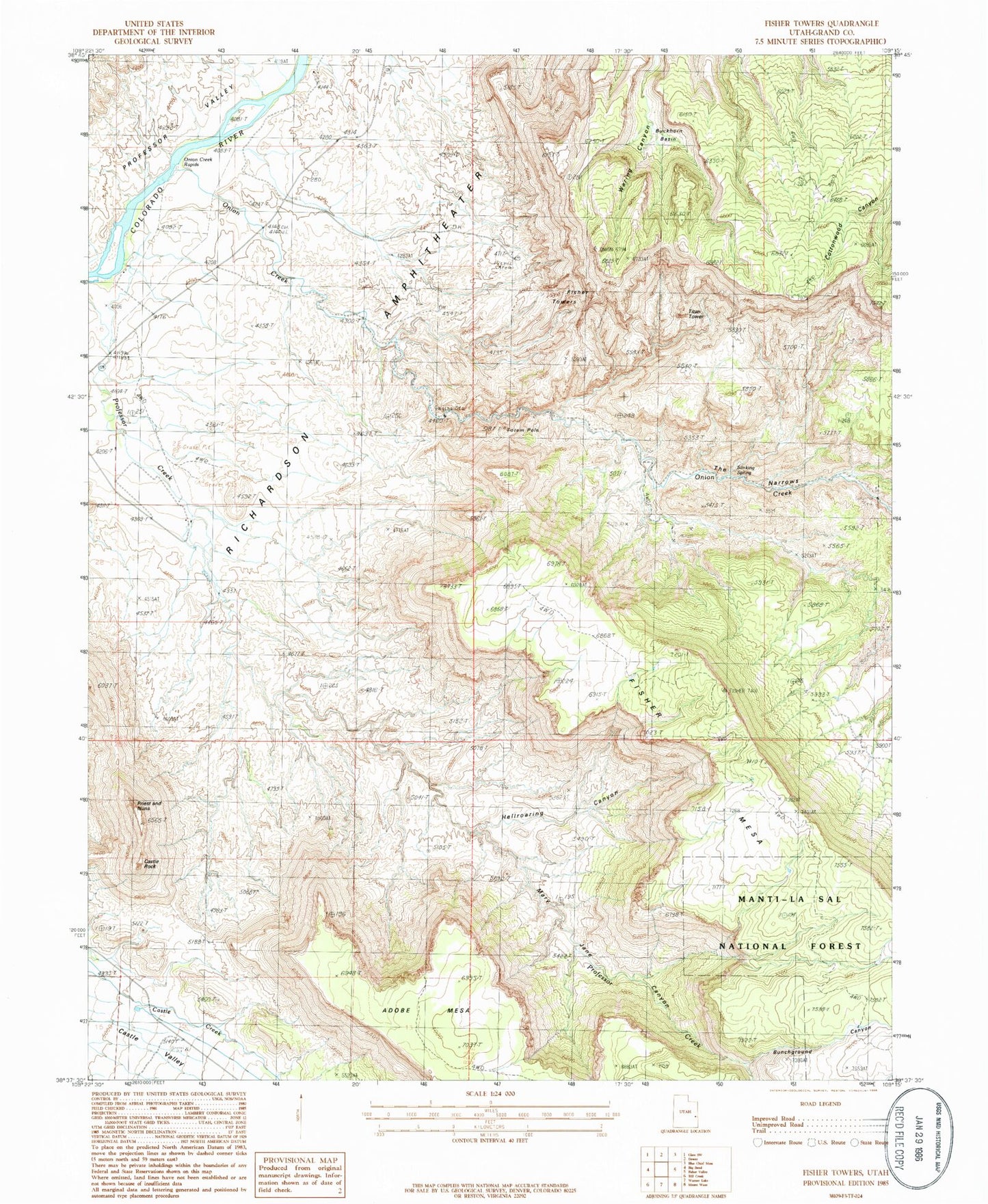
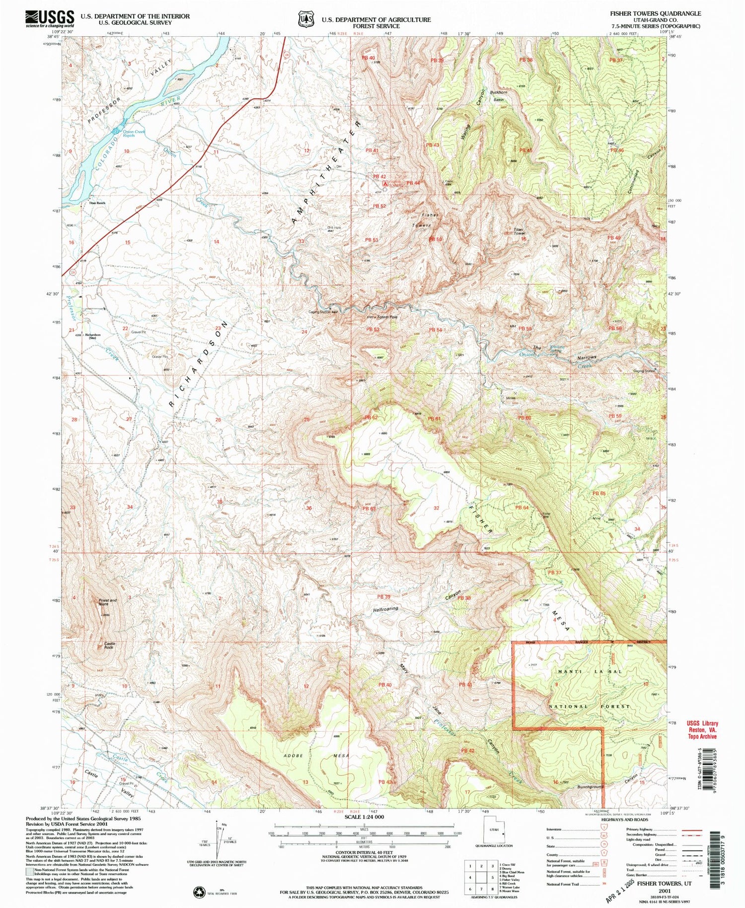
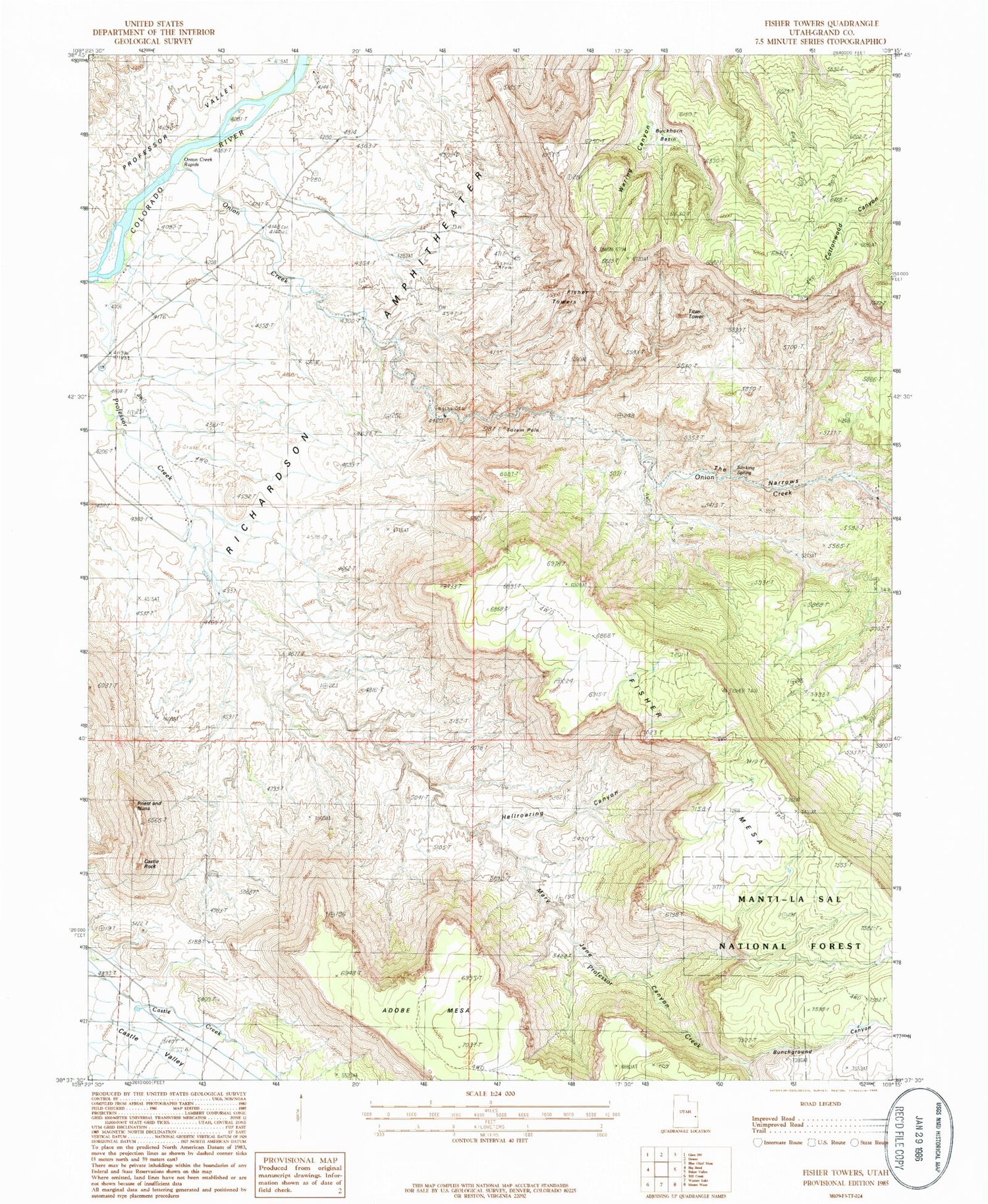
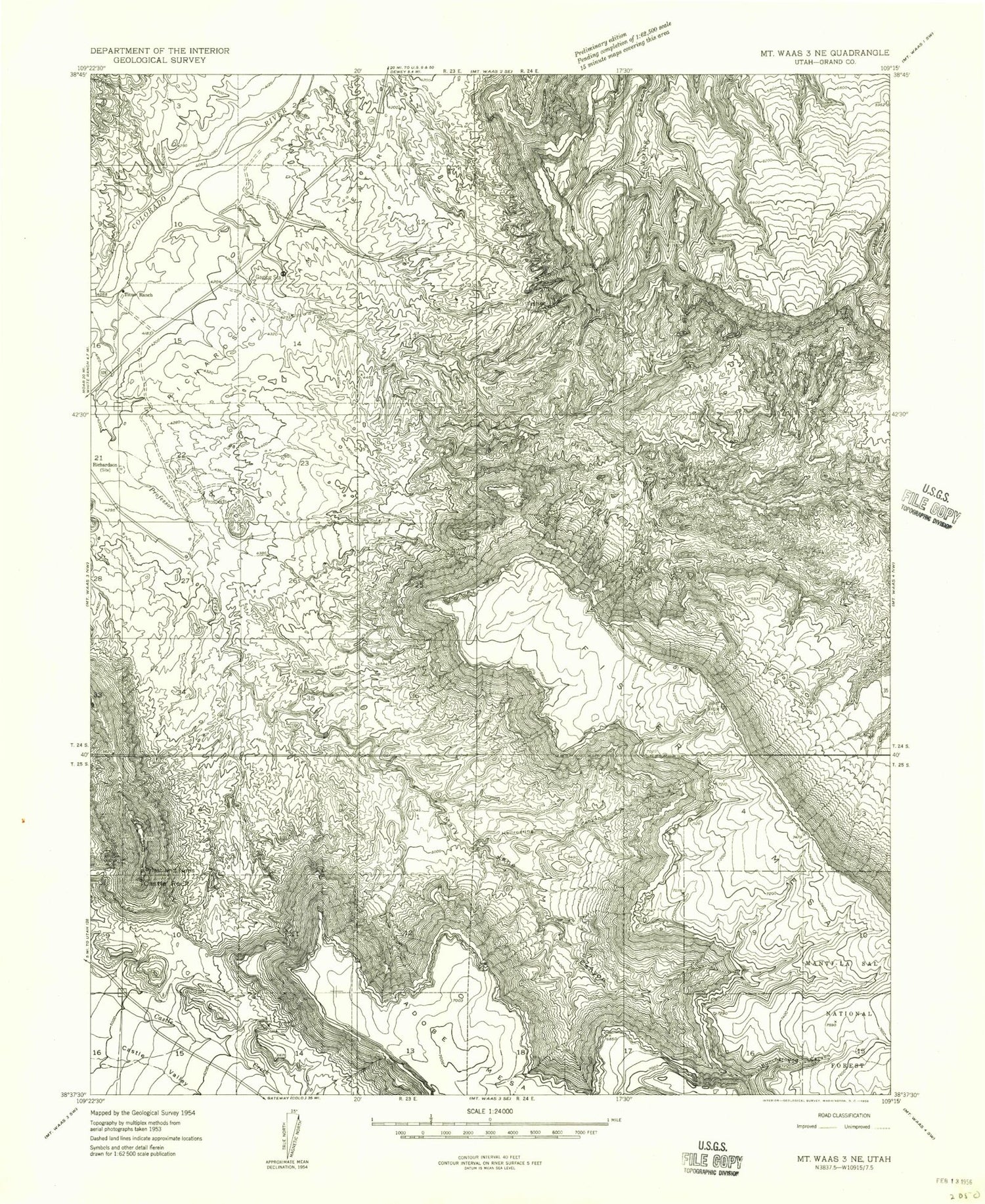
Classic USGS Fisher Towers Utah 7.5'x7.5' Topo Map
Couldn't load pickup availability
Historical USGS topographic quad map of Fisher Towers in the state of Utah. Typical map scale is 1:24,000, but may vary for certain years, if available. Print size: 24" x 27"
This quadrangle is in the following counties: Grand.
The map contains contour lines, roads, rivers, towns, and lakes. Printed on high-quality waterproof paper with UV fade-resistant inks, and shipped rolled.
Contains the following named places: Bunchground Canyon, Castle Rock, Fisher Towers, Hellroaring Canyon, Mary Jane Canyon, Onion Creek, Priest and Nuns, Richardson, Richardson Amphitheater, Titus Ranch, Buckhorn Basin, Fisher Towers Picnic Area, The Narrows, Onion Creek Rapids, Stinking Spring, Titan Tower, Totem Pole, Castle Rock/Priest and Nuns Point of Interest, Moab Division, The Titan, Bunchground Canyon, Castle Rock, Fisher Towers, Hellroaring Canyon, Mary Jane Canyon, Onion Creek, Priest and Nuns, Richardson, Richardson Amphitheater, Titus Ranch, Buckhorn Basin, Fisher Towers Picnic Area, The Narrows, Onion Creek Rapids, Stinking Spring, Titan Tower, Totem Pole, Castle Rock/Priest and Nuns Point of Interest, Moab Division, The Titan