MyTopo
Classic USGS Fishs Eddy New York 7.5'x7.5' Topo Map
Couldn't load pickup availability
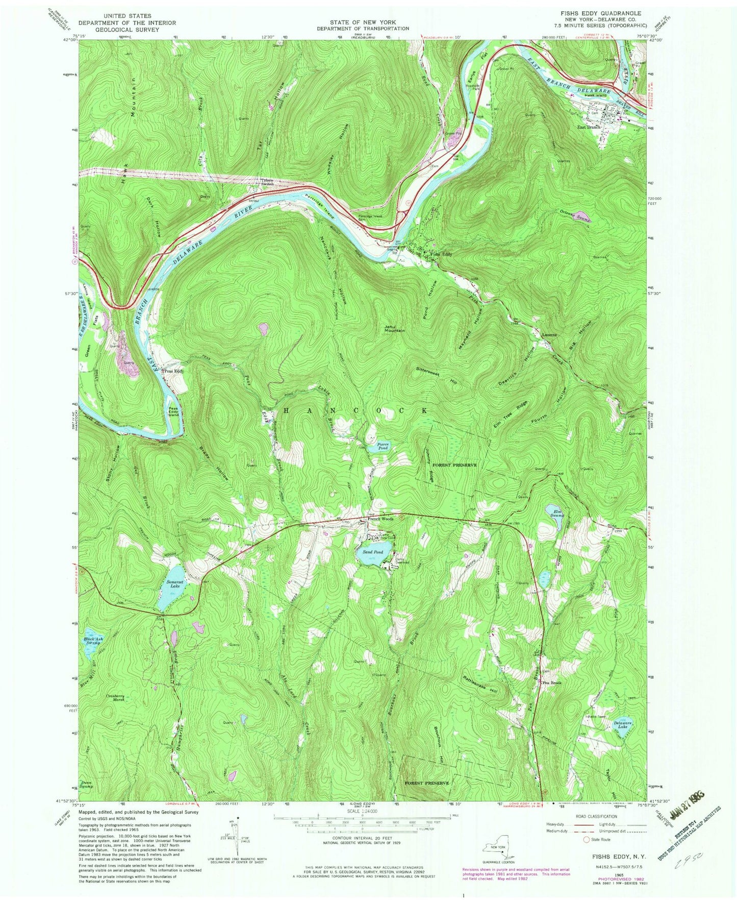
Historical USGS topographic quad map of Fishs Eddy in the state of New York. Typical map scale is 1:24,000, but may vary for certain years, if available. Print size: 24" x 27"
This quadrangle is in the following counties: Delaware.
The map contains contour lines, roads, rivers, towns, and lakes. Printed on high-quality waterproof paper with UV fade-resistant inks, and shipped rolled.
Contains the following named places: Big Hollow, Bittersweet Hill, Black Ash Swamp, Bolton Brook, Bouchoux Hill, Brady Hollow, Camp Deerhead, Camp Pine Cone, City Brook, Cranberry Marsh, Dark Hollow, Deerlick Hollow, Delaware Lake, Dunn Swamp, Earlys Flat, East Branch, Eel Weir Hollow, Elm Swamp, Elm Tree Ridge, Fish Creek, Fishs Eddy, Fourth Hollow, Gee Brook, Green Flats, Hawk Island, Hawk Mountain, Johnny Ridge, Lakin Brook, Lakins Island, Maynard Hollow, Nancokus Hollow, Orleans Swamp, Partridge Island, Partridge Island Cemetery, Peas Eddy, Peas Eddy Brook, Peas Eddy Island, Pierce Pond, Pond Hollow, Rattlesnake Hill, Read Creek, Sand Pond, Somerset Lake, Stony Hollow, Tar Hollow, Taylor Hill, Tylers Switch, Beaver Kill, Wheeler Hollow, French Woods, Luzerne, Pea Brook, Town of Hancock, Pacatacan (historical), Pea Brook Cemetery, French Woods Church Cemetery, East Branch Cemetery, Old East Branch Cemetery, Hancock Quarry, Bridge Street Bridge, Fish Eddy - Sullivan Road Bridge, French Woods Golf and Country Club, East Branch Post Office, East Branch Volunteer Fire Department, Jehu Mountain, Fishs Eddy Post Office