MyTopo
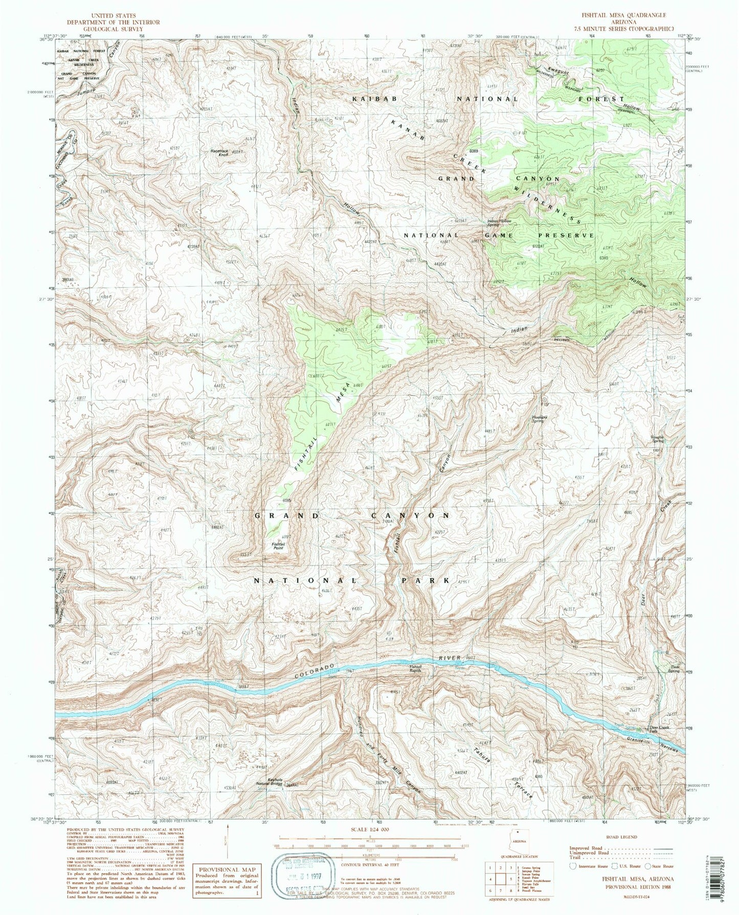
Classic USGS Fishtail Mesa Arizona 7.5'x7.5' Topo Map
Couldn't load pickup availability
Historical USGS topographic quad map of Fishtail Mesa in the state of Arizona. Typical map scale is 1:24,000, but may vary for certain years, if available. Print size: 24" x 27"
This quadrangle is in the following counties: Coconino, Mohave.
The map contains contour lines, roads, rivers, towns, and lakes. Printed on high-quality waterproof paper with UV fade-resistant inks, and shipped rolled.
Contains the following named places: Deer Creek, Deer Creek Falls, Deer Spring, Fishtail Mesa, Fishtail Canyon, Fishtail Point, Fishtail Rapids, Granite Narrows, Hundred and Forty Mile Canyon, Keyhole Natural Bridge, Little Saddle, Racetrack Knoll, Tahuta Terrace, Vaughn Spring, Hualapai Spring, Olo Mesa, Indian Hollow Spring, Doris Rapid