
MyTopo
Classic USGS Fitsum Peak Idaho 7.5'x7.5' Topo Map
Regular price
$16.95
Regular price
Sale price
$16.95
Unit price
per
Couldn't load pickup availability
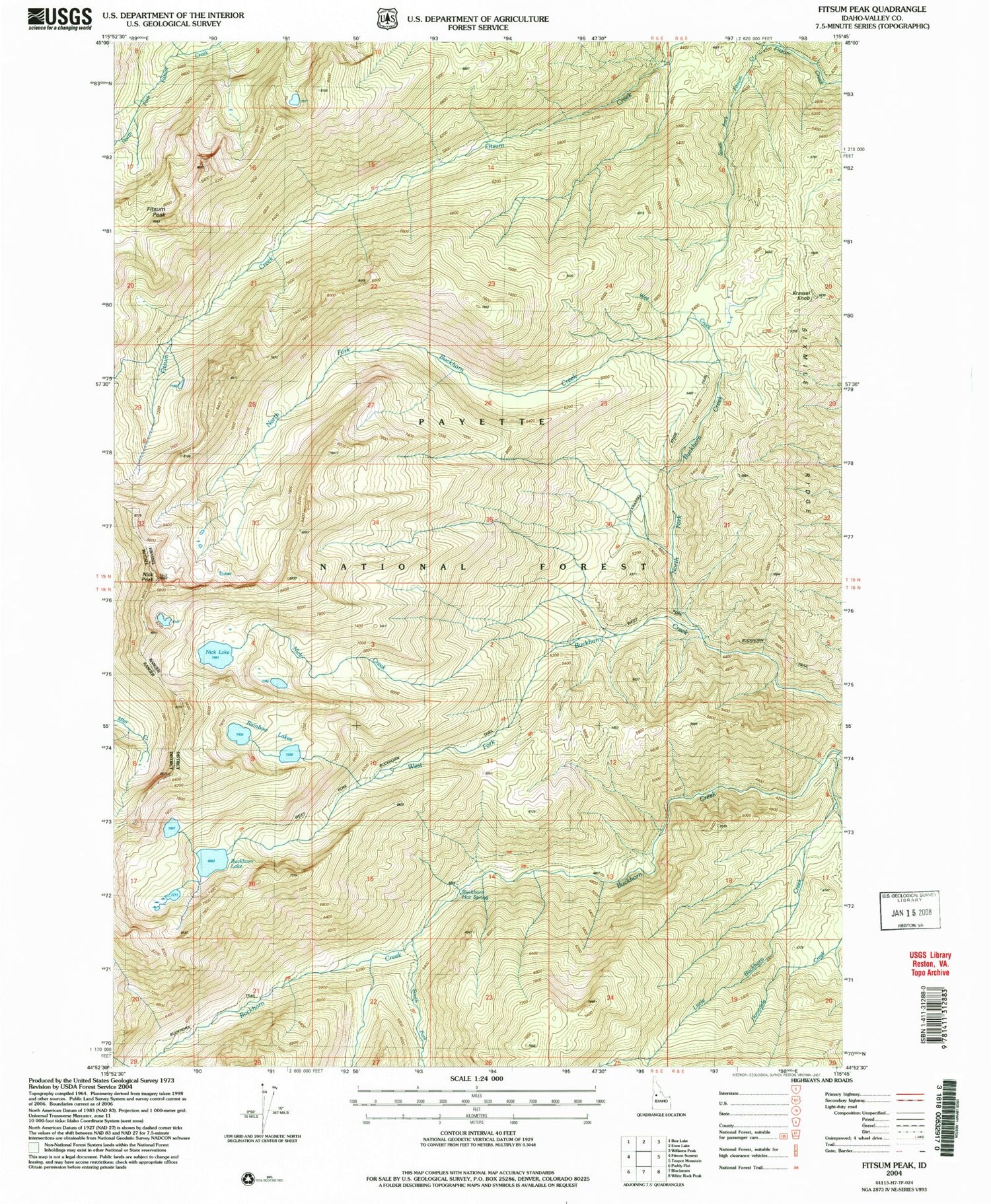
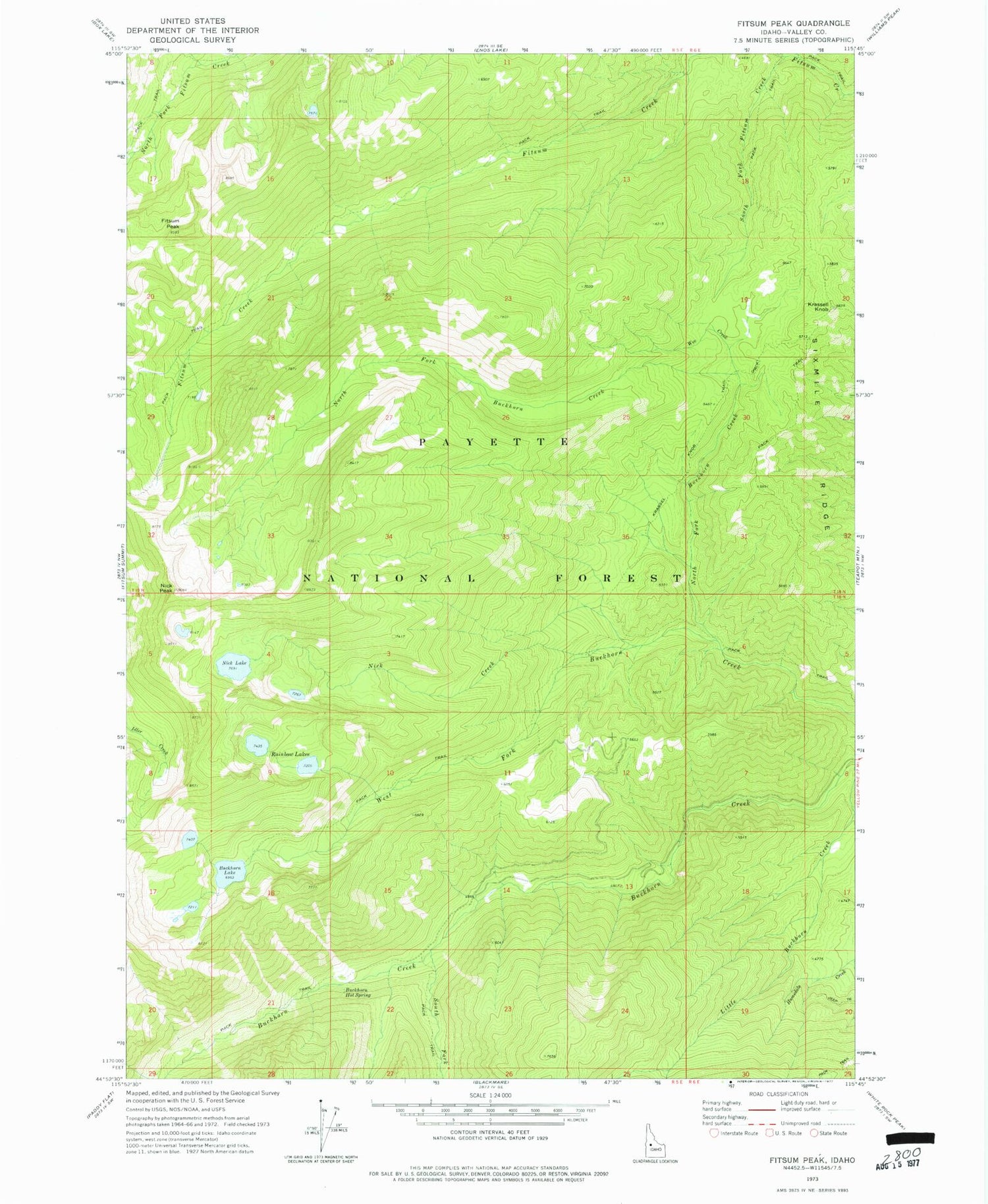
Historical USGS topographic quad map of Fitsum Peak in the state of Idaho. Typical map scale is 1:24,000, but may vary for certain years, if available. Print size: 24" x 27"
This quadrangle is in the following counties: Valley.
The map contains contour lines, roads, rivers, towns, and lakes. Printed on high-quality waterproof paper with UV fade-resistant inks, and shipped rolled.
Contains the following named places: Buckhorn Lake, Fitsum Peak, Homedale Creek, Krassell Knob, Little Buckhorn Creek, Nick Creek, Nick Peak, North Fork Buckhorn Creek, Rainbow Lakes, Sixmile Ridge, South Fork Buckhorn Creek, South Fork Fitsum Creek, Wee Creek, Buckhorn Hot Spring


