MyTopo
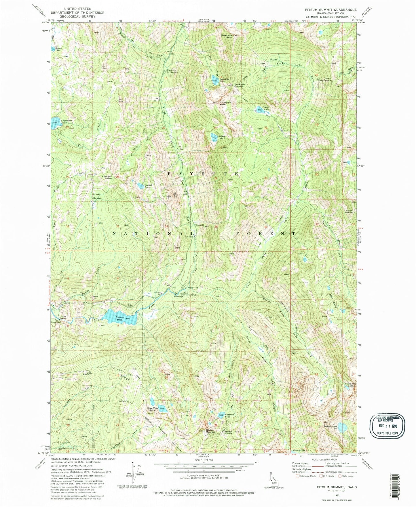
Classic USGS Fitsum Summit Idaho 7.5'x7.5' Topo Map
Couldn't load pickup availability
Historical USGS topographic quad map of Fitsum Summit in the state of Idaho. Typical map scale is 1:24,000, but may vary for certain years, if available. Print size: 24" x 27"
This quadrangle is in the following counties: Valley.
The map contains contour lines, roads, rivers, towns, and lakes. Printed on high-quality waterproof paper with UV fade-resistant inks, and shipped rolled.
Contains the following named places: Anderson Lake, Black Lee Campground, Black Lee Creek, Boulder Driveway Trail, Boulder Mountain, Boulder Summit, Buckhorn Mountain Lake, Copeland Creek, Crystal Lake, East Fork Lake Fork, Fall Creek Saddle, Fall Creek Trail, Fitsum Summit, Golden Lake, Idler Creek, Idler Lakes, Jumbo Basin, Lake Fork Forest Service Station, Maki Lake, Middle Fork Lake, Middle Fork Lake Fork, North Fork Lake Fork, Sawtooth Peak, Shaw Twin Lakes, Slick Rock, Snowslide Lake, Snowslide Peak, Snowslide Summit, South Fork Lake Fork, Twin Lakes Ridge, Lake Fork Campground, North Fitsum Summit, Browns Pond, Browns Pond Dam, Molony Dam, Molony Lake, Shaw Twins-Upper Dam, Shaw Twin Lakes Upper, McCall Division