
MyTopo
Classic USGS Fitting Nevada 7.5'x7.5' Topo Map
Couldn't load pickup availability
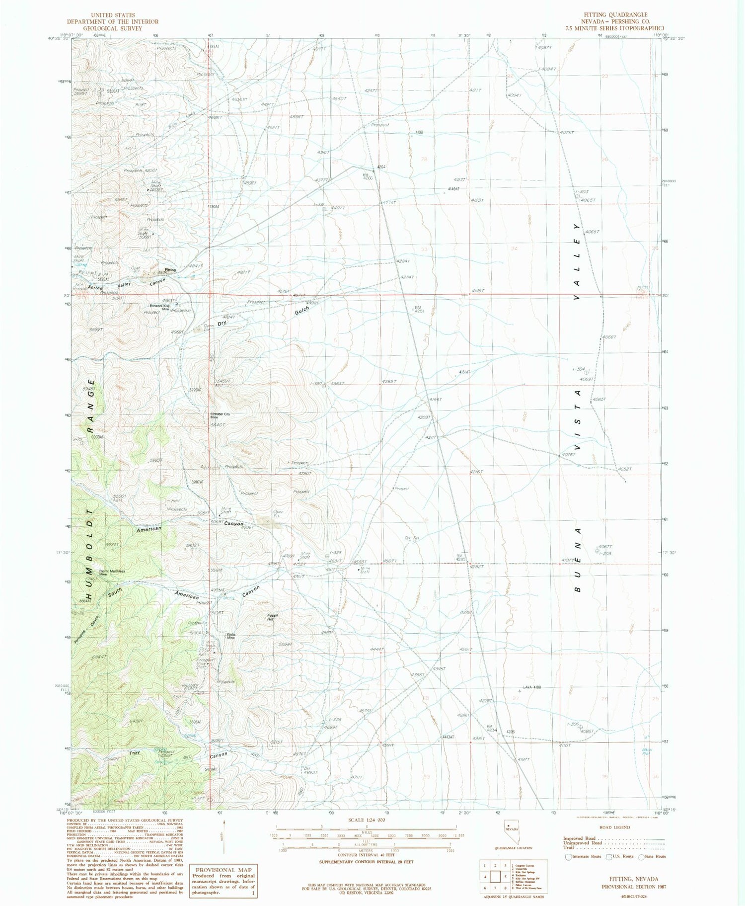
Historical USGS topographic quad map of Fitting in the state of Nevada. Map scale may vary for some years, but is generally around 1:24,000. Print size is approximately 24" x 27"
This quadrangle is in the following counties: Pershing.
The map contains contour lines, roads, rivers, towns, and lakes. Printed on high-quality waterproof paper with UV fade-resistant inks, and shipped rolled.
Contains the following named places: American Canyon, American Canyon Mines, Bonanza King Mine, Cinnabar City Mine, Dry Gulch, Dry Gulch Mines, Enterprise Mine, Fitting, Fitting Post Office, Fossil Hill, Hillside Mine, Indian Creek, Kaolinite Mine, Little Linda Mine, Pacific Matchless Mine, Pinite Mine, Porcupine Canyon, South American Canyon, South American Canyon Mines, Spring Valley Mines, Spring Valley Mining District, Stevensville, Strief Ranch, Troy Canyon, Troy Canyon Mines, Wabash Mine, Zimmershed Ranch


