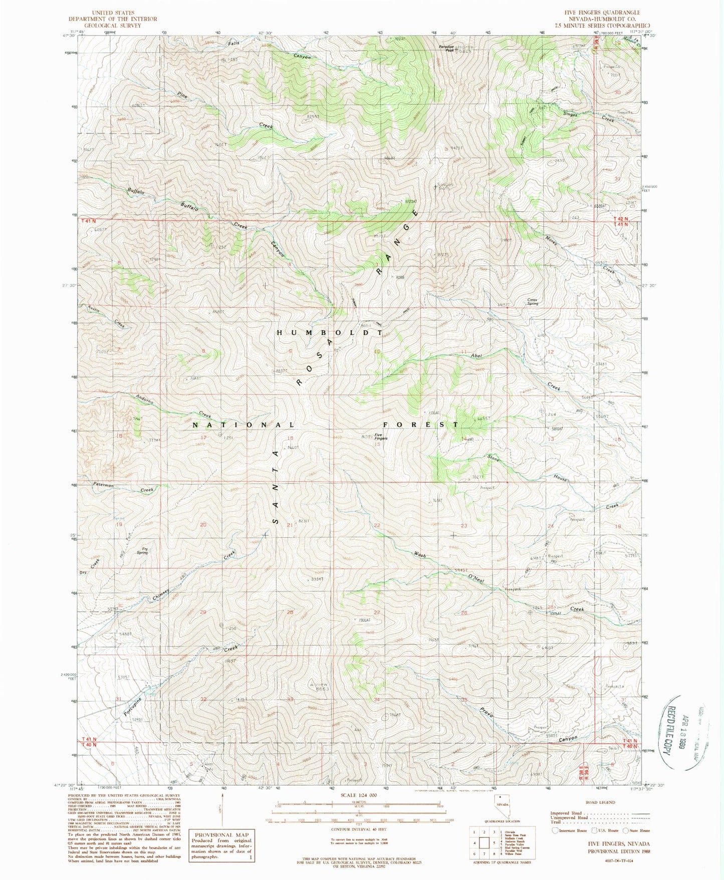
MyTopo
Classic USGS Five Fingers Nevada 7.5'x7.5' Topo Map
Regular price
$16.95
Regular price
Sale price
$16.95
Unit price
per
Couldn't load pickup availability
Historical USGS topographic quad map of Five Fingers in the state of Nevada. Map scale may vary for some years, but is generally around 1:24,000. Print size is approximately 24" x 27"
This quadrangle is in the following counties: Humboldt.
The map contains contour lines, roads, rivers, towns, and lakes. Printed on high-quality waterproof paper with UV fade-resistant inks, and shipped rolled.
Contains the following named places: Carex Spring, Charleston Hill Mine, Eclipse Mine, Five Fingers, Fry Spring, Paradise Peak, Santa Rosa Range, Shon Mining District, Singas Creek Recreational Site, Summit Trail