MyTopo
Classic USGS Five Points Georgia 7.5'x7.5' Topo Map
Couldn't load pickup availability
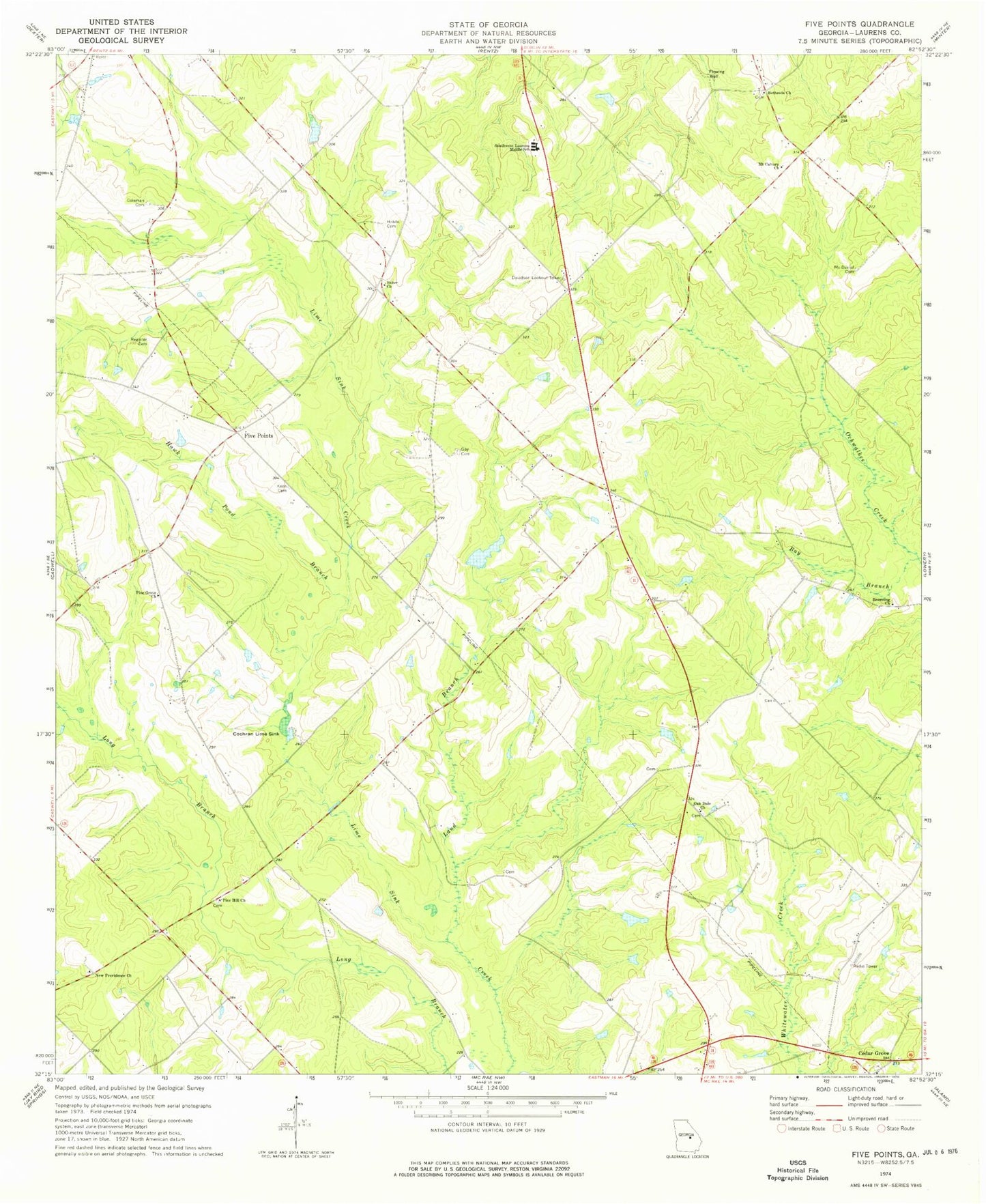
Historical USGS topographic quad map of Five Points in the state of Georgia. Map scale may vary for some years, but is generally around 1:24,000. Print size is approximately 24" x 27"
This quadrangle is in the following counties: Laurens.
The map contains contour lines, roads, rivers, towns, and lakes. Printed on high-quality waterproof paper with UV fade-resistant inks, and shipped rolled.
Contains the following named places: Baker Church, Baker School, Bay Branch, Bedingfield Lake, Bedingfield Lake Dam, Bethesda Church, Big Branch, Browning Church, Cedar Grove, Cedar Grove Church, Cochran Lime Sink, Coleman Cemetery, Cross Church, Currie Lake, Currie Lake Dam, Davidson Lookout Tower, Evans School, Five Points, Gay Cemetery, Gay Pond, Gay Pond Dam, Grinstead School, Hawk Pond Branch, Hobbs Cemetery, Keen Cemetery, Land Branch, Laurens County Fire Department Station 14, McDaniel Cemetery, Mount Calvary Church, New Faith Church, New Providence Church, Oak Dale Church, Oakdale School, Pine Grove Church, Pine Hill Church, Register Cemetery, Southwest Laurens Middle School, Warren Grove Church, ZIP Code: 31075