MyTopo
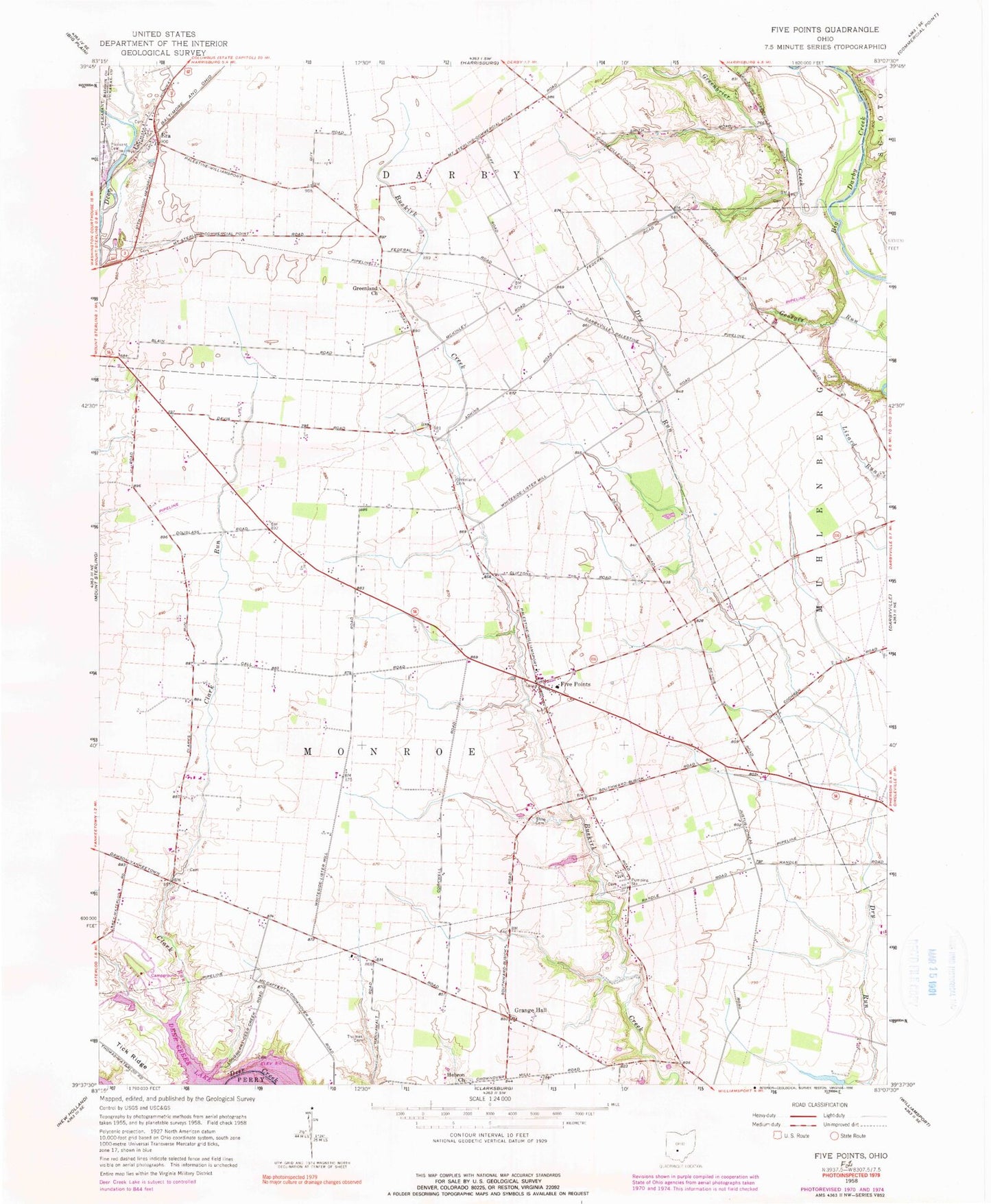
Classic USGS Five Points Ohio 7.5'x7.5' Topo Map
Couldn't load pickup availability
Historical USGS topographic quad map of Five Points in the state of Ohio. Map scale may vary for some years, but is generally around 1:24,000. Print size is approximately 24" x 27"
This quadrangle is in the following counties: Madison, Pickaway.
The map contains contour lines, roads, rivers, towns, and lakes. Printed on high-quality waterproof paper with UV fade-resistant inks, and shipped rolled.
Contains the following named places: Alkire Cemetery, Allen School, Anderson Farms, Barnes Family Farms, Clark Run, Clark Run Dam, Clark Run Lake, Curt Knisley Farm Cemetery, Dick School, Dunlap Pond Dam Number One, Dunlap Pond Number One, Era, Era Post Office, Five Points, Fivepoints Post Office, Grange Hall, Greenbrier Creek, Greenland Cemetery, Greenland Church, Greenland School, Gulicks Ford, Hebron Church, Hebron Church Cemetery, Hill School, Hobuck School, Ingman School, Keppler Ford, Larey School, Lewis Farm Cemetery, Limbs and Leaves Tree Farm, McKinley Cemetery, McKinley School, Monroe Elementary School, Opossum Run, Pickens Tree Farm, Pleasant Grove School, Rebellion School, Robison School, Rowlen School, Shilo Cemetery, Spring Valley Farm, Sun Set Mobile Home Park, Thomas Cemetery, Thomas School, Tick Ridge, Tick Ridge School, Township of Monroe, West Union Shool, White School