MyTopo
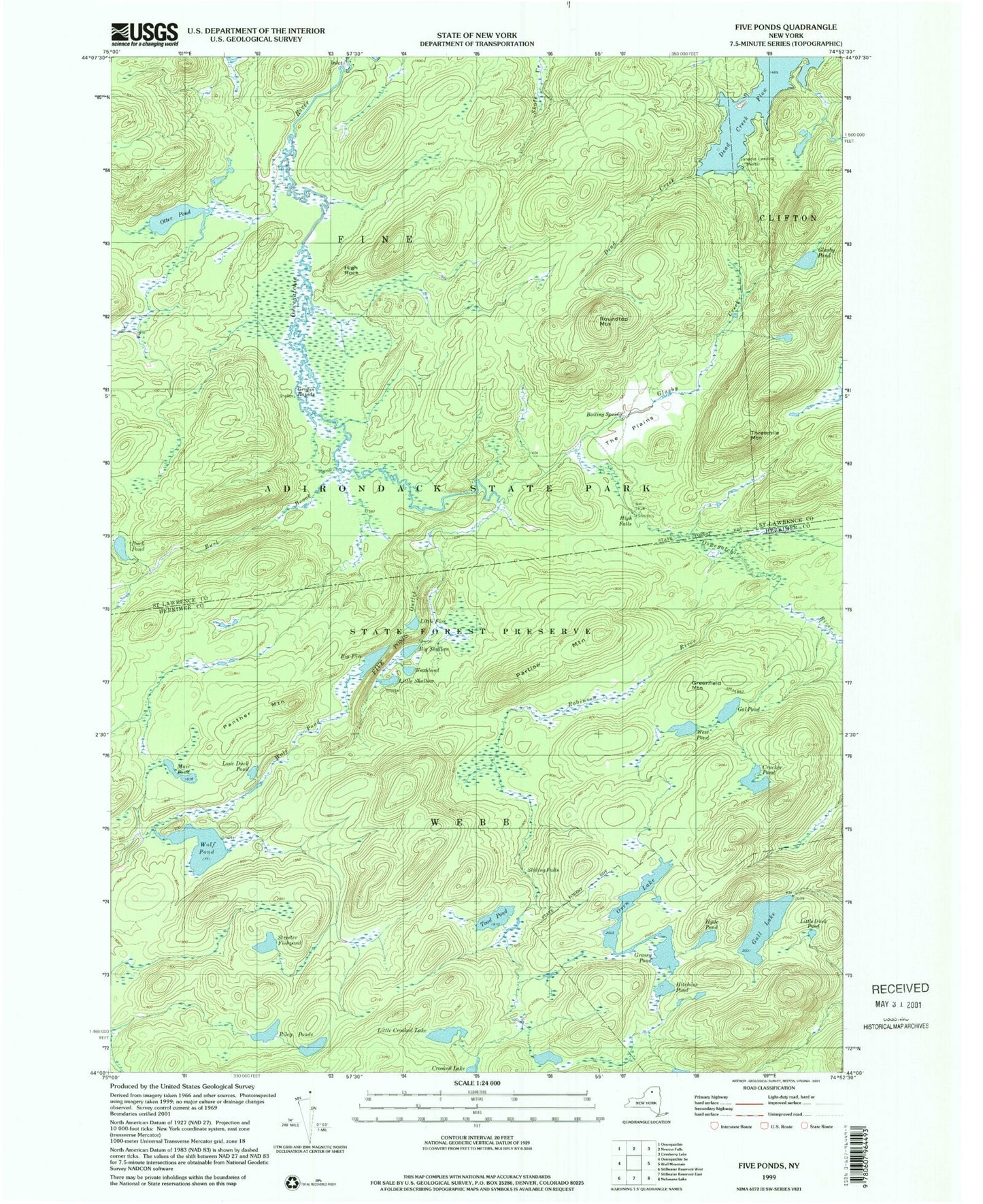
USGS Classic Five Ponds New York 7.5'x7.5' Topo Map
Couldn't load pickup availability
Historical USGS topographic quad map of Five Ponds in the state of New York. Scale: 1:24000. Print size: 24" x 27"
This quadrangle is in the following counties: Herkimer, St. Lawrence.
The map contains contour lines, roads, rivers, towns, lakes, and grids including latitude / longitude and UTM / MGRS. Printed on high-quality waterproof paper with UV fade-resistant inks.
Contains the following named places: Big Five, Big Shallow, Cracker Pond, Five Ponds, Gal Pond, Grassy Pond, Greenfield Mountain, Gull Lake, Hammer Creek, Hitchins Pond, Hyde Pond, Little Crooked Lake, Little Duck Pond, Little Five, Little Shallow, Lone Duck Pond, Muir Pond, Oven Lake, Panther Mountain, Partlow Mountain, Riley Ponds, Robinson River, Sliding Falls, Streeter Fishpond, Toad Pond, Washbowl, West Pond, Wolf Pond, Boiling Spring, Buck Brook, Buck Pond, Cage Lake Outlet, Dead Creek, Glasby Creek, Glasby Pond, Griffin Rapids, High Falls, High Rock, Inlet, Janacks Landing Shelter, Otter Pond, Roundtop Mountain, The Plains, Threemile Mountain, Dead Creek Flow, Wolf Pond Outlet