MyTopo
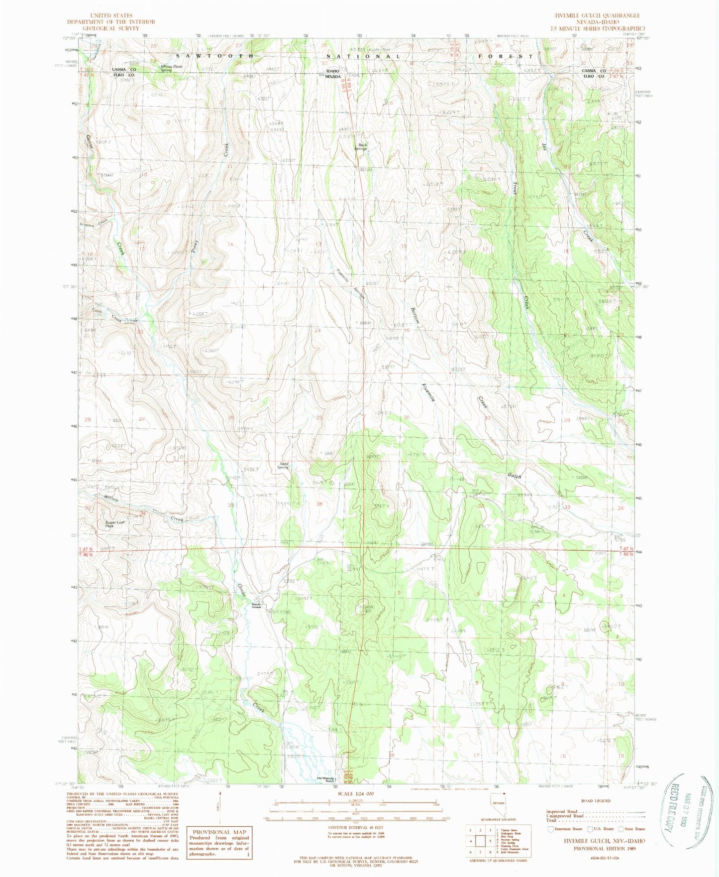
Classic USGS Fivemile Gulch Nevada 7.5'x7.5' Topo Map
Regular price
$16.95
Regular price
Sale price
$16.95
Unit price
per
Couldn't load pickup availability
Historical USGS topographic quad map of Fivemile Gulch in the states of Nevada, Idaho. Map scale may vary for some years, but is generally around 1:24,000. Print size is approximately 24" x 27"
This quadrangle is in the following counties: Cassia, Elko.
The map contains contour lines, roads, rivers, towns, and lakes. Printed on high-quality waterproof paper with UV fade-resistant inks, and shipped rolled.
Contains the following named places: Buck Springs, Coon Creek, Fivemile Springs, Goose Creek State Recreation Ground and Game Refuge, Old Winecup Ranch, Piney Creek, Rancho Grande, Sand Spring, Stratton Creek, Sugar Loaf Peak, Thoroughbred Creek, Whitey Davis Spring, Willow Creek