
MyTopo
Classic USGS Flag Mountain Alabama 7.5'x7.5' Topo Map
Couldn't load pickup availability
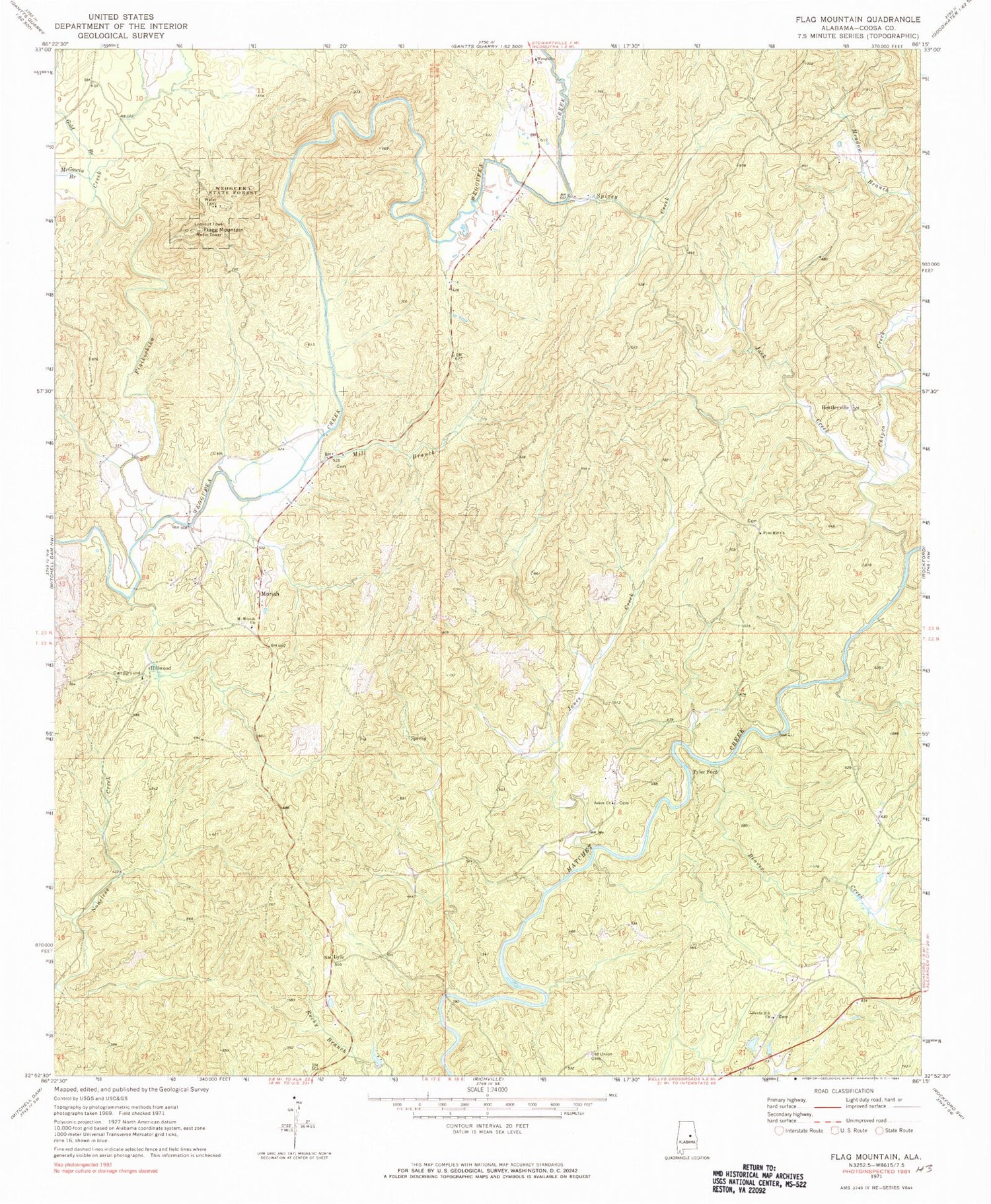
Historical USGS topographic quad map of Flag Mountain in the state of Alabama. Typical map scale is 1:24,000, but may vary for certain years, if available. Print size: 24" x 27"
This quadrangle is in the following counties: Coosa.
The map contains contour lines, roads, rivers, towns, and lakes. Printed on high-quality waterproof paper with UV fade-resistant inks, and shipped rolled.
Contains the following named places: Beaver Creek, Flag Mountain, Flint Hill Church, Gold Branch, Jones Creek, McCutchen Branch, McGowin Branch, Mill Branch, Moriah, Old Union Cemetery, Salem Church, Spivey Creek, Weogufka State Forest, Bell Rattle Cemetery, Flint Hill Cemetery, Hatchett Creek Hunting Club, Island Ford, Liberty Hill Cemetery, Mount Moriah Cemetery, Old Mount Moriah Cemetery, Scott Ford, Weogufka Cemetery, Liberty Hill Primitive Baptist Church, Mount Moriah Baptist Church, Weogufka First Baptist Church, Bentleyville, Hillwood, Lyle, Tyler Ford, Cowart Number One Mine, Cowart Number Two Mine, Pond Mine, Seminole Mine, Weogufka (historical), Weogufka Mountains, Finikochika Creek, Jack Creek, Chipco Creek, Mill Creek, Hatchet Vent Mine, Flag Mountain Lookout Tower, O J Mooney Family Cemetery, Salem Cemetery


