MyTopo
Classic USGS Flag Point Oregon 7.5'x7.5' Topo Map
Couldn't load pickup availability
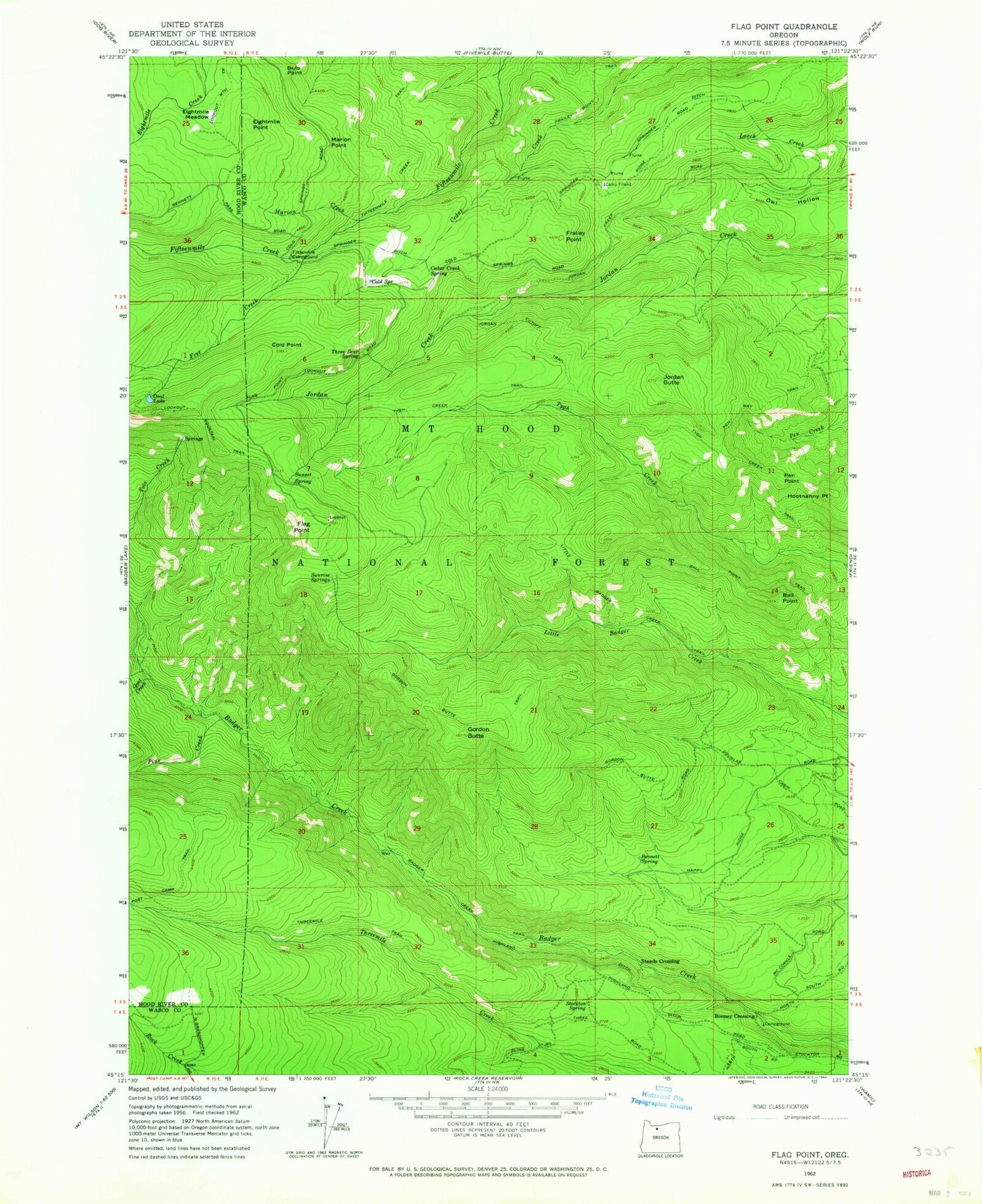
Historical USGS topographic quad map of Flag Point in the state of Oregon. Typical map scale is 1:24,000, but may vary for certain years, if available. Print size: 24" x 27"
This quadrangle is in the following counties: Hood River, Wasco.
The map contains contour lines, roads, rivers, towns, and lakes. Printed on high-quality waterproof paper with UV fade-resistant inks, and shipped rolled.
Contains the following named places: Badger Creek Trail, Ball Point, Ball Point Trail, Bennett Spring, Bonney Crossing, Bulo Point, Camp Friend, Cedar Creek Spring, Cold Point, Cold Spring, Drop Creek, Eightmile Meadow, Eightmile Point, Fifteen Mile Recreation Site, Flag Point, Frailey Point, Frailey Point Trail, Fret Creek, Goat Creek, Gordon Butte, Gordon Butte Trail, Hootnanny Point, Jordan Butte, Jordan Cutoff Trail, Little Badger Creek Trail, Marion Creek, Marion Point, Oval Lake, Pen Point, Pen Way Trail, Pine Creek, Steeds Crossing, Stockton Spring, Sunrise Springs, Sunset Spring, Three Bear Spring, Threemile Trail, Tygh Creek Trail, Springer Ridge, Denest Spring, Bird Spring, Bonney Crossing Recreation Site, Badger Creek Wilderness, Springer Ditch, Owl Quarry, Shadley Spring