
MyTopo
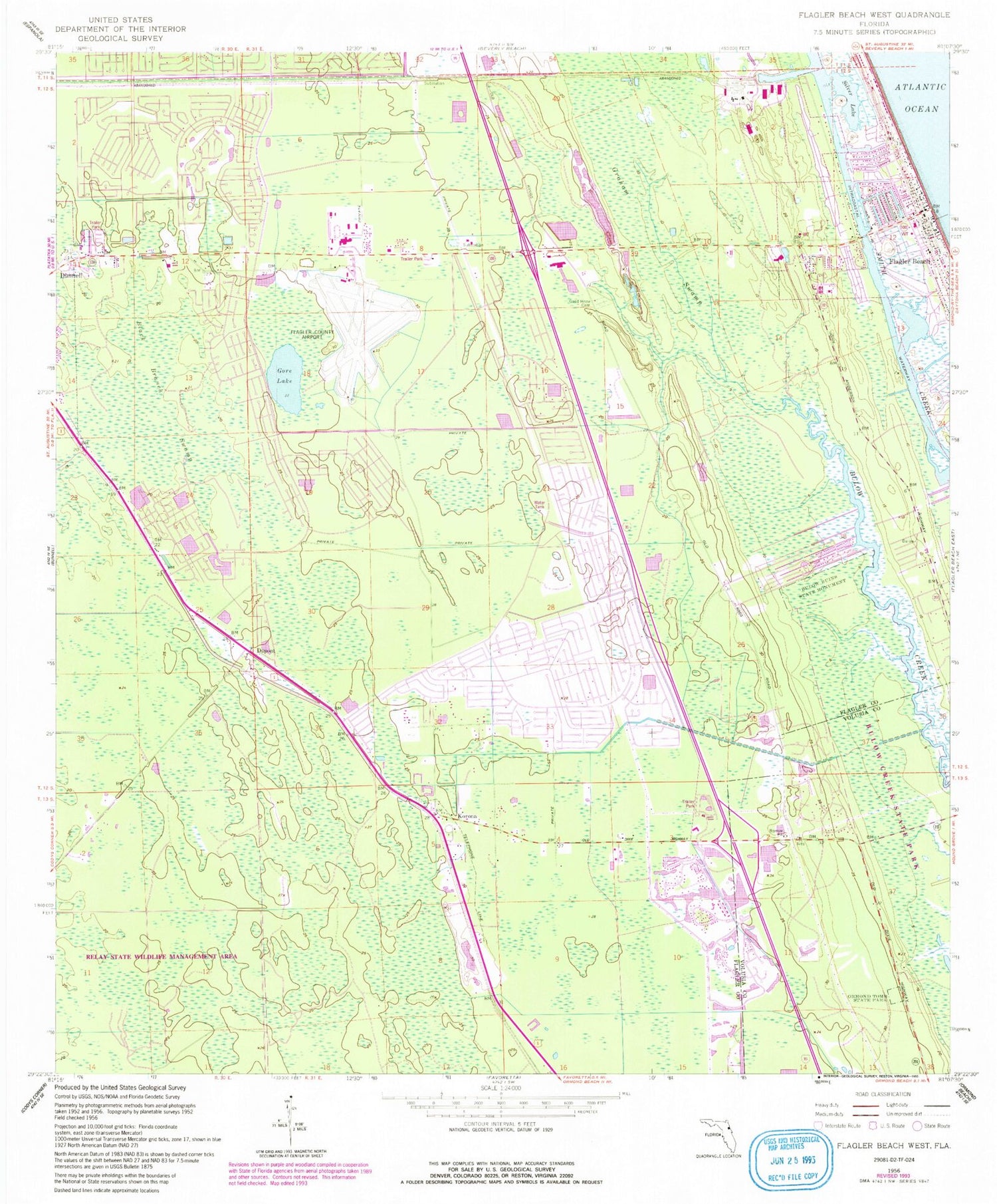
Classic USGS Flagler Beach West Florida 7.5'x7.5' Topo Map
Couldn't load pickup availability
Historical USGS topographic quad map of Flagler Beach West in the state of Florida. Map scale may vary for some years, but is generally around 1:24,000. Print size is approximately 24" x 27"
This quadrangle is in the following counties: Flagler, Volusia.
The map contains contour lines, roads, rivers, towns, and lakes. Printed on high-quality waterproof paper with UV fade-resistant inks, and shipped rolled.
Contains the following named places: Black Branch Swamp, Bulow Creek State Park, Bulow Plantation Ruins Historic State Park, Bunnell Volunteer Fire Department Station 62, Central Baptist Church of Flagler County, City of Flagler Beach, City of Flagler Beach Wastewater Treatment Plant, Dupont, First Baptist Church of Bunnell, Flagler Auditorium, Flagler Beach, Flagler Beach Fire Department Station 1, Flagler Beach Library, Flagler Beach Police Department, Flagler Beach Post Office, Flagler Beach Trailer Park, Flagler County Adult School, Flagler County Fire Department Station 92 Airport, Flagler County Fire Rescue 11, Flagler Executive Airport, Flagler-Palm Coast High School, Florida Hospital Flagler, Good Hope Cemetery, Gore Lake, J and E Ormond Grant, Korona, Korona Volunteer Fire Department Station 31, Lehigh Cement Company Lake, Ormond Tomb State Park, Palm Coast Fire Department Station 25, Palm Terrace Mobile Manor, Plantation Oaks Mobile Home Park, Praise Assembly of God Church, Robert McHardy Grant, Saint James Baptist Church, Saint Mark by the Sea Lutheran Church, Saint Marys Cemetery, Silver Lake, Volusia County Fire Services Station 16 Halifax Plantation, ZIP Code: 32136


