MyTopo
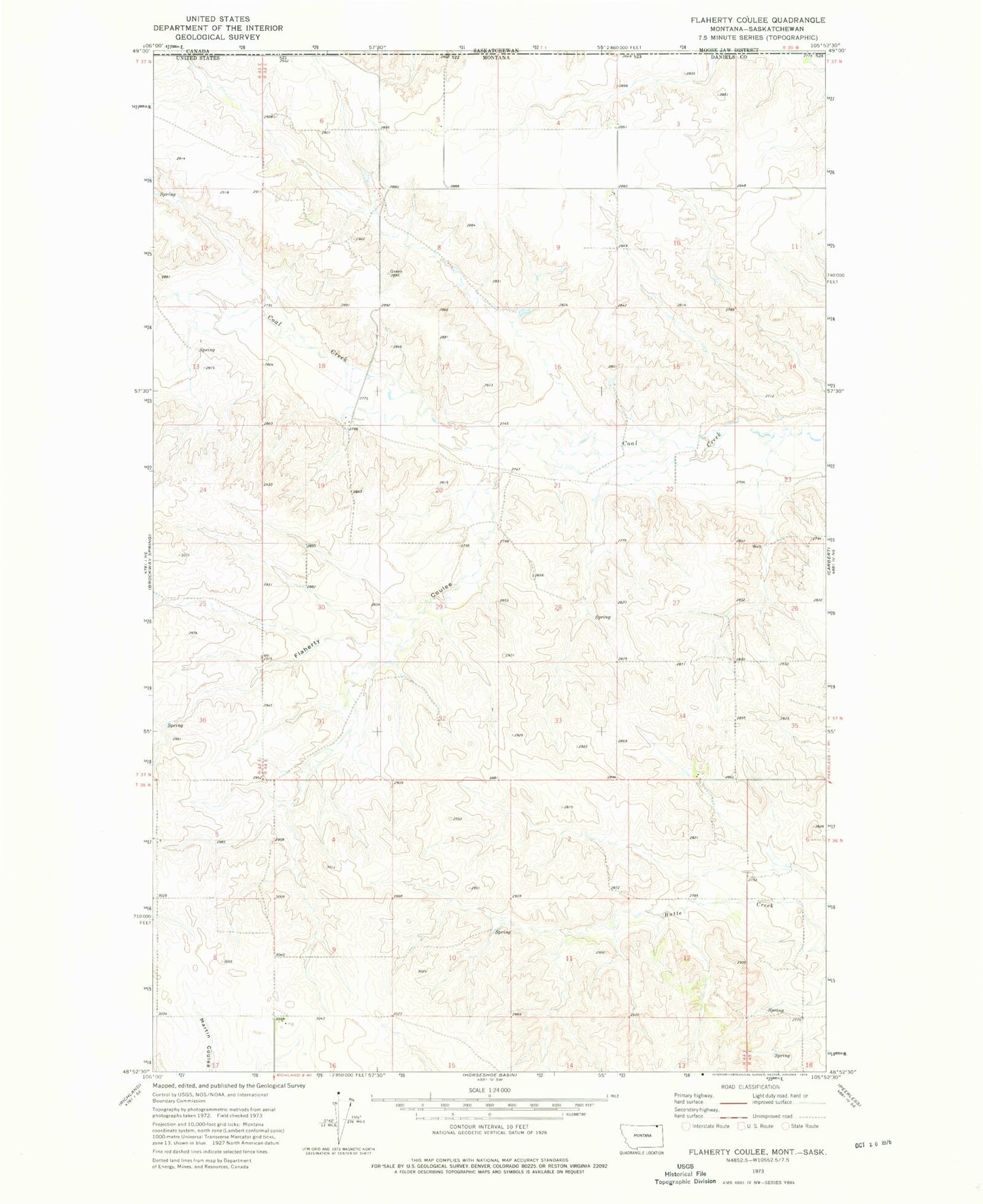
Classic USGS Flaherty Coulee Montana 7.5'x7.5' Topo Map
Couldn't load pickup availability
Historical USGS topographic quad map of Flaherty Coulee in the state of Montana. Map scale may vary for some years, but is generally around 1:24,000. Print size is approximately 24" x 27"
This quadrangle is in the following counties: Daniels.
The map contains contour lines, roads, rivers, towns, and lakes. Printed on high-quality waterproof paper with UV fade-resistant inks, and shipped rolled.
Contains the following named places: 36N44E16BBBD01 Well, 37N43E25DDDD01 Well, 37N44E03BCCB01 Well, 37N44E03CDCD01 Well, 37N44E04ADDD01 Well, 37N44E04ADDD02 Well, 37N44E04DCCD01 Well, 37N44E05ACCC01 Well, 37N44E05DBBB01 Well, 37N44E07AAAA01 Well, 37N44E08DBDB01 Well, 37N44E09AAAA01 Well, 37N44E32ADDA01 Well, Flaherty Coulee