MyTopo
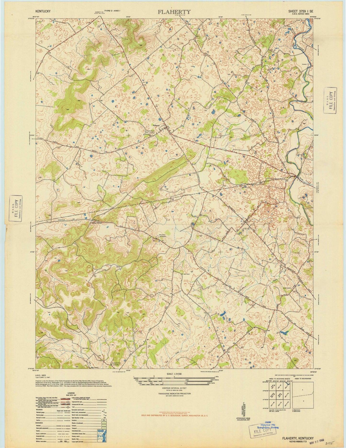
Classic USGS Flaherty Kentucky 7.5'x7.5' Topo Map
Couldn't load pickup availability
Historical USGS topographic quad map of Flaherty in the state of Kentucky. Map scale may vary for some years, but is generally around 1:24,000. Print size is approximately 24" x 27"
This quadrangle is in the following counties: Hardin, Meade.
The map contains contour lines, roads, rivers, towns, and lakes. Printed on high-quality waterproof paper with UV fade-resistant inks, and shipped rolled.
Contains the following named places: Arms Cemetery, Bee Knob Hill, Brushy Fork, Flaherty, Flaherty School, Flaherty Volunteer Fire Department Station 1, Flippin Creek, Forks of Otter Creek Cemetery, Fullove Hill, George Mason Historical Marker, Hilltop Church, Howell Methodist Church Cemetery, Hynes Cemetery, Liberty Church, Martin Cemetery, McCoy Cemetery, New Salem Church, Pleasantview Church, Radcliff Division, Saint Martins Catholic School, Sand Ridge, Swan Cemetery, Tarpley Cemetery, Yates Cemetery, ZIP Codes: 40162, 40175