MyTopo
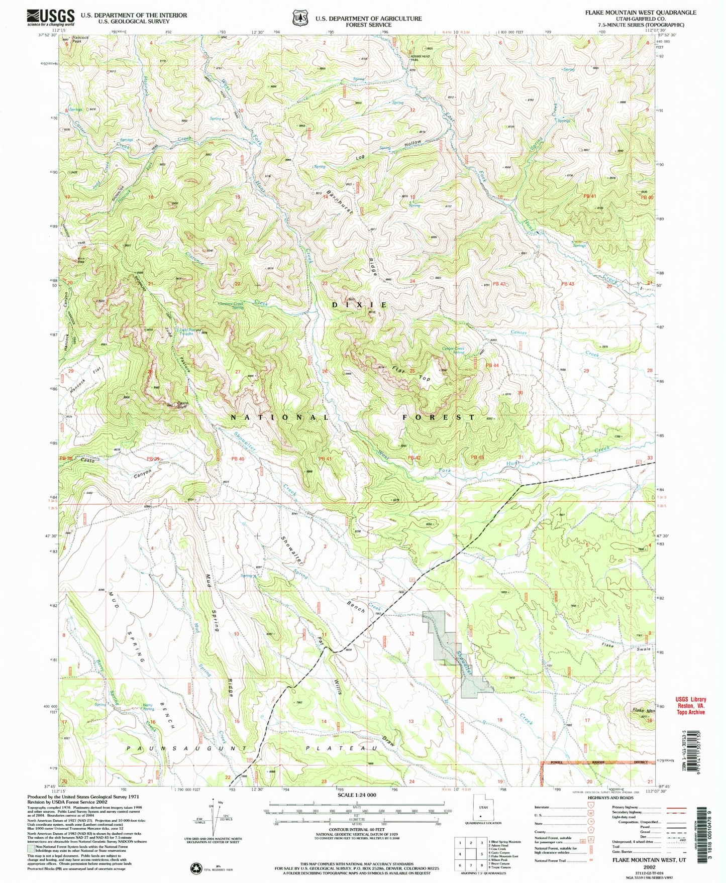
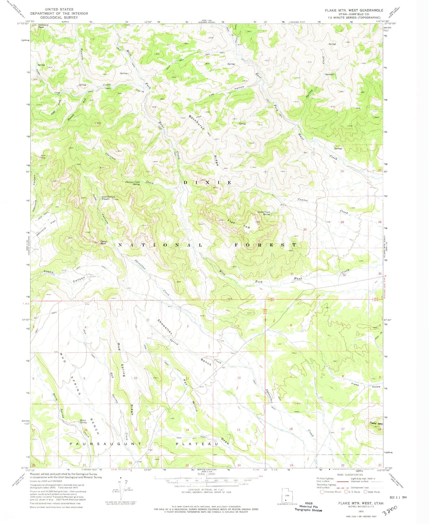
Classic USGS Flake Mountain West Utah 7.5'x7.5' Topo Map
Couldn't load pickup availability
Historical USGS topographic quad map of Flake Mountain West in the state of Utah. Map scale may vary for some years, but is generally around 1:24,000. Print size is approximately 24" x 27"
This quadrangle is in the following counties: Garfield.
The map contains contour lines, roads, rivers, towns, and lakes. Printed on high-quality waterproof paper with UV fade-resistant inks, and shipped rolled.
Contains the following named places: Barnhurst Ridge, Berry Spring, Carter Creek, Casto Bluff, Center Creek Spring, Clarence Creek, Clarence Creek Spring, Flake Mountain, Flat Top, Hancock Creek, Hancock Flat, Hancock Fork, Hancock Peak, Judd Creek, Judd Pasture, Judd Pasture Troughs, Log Hollow, Mud Spring Bench, Mud Spring Ridge, Showalter Bench, Spring Creek