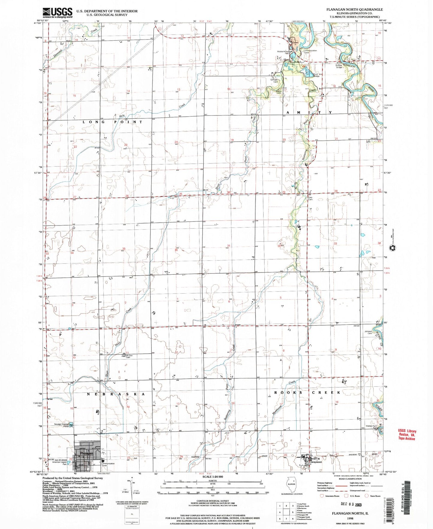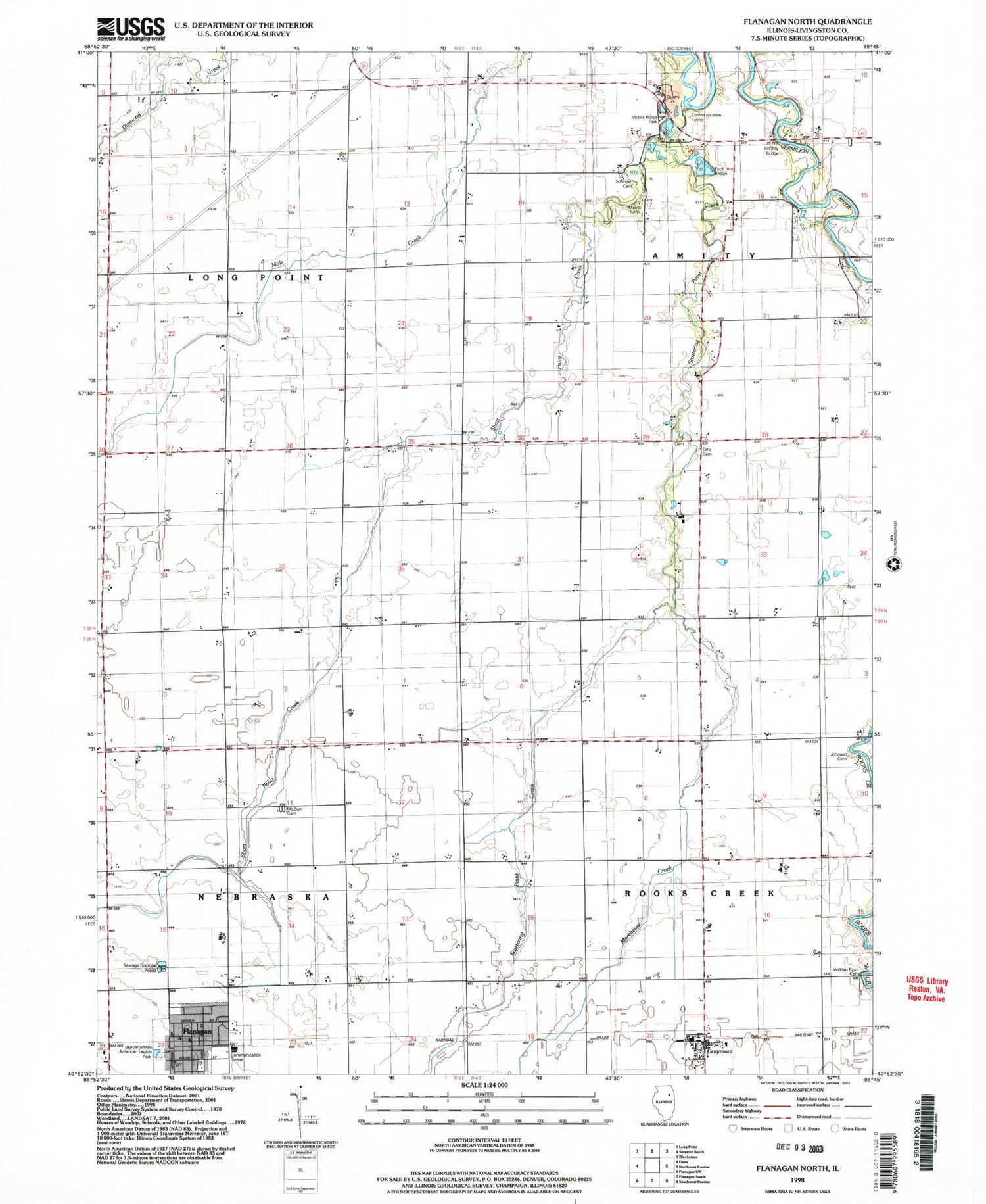
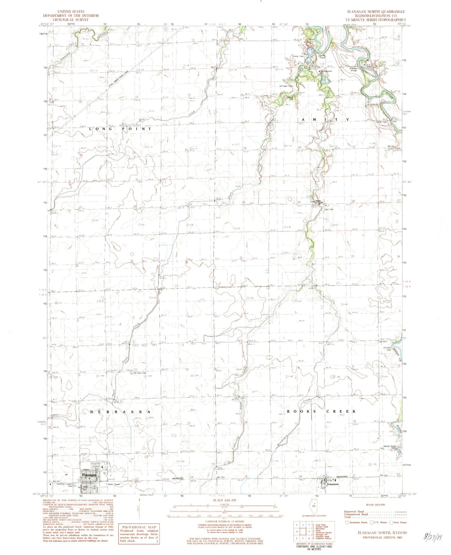
MyTopo
Classic USGS Flanagan North Illinois 7.5'x7.5' Topo Map
Couldn't load pickup availability
Historical USGS topographic quad map of Flanagan North in the state of Illinois. Map scale may vary for some years, but is generally around 1:24,000. Print size is approximately 24" x 27"
This quadrangle is in the following counties: Livingston.
The map contains contour lines, roads, rivers, towns, and lakes. Printed on high-quality waterproof paper with UV fade-resistant inks, and shipped rolled.
Contains the following named places: Adams RLA Number 1 Airport, American Legion Park, Artesian Park, Bradley Bridge, Earp Cemetery, Flanagan, Flanagan - Graymont Emergency Ambulance Service, Flanagan Graymont Fire Protection District, Flanagan Post Office, Flanagan United Methodist Church, Graymont, Graymont Elementary School, Graymont Post Office, Johnson Cemetery, Morehouse Creek, Morris Cemetery, Mount Zion Cemetery, Nigh Chapel Cemetery, Nigh Chapel United Methodist Church, Scattering Point Creek, Scattering Point School, Short Point Creek, Springer Cemetery, Township of Amity, Township of Long Point, Township of Nebraska, Township of Rooks Creek, Village of Flanagan, Walden Farm Cemetery, ZIP Codes: 61740, 61743