MyTopo
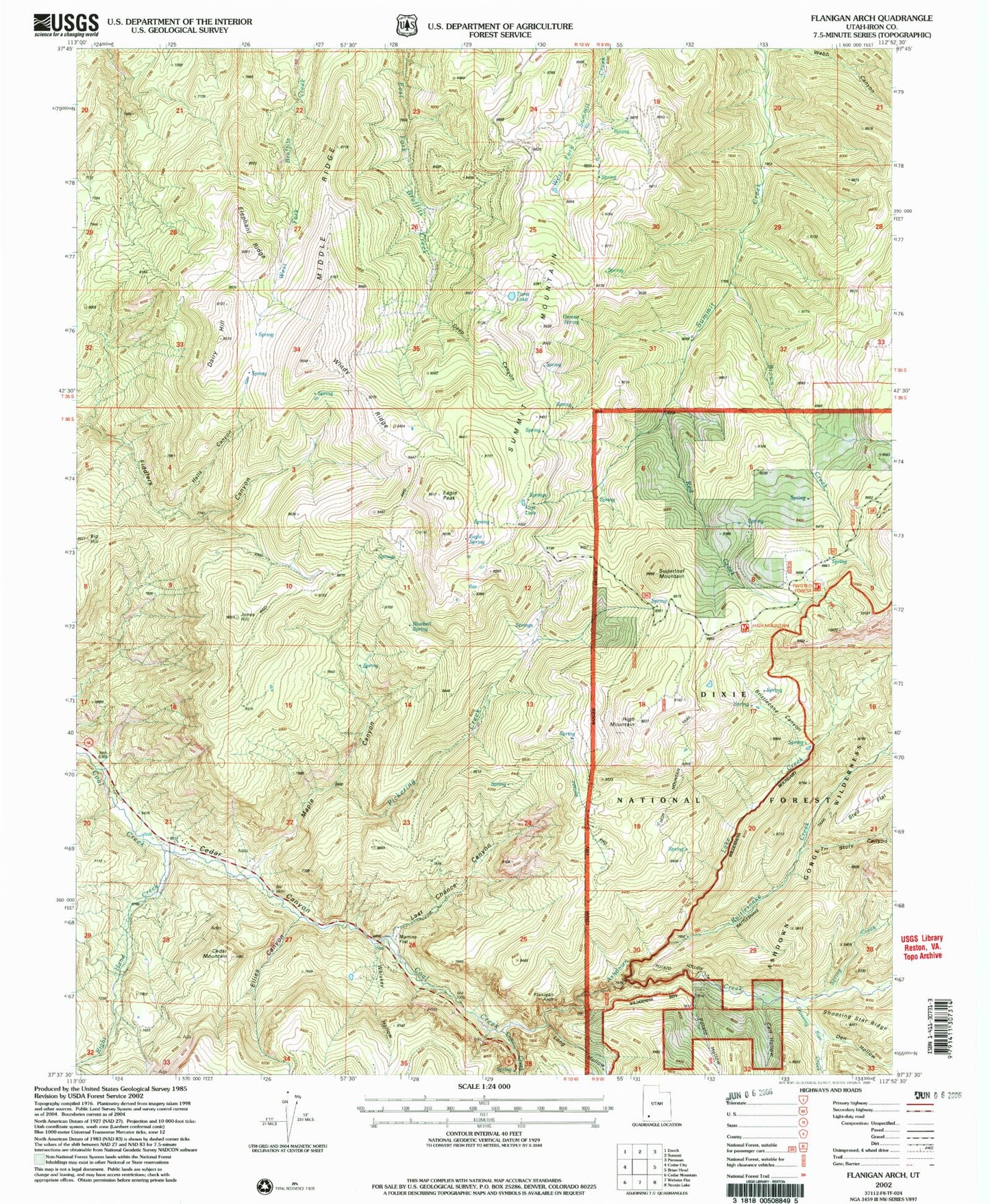
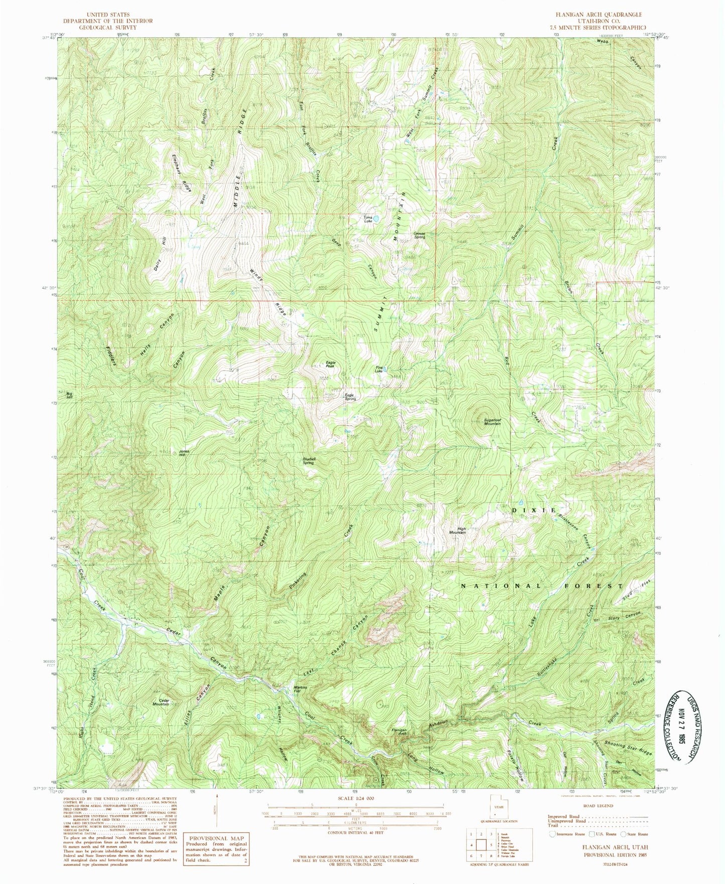
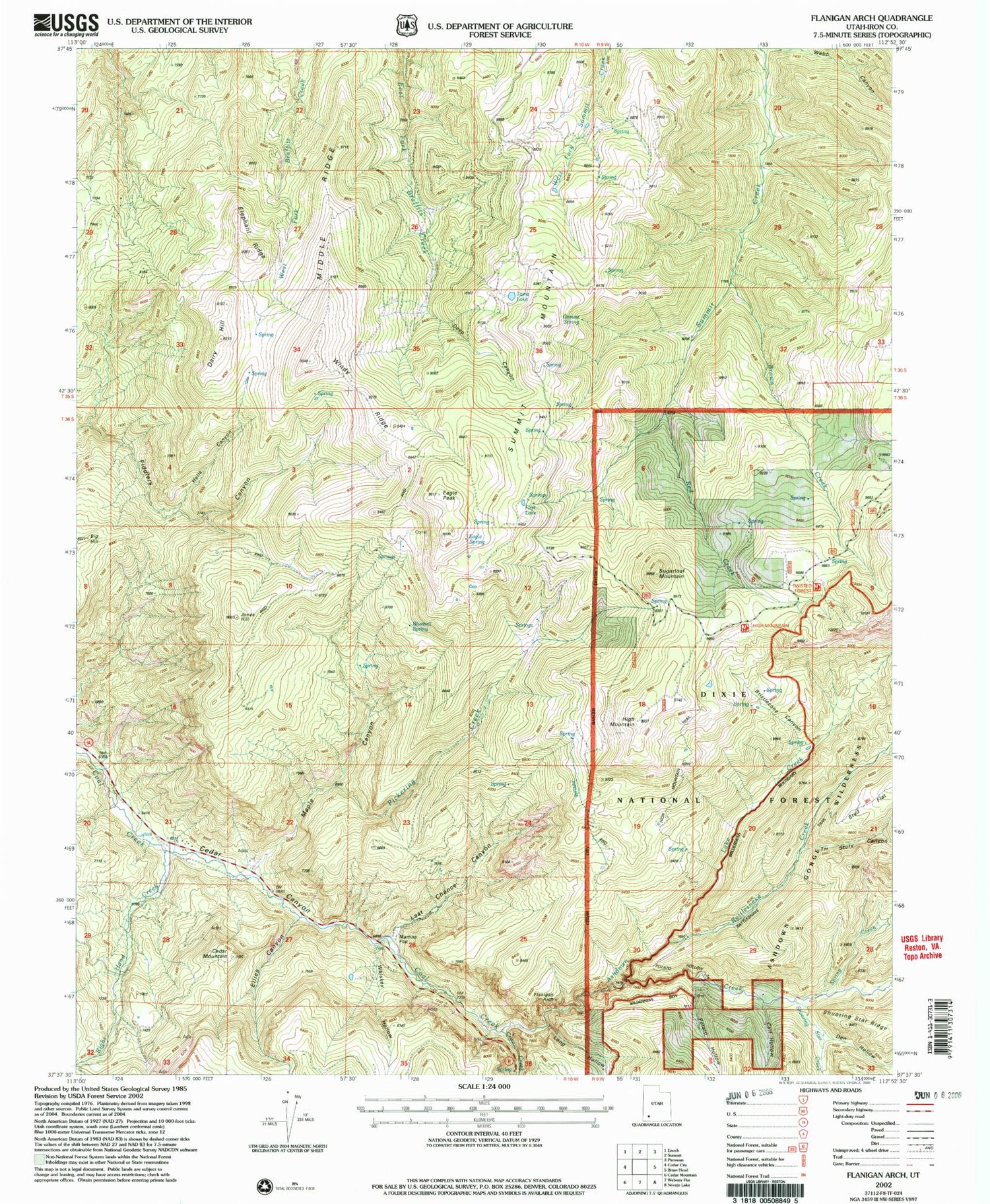
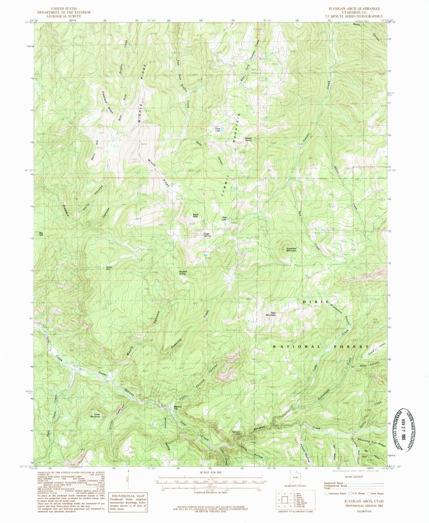
Classic USGS Flanigan Arch Utah 7.5'x7.5' Topo Map
Couldn't load pickup availability
Historical USGS topographic quad map of Flanigan Arch in the state of Utah. Typical map scale is 1:24,000, but may vary for certain years, if available. Print size: 24" x 27"
This quadrangle is in the following counties: Iron.
The map contains contour lines, roads, rivers, towns, and lakes. Printed on high-quality waterproof paper with UV fade-resistant inks, and shipped rolled.
Contains the following named places: Ashdown Creek, Big Hill, Bluebell Spring, Brown Creek, Calf Hollow, Cluff Mine, Crow Creek, Dairy Hill, Deep Canyon, Den Hollow, Eagle Peak, Eagle Spring, Ellies Canyon, First Lake, Grouse Spring, Hells Canyon, High Mountain, Jones Hill, Lake Creek, Last Chance Canyon, Long Hollow, MacFarlane Mine, Maple Canyon, Martins Flat, Middle Ridge, Pickering Creek, Potato Hollow, Rattlesnake Creek, Red Creek, Right Hand Creek, Shooting Star Creek, Spring Creek, Stud Flat, Sugarloaf Mountain, Summit Mountain, Third House Flat, Tinks Racetrack, Toms Lake, Tri Story Canyon, Whiskey Hollow, Windy Ridge, Avavick Knoll, Cedar Mountain, Flanigan Arch, Rattlesnake Creek Trail, Ashdoen Gorge Wilderness, Maple Canyon Creek, Ashdown Gorge Wilderness