
MyTopo
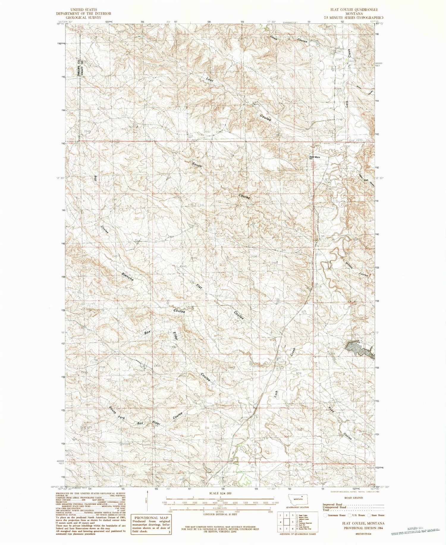
Classic USGS Flat Coulee Montana 7.5'x7.5' Topo Map
Couldn't load pickup availability
Historical USGS topographic quad map of Flat Coulee in the state of Montana. Map scale may vary for some years, but is generally around 1:24,000. Print size is approximately 24" x 27"
This quadrangle is in the following counties: Phillips, Valley.
The map contains contour lines, roads, rivers, towns, and lakes. Printed on high-quality waterproof paper with UV fade-resistant inks, and shipped rolled.
Contains the following named places: Blanche Coulee, Bog Coulee, Box Elder Coulee, Coal Bank Coulee, Coon Coulee, Dead Mans Hill, Fisher Dam, Flat Coulee, Home Coulee, Larb, Larb Post Office, Lost Coulee, Pippen Dam, Pippin School, Road Coulee, South Coulee, South Fork Box Elder Coulee, South Shed Coulee, Whites Coulee


