MyTopo
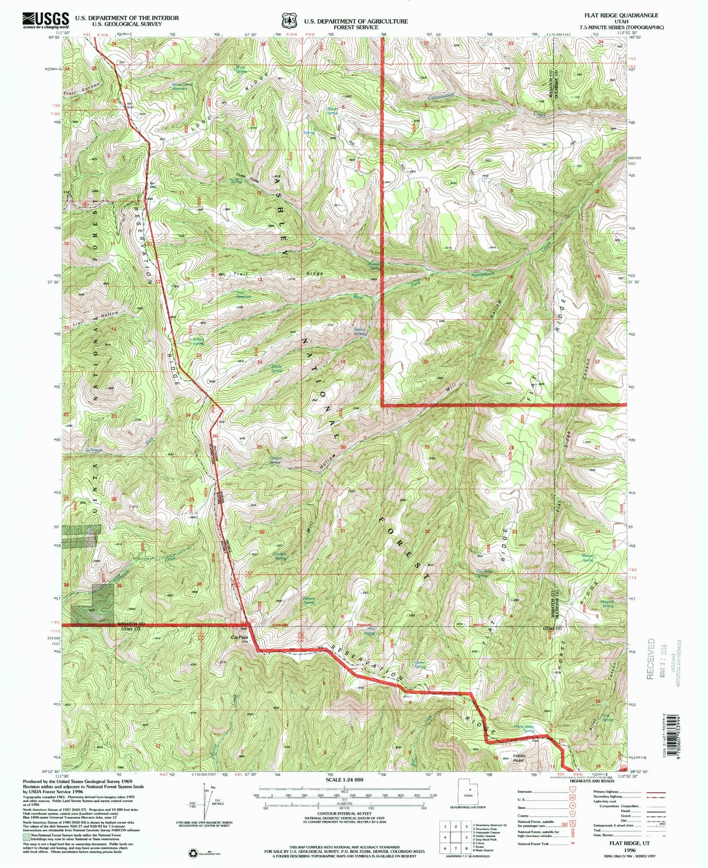
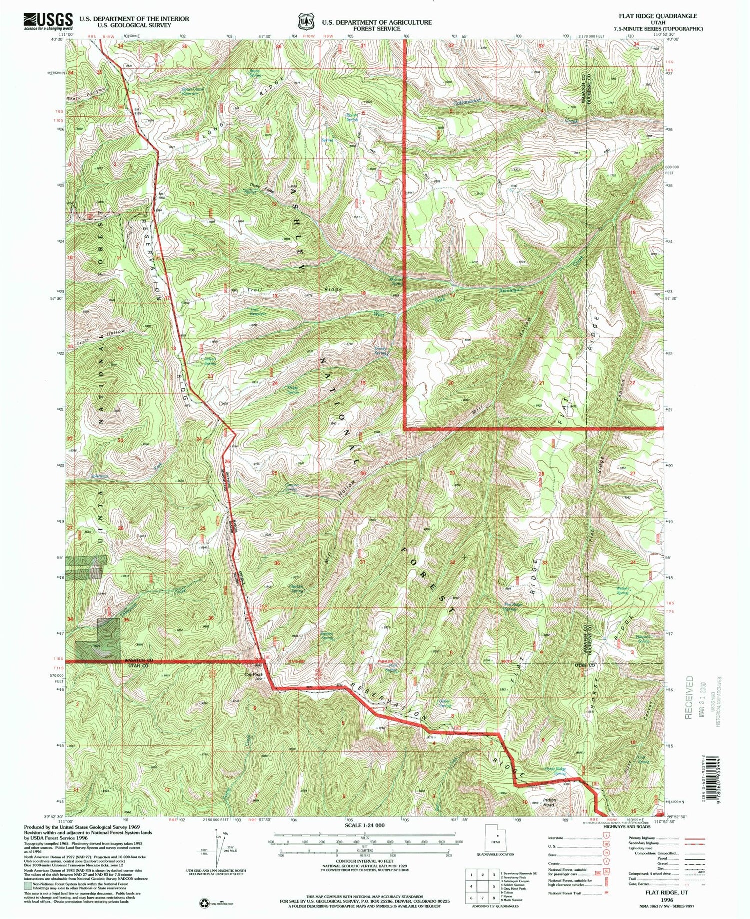
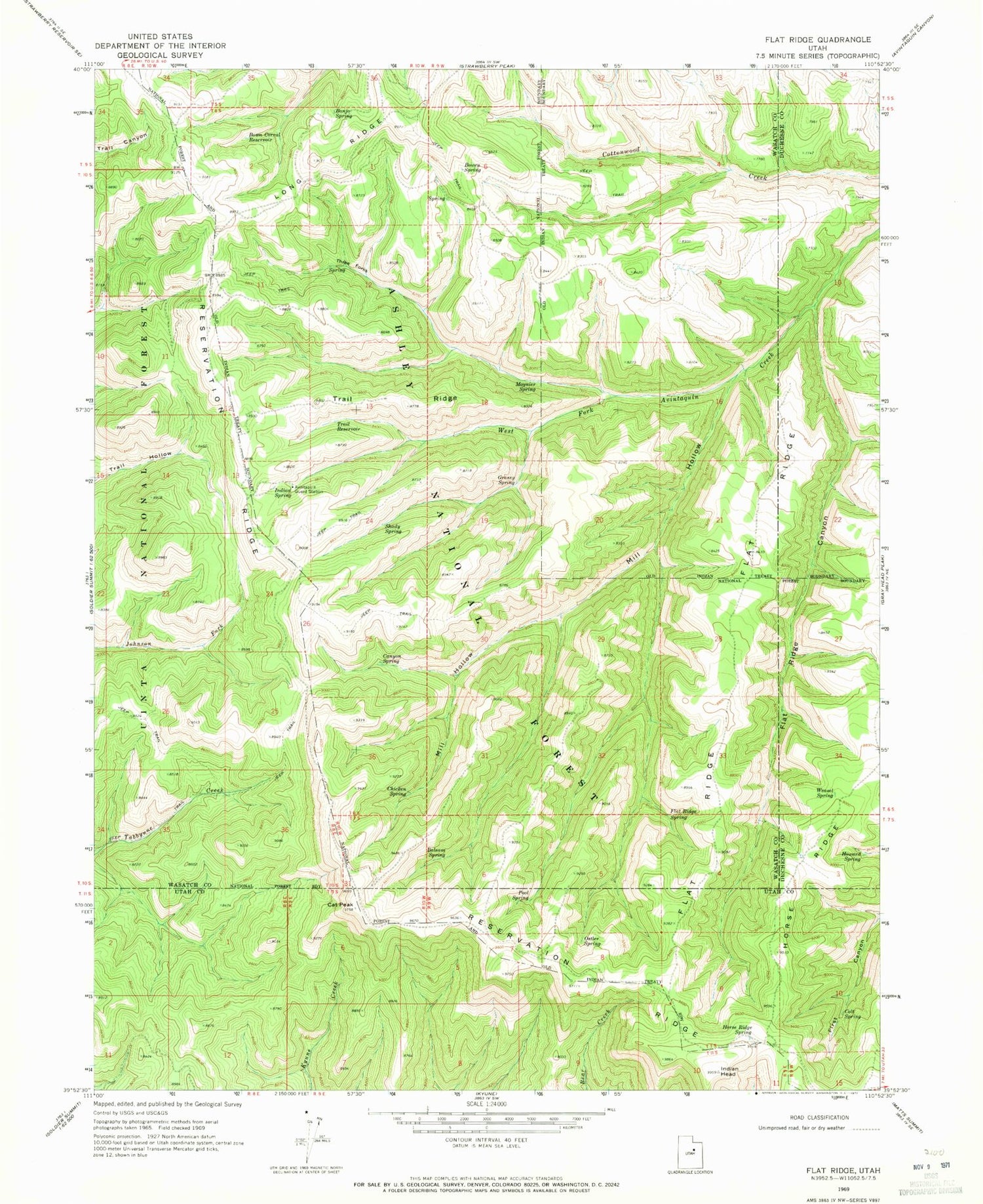
Classic USGS Flat Ridge Utah 7.5'x7.5' Topo Map
Couldn't load pickup availability
Historical USGS topographic quad map of Flat Ridge in the state of Utah. Map scale may vary for some years, but is generally around 1:24,000. Print size is approximately 24" x 27"
This quadrangle is in the following counties: Duchesne, Utah, Wasatch.
The map contains contour lines, roads, rivers, towns, and lakes. Printed on high-quality waterproof paper with UV fade-resistant inks, and shipped rolled.
Contains the following named places: Avintaquin Guard Station, Balsam Spring, Banjo Spring, Bowen Spring, Bown Corral Reservoir, Canyon Spring, Cat Peak, Chicken Spring, Colt Spring, Flat Ridge, Flat Ridge Canyon, Flat Ridge Spring, Grassy Spring, Horse Ridge, Horse Ridge Spring, Howard Spring, Indian Head, Indian Spring, Mill Hollow, Moymer Cabin, Moynier Spring, Ostler Spring, Pool Spring, Reservation Ridge, Shady Spring, Three Forks, Trail Reservoir, Trail Ridge, Weasel Spring