MyTopo
Classic USGS Flat Rock Draw SW Texas 7.5'x7.5' Topo Map
Regular price
$16.95
Regular price
Sale price
$16.95
Unit price
per
Couldn't load pickup availability
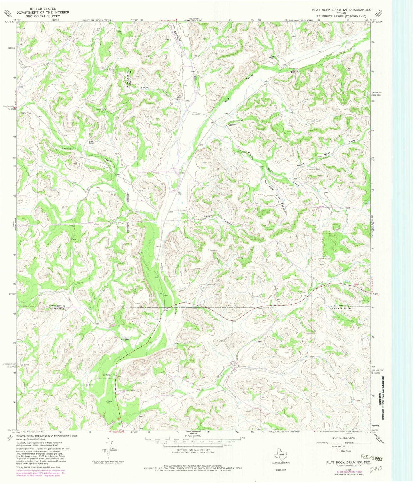
Historical USGS topographic quad map of Flat Rock Draw SW in the state of Texas. Map scale may vary for some years, but is generally around 1:24,000. Print size is approximately 24" x 27"
This quadrangle is in the following counties: Crockett, Sutton, Val Verde.
The map contains contour lines, roads, rivers, towns, and lakes. Printed on high-quality waterproof paper with UV fade-resistant inks, and shipped rolled.
Contains the following named places: Dry Devils River, Flat Rock Draw, Glasscock Ranch, Granger Draw, House Draw, Hunnicut Ranch, Hunt Ranch, Jackson Draw, Ogels Road Canyon, Phillips Ranch, Pot Hole City Canyon, Rough Canyon