MyTopo
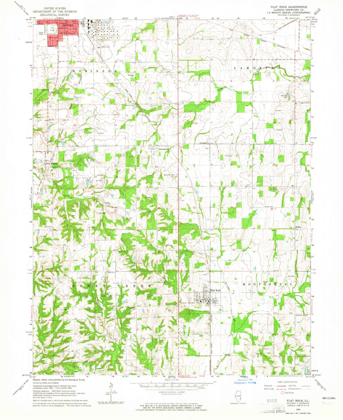
Classic USGS Flat Rock Illinois 7.5'x7.5' Topo Map
Couldn't load pickup availability
Historical USGS topographic quad map of Flat Rock in the state of Illinois. Map scale may vary for some years, but is generally around 1:24,000. Print size is approximately 24" x 27"
This quadrangle is in the following counties: Crawford.
The map contains contour lines, roads, rivers, towns, and lakes. Printed on high-quality waterproof paper with UV fade-resistant inks, and shipped rolled.
Contains the following named places: Antoka Farms, Beckwith Cemetery, Brown School, Buncombe School, Campbell Lake, Campbell Lake Dam, Cecedar Cemetery, City Park, Clark School, Dickinson Cemetery, Duncanville, Duncanville Cemetery, Flat Rock, Flat Rock Area Fire Protection District, Flat Rock Post Office, Ford Cemetery, Good Hope Cemetery, Guyer Farms, Higgins Cemetery, Hope School, Jones Cemetery, La Motte School, McCarthy School, Meskimmon School, Miller Farms, Mills School, Minnick Cemetery, Montgomery School, Morea, Neathery Cemetery, New Hebron, New Hebron Baptist Church, Rich Cemetery, Rich Pork Farm, Seaney Cemetery, Shady Lane Fish Farm, Swaringen Church, Swearingen Cemetery, Taylor School, Tohill Cemetery, Township of Honey Creek, Triple F Farms, Union Church, Union School, Village of Flat Rock