MyTopo
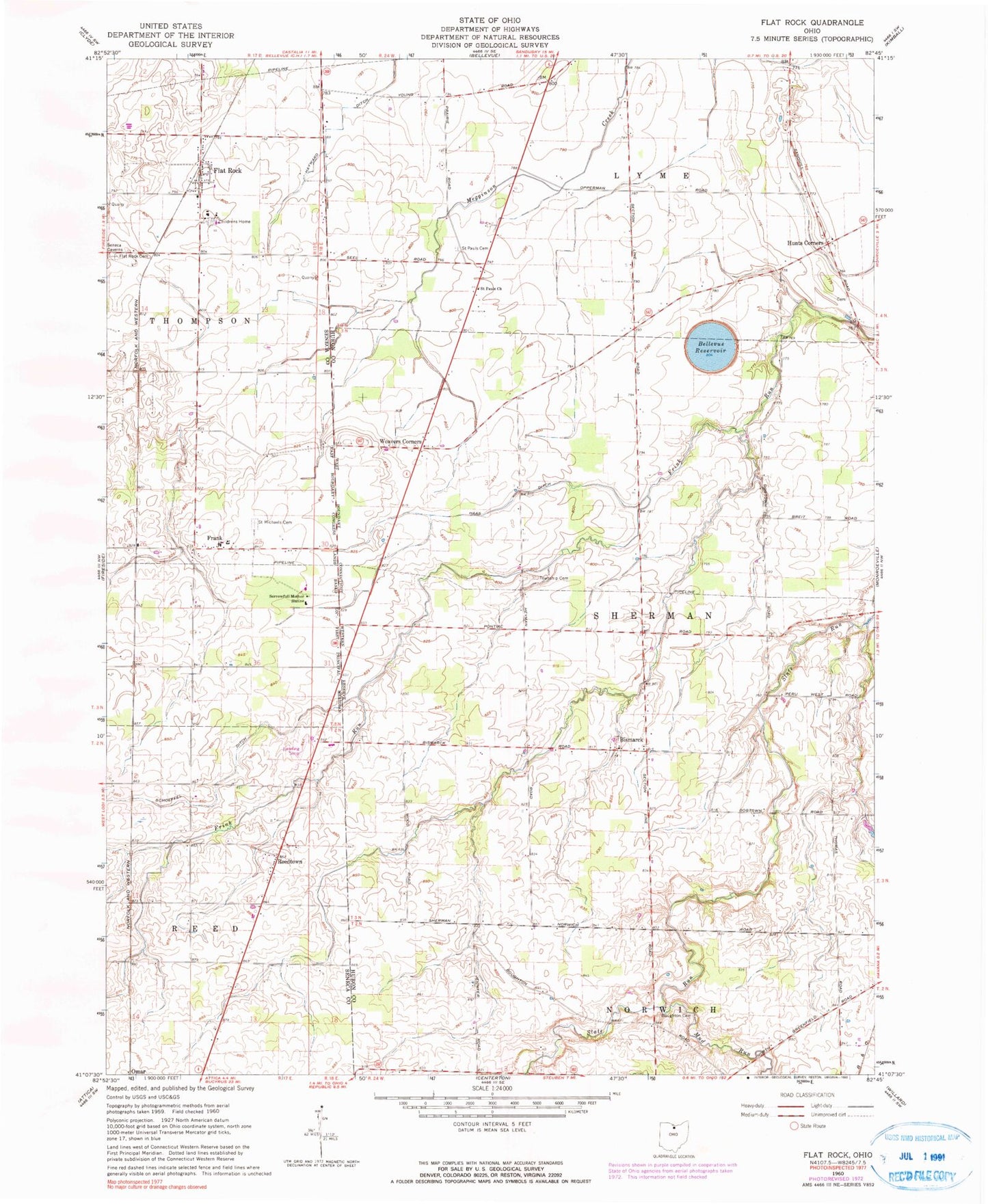
Classic USGS Flat Rock Ohio 7.5'x7.5' Topo Map
Couldn't load pickup availability
Historical USGS topographic quad map of Flat Rock in the state of Ohio. Map scale may vary for some years, but is generally around 1:24,000. Print size is approximately 24" x 27"
This quadrangle is in the following counties: Huron, Seneca.
The map contains contour lines, roads, rivers, towns, and lakes. Printed on high-quality waterproof paper with UV fade-resistant inks, and shipped rolled.
Contains the following named places: Bellevue Reservoir, Bellevue Reservoir Number Five Dam, Bismarck, Bismark Post Office, Bollenbacher School, Bores Farm, Boughton Cemetery, Central School, Dougherty Airport, Ebenezer United Methodist Church, English School, Flat Rock, Flat Rock Cemetery, Flat Rock Census Designated Place, Flat Rock Childrens Center, Flat Rock Post Office, Flat Rock Quarry, Fouthon School, Frank, Frank Post Office, H B Farms, Haas Ditch, Havana Post Office, Hayward Ditch, Heyman Cemetery, Hickory Grove Farms, Hunts Corners, Jones Cemetery, Magers Farms, Mud Run, Reedtown, Reedtown Post Office, Saint Michaels Cemetery, Saint Pauls Cemetery, Saint Sebastian Catholic Cemetery, Saint Sebastian Catholic Church, Schoeffel Ditch, School Number 1, School Number 2, School Number 6, Siesel Farms, Sorrowfull Mother Shrine, Stockmaster Farms, Township of Lyme, Township of Sherman, Tri View Farms, Weavers Corners, Weavers Corners Post Office, Weymouth Post Office, Windfall Post Office, Woodside Farms, Zieber Egg Farm, ZIP Codes: 44811, 44828