
MyTopo
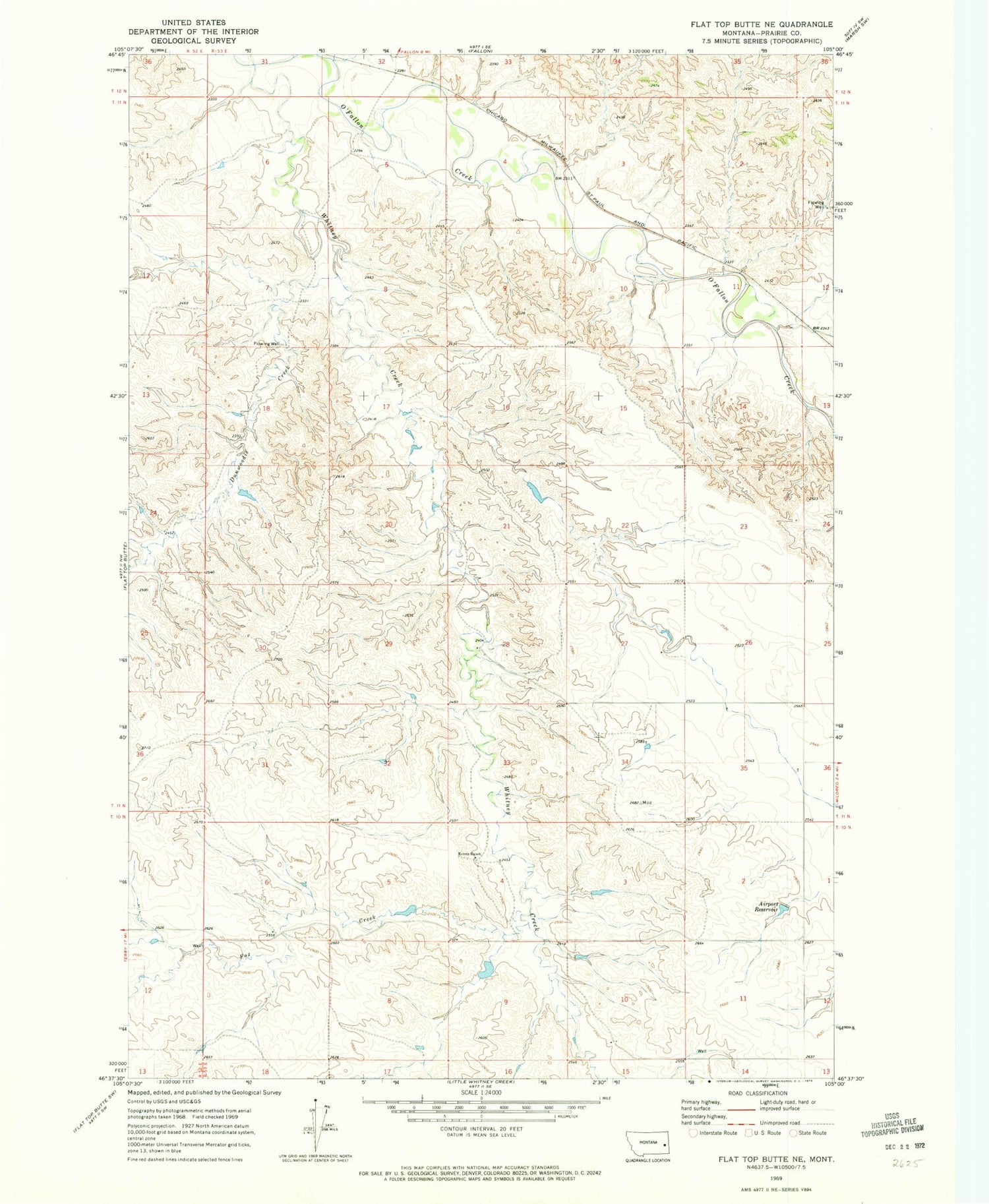
Classic USGS Flat Top Butte NE Montana 7.5'x7.5' Topo Map
Couldn't load pickup availability
Historical USGS topographic quad map of Flat Top Butte NE in the state of Montana. Map scale may vary for some years, but is generally around 1:24,000. Print size is approximately 24" x 27"
This quadrangle is in the following counties: Prairie.
The map contains contour lines, roads, rivers, towns, and lakes. Printed on high-quality waterproof paper with UV fade-resistant inks, and shipped rolled.
Contains the following named places: 11N53E01CCAC01 Well, 11N53E07DC__01 Well, 11N53E15ADDA01 Well, 11N53E28CABB01 Well, 11N53E33BA__01 Well, Airport Reservoir, Bar-G School, Dunwoodie Creek, Evertz Ranch, Fort Whitney, Fox Creek, Hyde Number 2 Dam, Powers-Wade School, Shumaker Number 2 Dam, Terry South Division, Thirteen Flat School, Wade School, Whitney, Whitney Creek, Whitney Post Office, Whitney School


