MyTopo
Classic USGS Flatiron Mountain Montana 7.5'x7.5' Topo Map
Regular price
$16.95
Regular price
Sale price
$16.95
Unit price
per
Couldn't load pickup availability
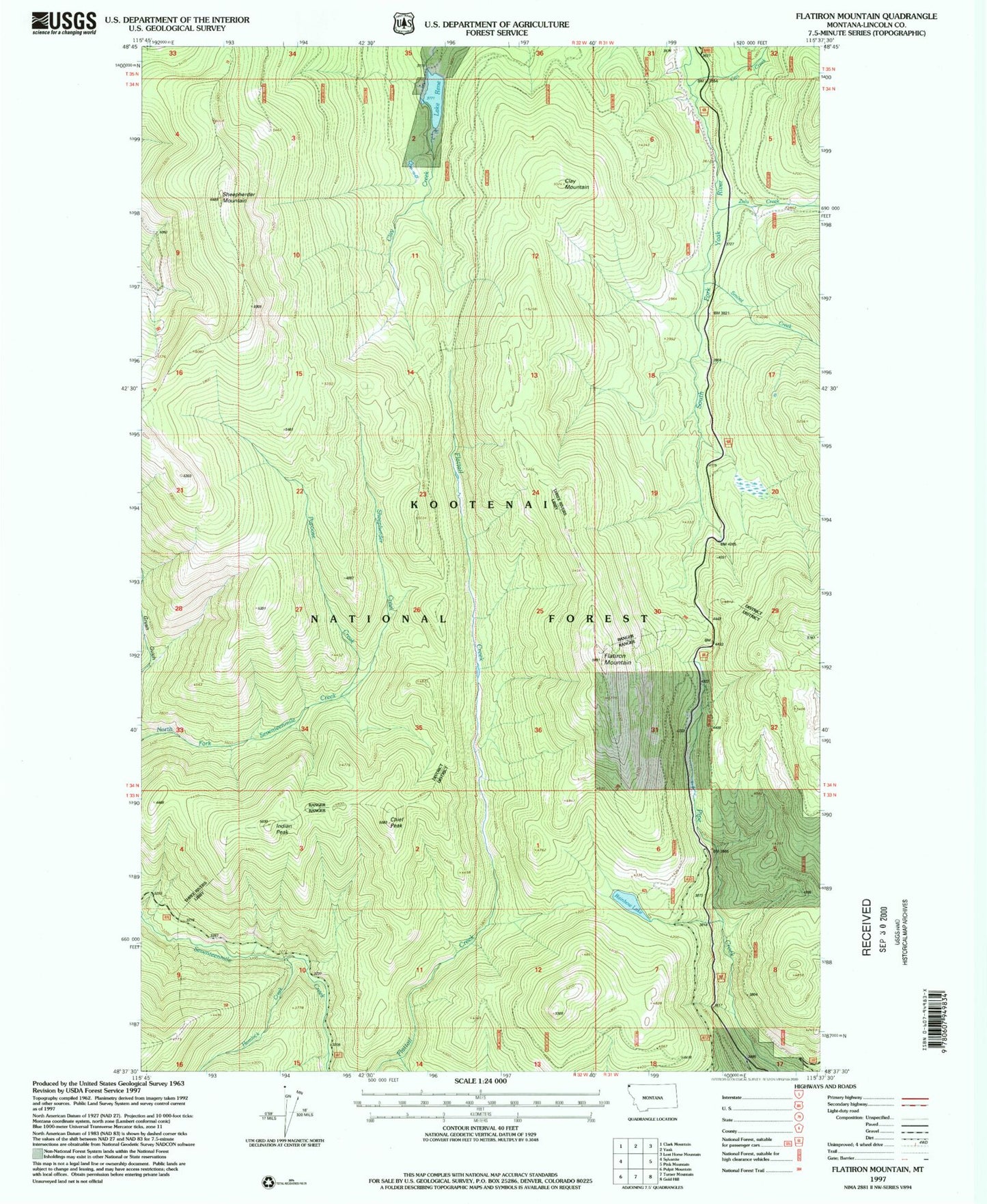
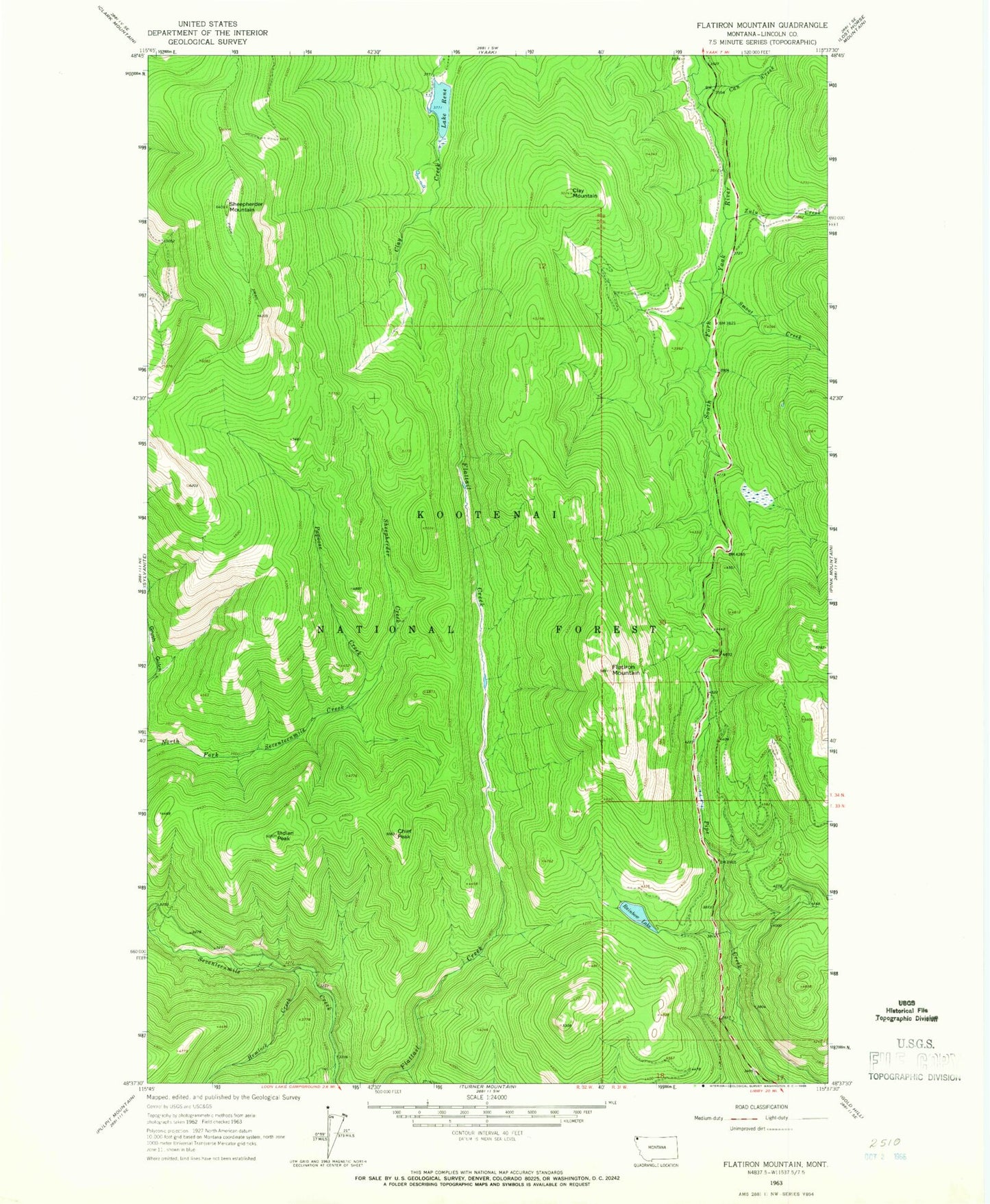
Historical USGS topographic quad map of Flatiron Mountain in the state of Montana. Map scale may vary for some years, but is generally around 1:24,000. Print size is approximately 24" x 27"
This quadrangle is in the following counties: Lincoln.
The map contains contour lines, roads, rivers, towns, and lakes. Printed on high-quality waterproof paper with UV fade-resistant inks, and shipped rolled.
Contains the following named places: Can Creek, Chief Peak, Clay Mountain, Flatiron Mountain, Hemlock Creek, Indian Peak, Lake Rene, Lake Rene Dam, Mule Creek, Papoose Creek, Rainbow Lake, Sheepherder Creek, Sheepherder Mountain, Smoot Creek, Zulu Creek