MyTopo
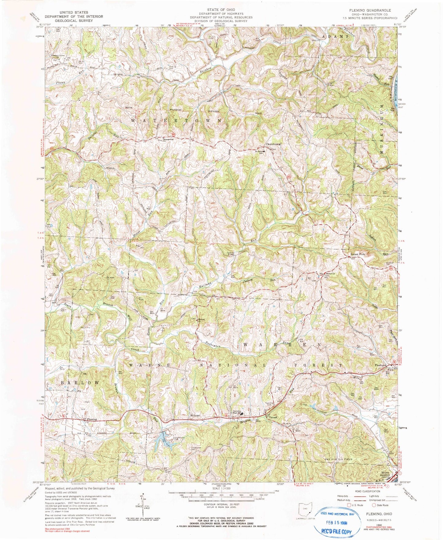
Classic USGS Fleming Ohio 7.5'x7.5' Topo Map
Couldn't load pickup availability
Historical USGS topographic quad map of Fleming in the state of Ohio. Map scale may vary for some years, but is generally around 1:24,000. Print size is approximately 24" x 27"
This quadrangle is in the following counties: Washington, Wood.
The map contains contour lines, roads, rivers, towns, and lakes. Printed on high-quality waterproof paper with UV fade-resistant inks, and shipped rolled.
Contains the following named places: Alden, Bethel Cemetery, Bethel Church, Brabham Cemetery, Browns Run, Chainey Run, Christopher Cemetery, Churchtown, Churchtown Cemetery, Coffmans Farms, Deming Cemetery, Evangelical Cemetery, Evangelical Church, Fleming, Goodfellows Park, Goodfellows Park Lake, Goodfellows Park Lake Dam, Halfway Run, Henry Cemetery, Horse Run, Kern Greenhouse, Langs Buckeye Dairy Farm, Locust Fork, McAvan, Pleasant Grove Cemetery, Pleasant Grove Church, Russet Run, Saint John Cemetery, Township of Warren, Township of Watertown, Tunnel, Tunnel Cemetery, Tunnel United Methodist Church, Turkeyhen Run, Union Carbide Waste Retention Dam, Union Carbide Waste Retention Pond, Warren Chapel Cemetery, Warren Chapel Methodist Church, Warren Elementary School, Warren Township Volunteer Fire Department Station 1, Warren Township Volunteer Fire Department Station 2, ZIP Code: 45729