
MyTopo
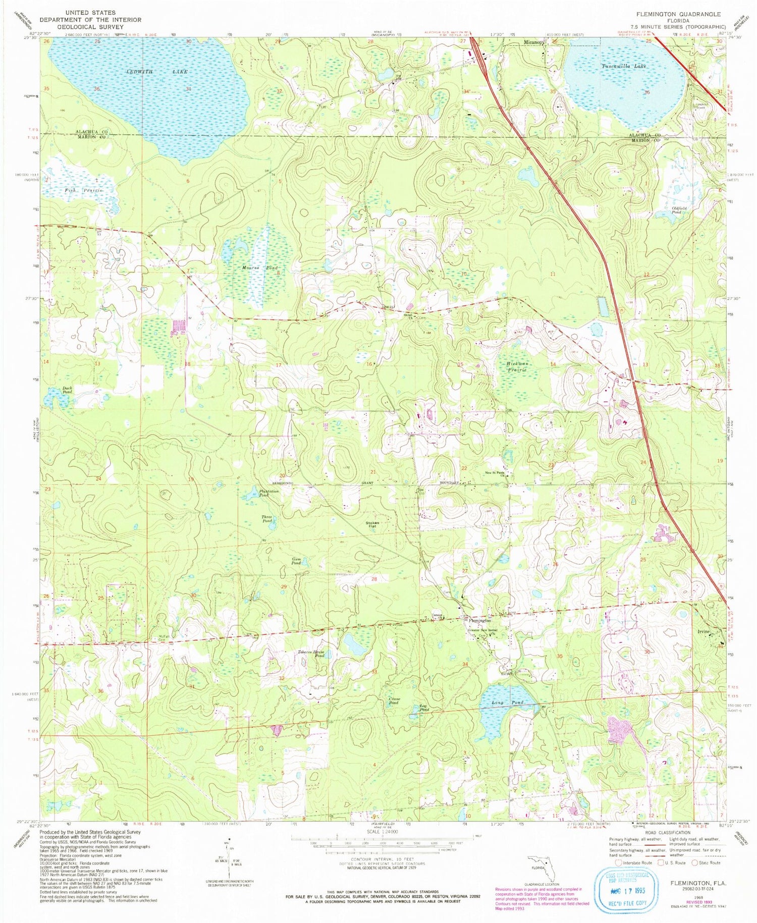
Classic USGS Flemington Florida 7.5'x7.5' Topo Map
Couldn't load pickup availability
Historical USGS topographic quad map of Flemington in the state of Florida. Map scale may vary for some years, but is generally around 1:24,000. Print size is approximately 24" x 27"
This quadrangle is in the following counties: Alachua, Marion.
The map contains contour lines, roads, rivers, towns, and lakes. Printed on high-quality waterproof paper with UV fade-resistant inks, and shipped rolled.
Contains the following named places: Canaan Baptist Church, Canaan Missionary Baptist Church, Cellular Phone Tower - Pinnacle Towers, Cellular Phone Tower-Spectricite Communications, Crane Pond, Cuscowilla, Duck Pond, Fish Prairie, Flemington, Flemington Baptist Church, Fort Drane, Greater New Bethel Church, Gum Pond, Hickman, Hickman Prairie, Irvine, Ledwith Lake, Log Pond, Long Pond, McFall Cemetery, Micanopy Tower, Moores Pond, Mount Pedro Baptist Church, New Saint Paul Free Methodist Church, Oldfield Pond, Plantation Pond, Reddick-McIntosh Division, Shiloh United Methodist Church, Simonton, South Side, Southside Post Office, Stokes Flat, Three Pond, Tobacco House Pond, Tuscawilla Lake


