MyTopo
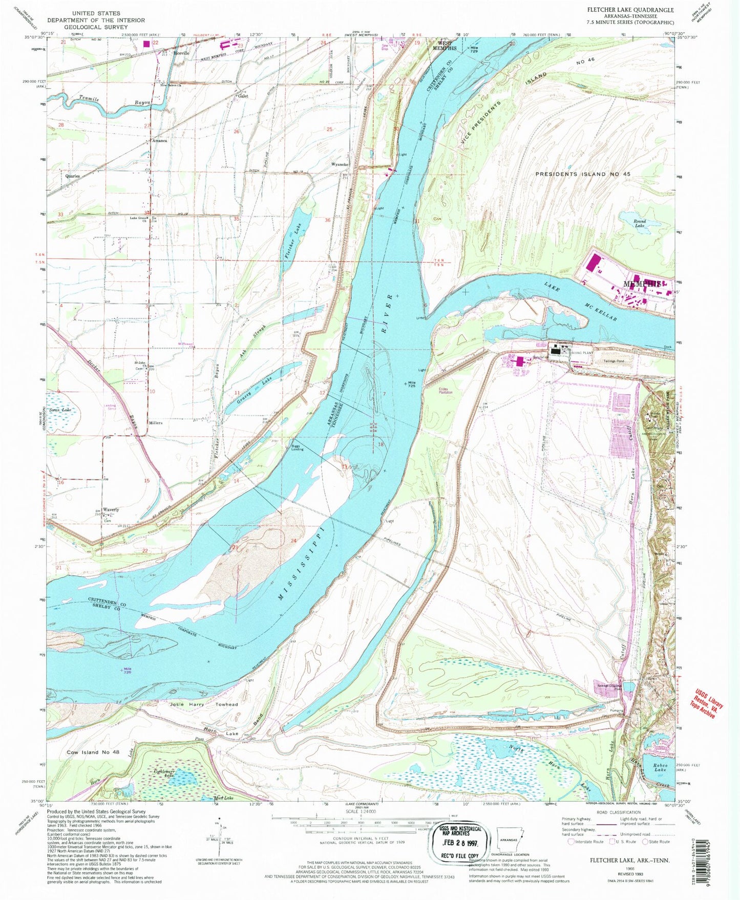
Classic USGS Fletcher Lake Arkansas 7.5'x7.5' Topo Map
Couldn't load pickup availability
Historical USGS topographic quad map of Fletcher Lake in the states of Arkansas, Tennessee. Map scale may vary for some years, but is generally around 1:24,000. Print size is approximately 24" x 27"
This quadrangle is in the following counties: Crittenden, Shelby.
The map contains contour lines, roads, rivers, towns, and lakes. Printed on high-quality waterproof paper with UV fade-resistant inks, and shipped rolled.
Contains the following named places: Allen Generating Plant, Amanca, Ash Slough, Bauxippi-Wyanoke Revetment, Biggs Landing, C.H. Nash Museum Chucalissa, Chucalissa Archaeological Park, Chucalissa Indian Village, Cockleburr Lake, Commissioner District 11, Cow Island Number Forty-eight, Dismal Point Dikes, Dismal Point Revetment, Ditch Number 17, Ditch Number 19, Ditch Number 20, Ensley Plantation, Ensley Revetment, Fletcher Bayou, Fletcher Lake, Frank C Pidgeon Industrial Development, Galet, Grassy Lake, Horn Lake Bend, Horn Lake Creek, Horn Lake Cutoff, Horn Lake Pass, Josie Harry Towhead, Lake Grove Church, Lake McKellar, Long Pond, Mallard Lake, Mallard Lake Dam, Millers, Mount Pleasant Church, New Salem Cemetery, New Salem Church, North Horn Lake, Opossum Lake, Presidents Island Number Forty-five, Quarles, Rainer Industrial Park, Riceville, Riceville School, Round Lake, Saint John Church, Saint Johns Cemetery, Saint Johns Church, Township of Proctor, United States Tennessee Valley Authority Allen Fossil Plant, Vice Presidents Island Number Forty-six, Waverly, Waverly School, Womacks Landing, Wyanke School, Wyanoke, Wyanoke Crevasse, Wyanoke Dikes, ZIP Code: 38109