MyTopo
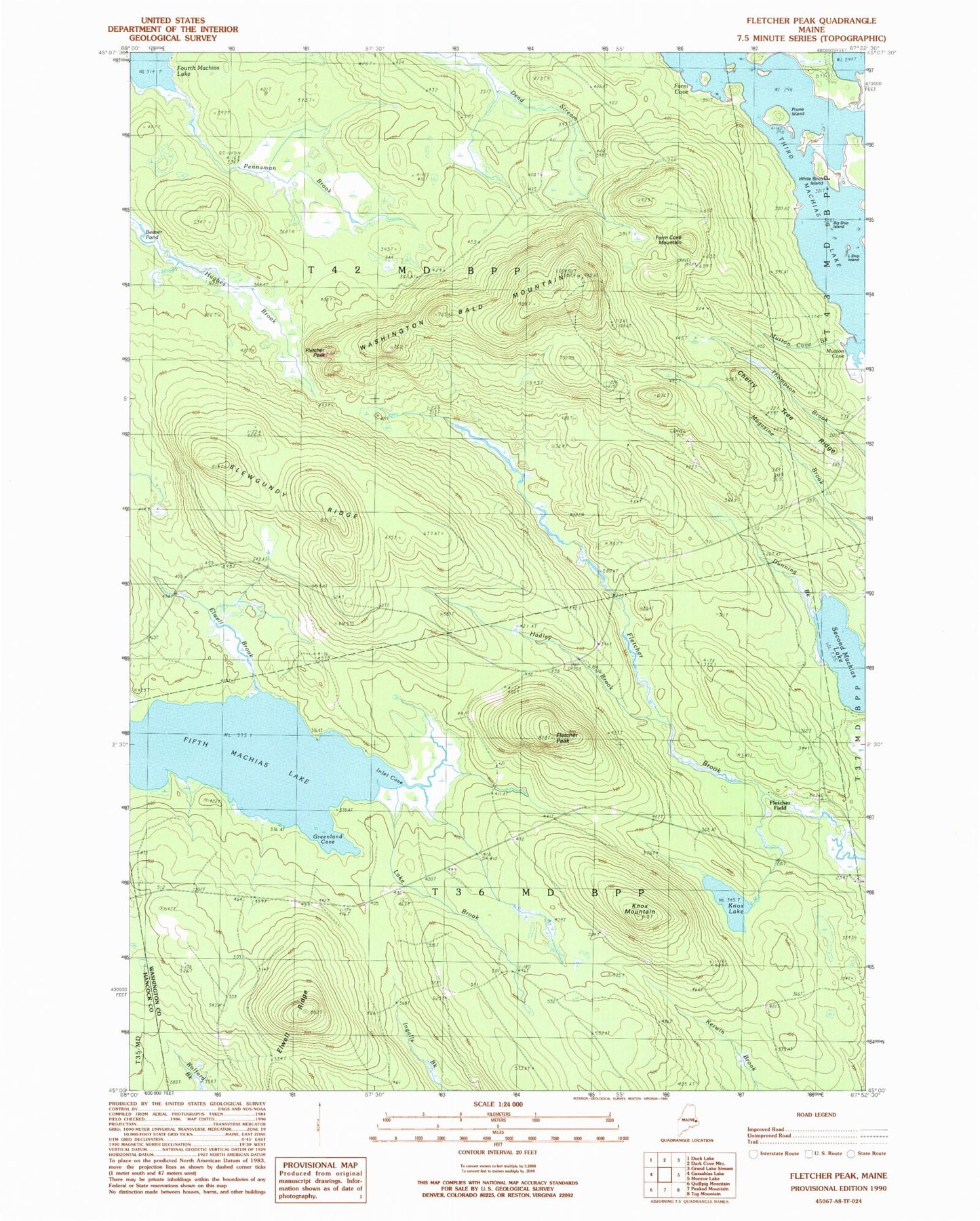
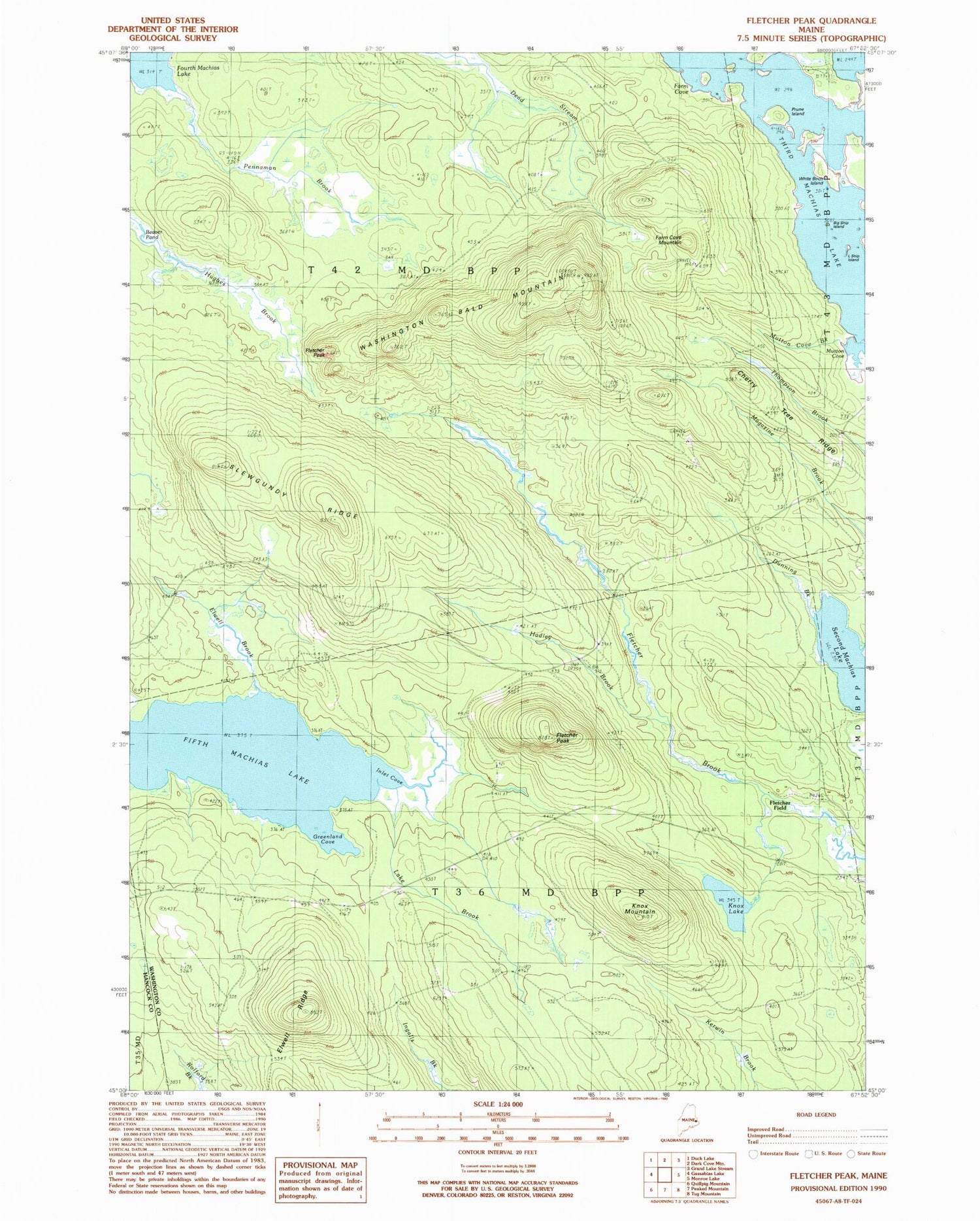
Classic USGS Fletcher Peak Maine 7.5'x7.5' Topo Map
Couldn't load pickup availability
Historical USGS topographic quad map of Fletcher Peak in the state of Maine. Typical map scale is 1:24,000, but may vary for certain years, if available. Print size: 24" x 27"
This quadrangle is in the following counties: Hancock, Washington.
The map contains contour lines, roads, rivers, towns, and lakes. Printed on high-quality waterproof paper with UV fade-resistant inks, and shipped rolled.
Contains the following named places: Beaver Pond, Big Ship Island, Cherry Tree Ridge, Dunning Brook, Elwell Brook, Elwell Ridge, Farm Cove, Farm Cove Mountain, Fifth Machias Lake, Fletcher Peak, Fletcher Peak, Greenland Cove, Hadley Brook, Hughes Brook, Inlet Cove, Knox Lake, Knox Mountain, Lake Brook, Little Ship Island, Mutton Cove, Mutton Cove Brook, Pennaman Brook, Prune Island, Second Machias Lake, Slewgundy Ridge, Third Machias Lake, Washington Bald Mountain, White Birch Island, Fletcher Field, T36 MD BPP, T42 MD BPP