MyTopo
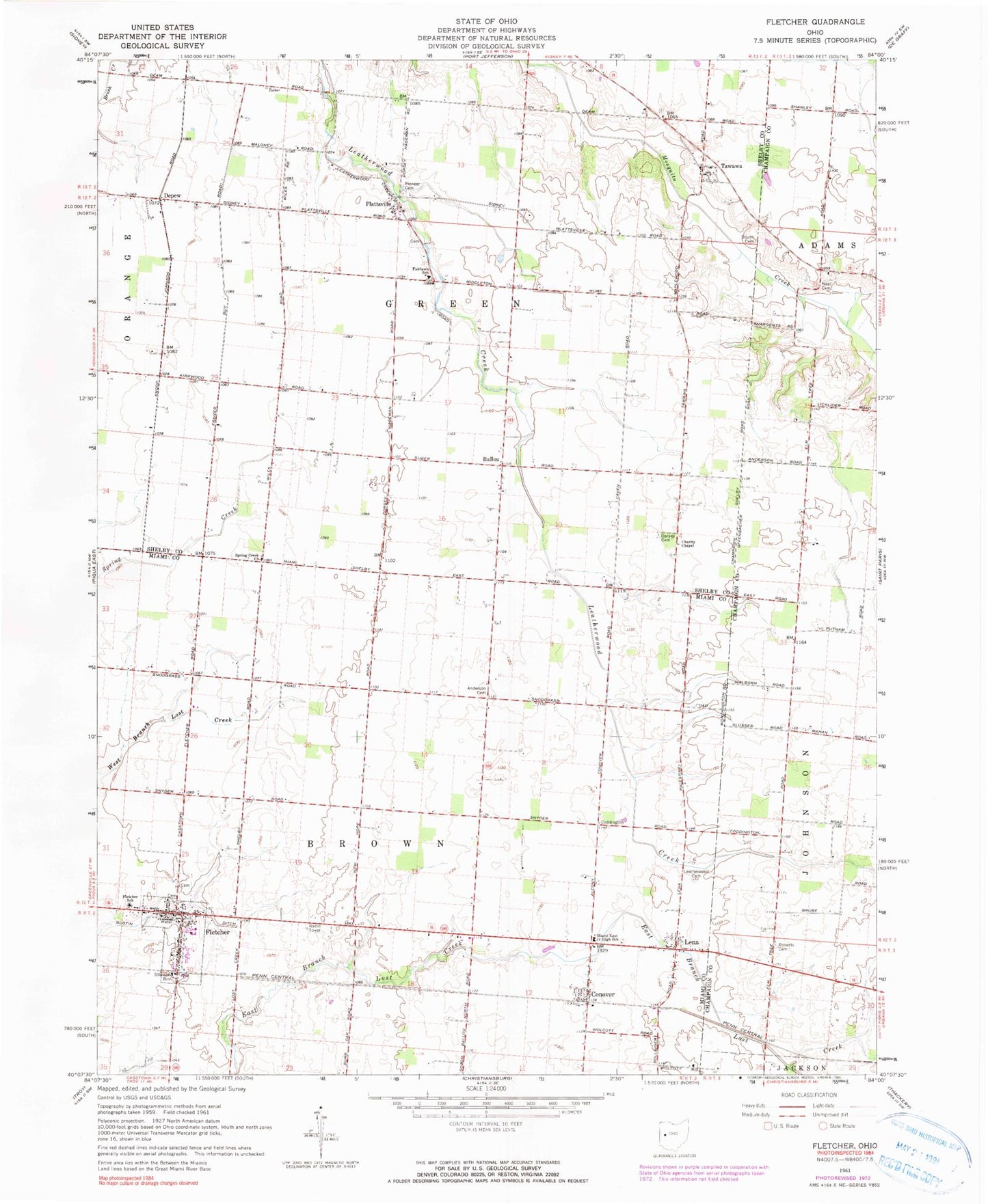
Classic USGS Fletcher Ohio 7.5'x7.5' Topo Map
Couldn't load pickup availability
Historical USGS topographic quad map of Fletcher in the state of Ohio. Map scale may vary for some years, but is generally around 1:24,000. Print size is approximately 24" x 27"
This quadrangle is in the following counties: Champaign, Miami, Shelby.
The map contains contour lines, roads, rivers, towns, and lakes. Printed on high-quality waterproof paper with UV fade-resistant inks, and shipped rolled.
Contains the following named places: Alibi School, Anderson Cemetery, Ballou, Ballou Post Office, Charity Chapel, Conover, Conover Post Office, Depew, Depew Post Office, Dorsey Cemetery, Fairlawn School, Fletcher, Fletcher Cemetery, Fletcher Elementary School, Fletcher Post Office, Fletcher Presbyterian Churchyard Cemetery, Fletcher United Methodist Church, Futura Farms, Futureama Farms, Gustin Ditch, Hageman, Hill Farms, Lake School, Leatherwood Cemetery, Leatherwood School, Lena, Lena Baptist Church, Lena Post Office, Miami East Junior High School, Neal Cemetery, New Hope School, Newton Presbyterian Church, Pioneer Cemetery, Plattsville, Plattsville Cemetery, Plattsville Post Office, Progress Farms, R C T Farm, Roberts Cemetery, Spring Creek Church, Sturm Cemetery, Tawawa, Tawawa Post Office, Township of Brown, Township of Green, Valentine, Village of Fletcher, ZIP Code: 45326