
MyTopo
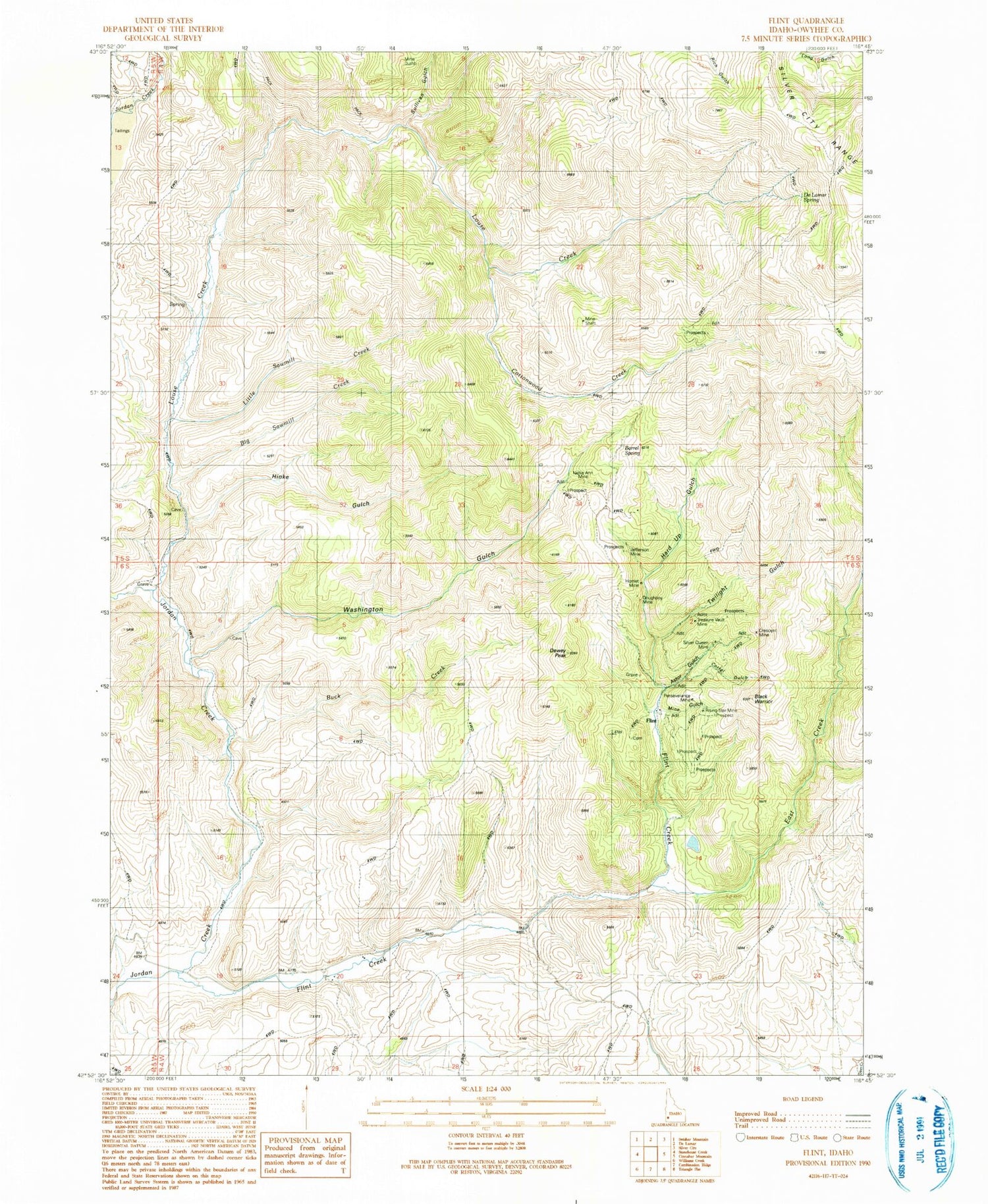
Classic USGS Flint Idaho 7.5'x7.5' Topo Map
Couldn't load pickup availability
Historical USGS topographic quad map of Flint in the state of Idaho. Map scale may vary for some years, but is generally around 1:24,000. Print size is approximately 24" x 27"
This quadrangle is in the following counties: Owyhee.
The map contains contour lines, roads, rivers, towns, and lakes. Printed on high-quality waterproof paper with UV fade-resistant inks, and shipped rolled.
Contains the following named places: Astor Gulch, Barrel Spring, Big I Grade, Big Sawmill Creek, Black Warrior, Buck Creek, Corral Gulch, Cottonwood Creek, Crescent Mine, De Lamar Spring, Dewey Peak, Doughboy Mine, East Creek, Flint, Flint Creek, Hard Up Gulch, Hinke Gulch, Hornet Mine, Jefferson Mine, Little Sawmill Creek, Louse Creek, Mine Gulch, Nellie Ann Mine, Perseverance Mine, Rising Star Mine, Silver Queen Mine, Sullivan Gulch, Treasure Vault Mine, Twilight Gulch, Washington Gulch


