MyTopo
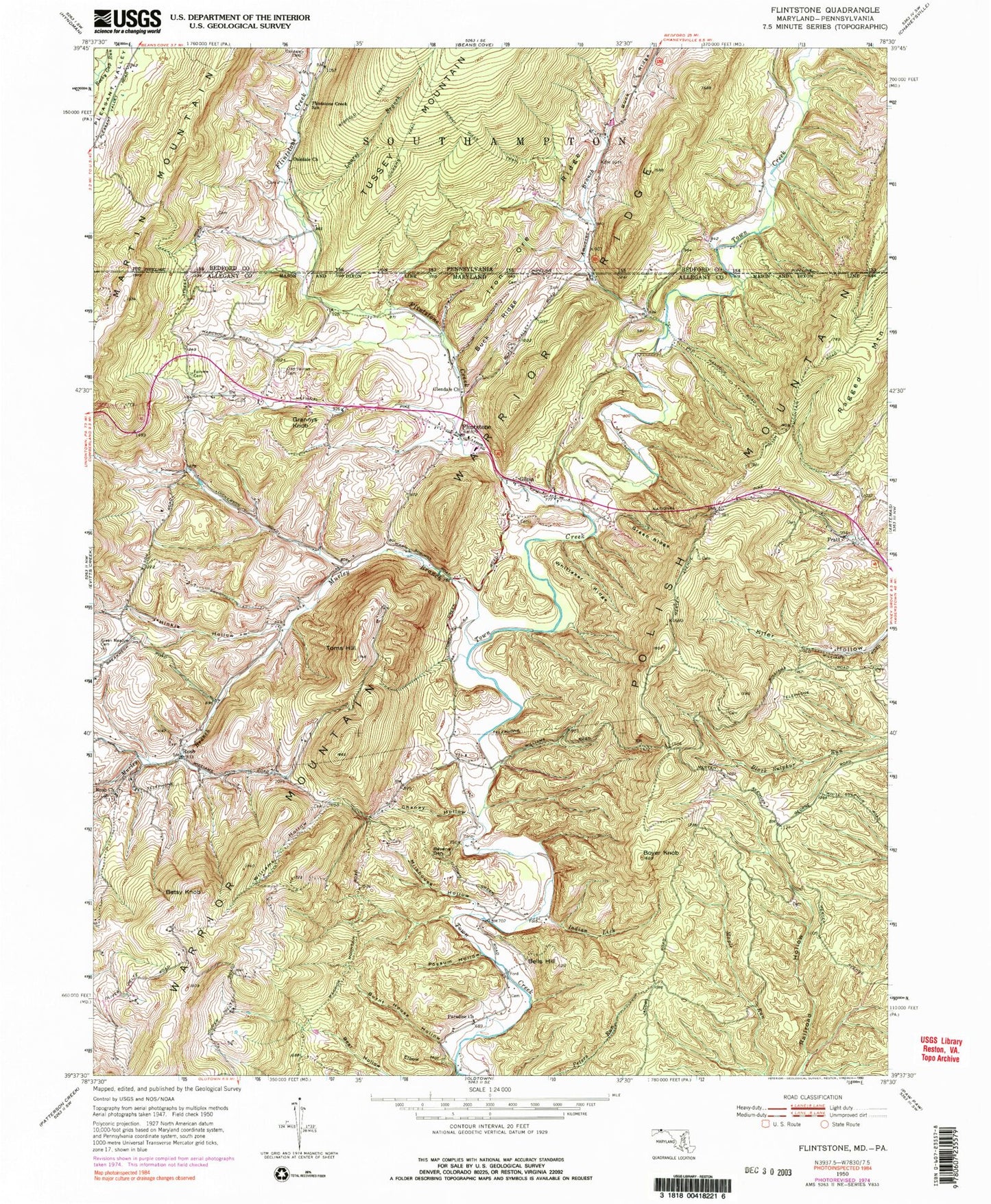
Classic USGS Flintstone Maryland 7.5'x7.5' Topo Map
Couldn't load pickup availability
Historical USGS topographic quad map of Flintstone in the states of Maryland, Pennsylvania. Typical map scale is 1:24,000, but may vary for certain years, if available. Print size: 24" x 27"
This quadrangle is in the following counties: Allegany, Bedford.
The map contains contour lines, roads, rivers, towns, and lakes. Printed on high-quality waterproof paper with UV fade-resistant inks, and shipped rolled.
Contains the following named places: Bear Hollow, Bells Hill, Boyer Knob, Buck Ridge, Burnt House Hollow, Chaney Hollow, Elbow Hollow, Fairview Cemetery, Flintstone, Flintstone Creek, Glendale Church, Green Meadow Cemetery, Green Ridge, Hinkle Hollow, Indian Lick, Lick Run, Milkhouse Hollow, Murley Branch, Paradise Church, Possum Hollow, Ravens Den, Rush Baptist Church, Toms Hill, Whittaker Ridge, Williams Hollow, Pratt, Rush, Betsy Knob, Gilpin, Grannys Knob, Martin Mountain, Polish Mountain, Don Pleasant Dam, Rainbow Lake, Amorine Branch, Browning Cemetery, Flintstone Elementary School, Flintstone Post Office, Flintstone United Methodist Church, Lashley Cemetery, Robinette Cemetery, Town Creek (historical), Murley Branch Spring, District 3 Flintstone, Rush Cemetery, Flintstone Volunteer Fire Company, Flintstone Census Designated Place, Bedrock Quarry, Maryland Natural Resource Police Western Region Town Hill Office, Amorine Branch, Iron Ore Ridge, Buck Ridge, Burnt Mills Trail, Dickens Trail, Flintstone Creek School, Martin Mountain, Oakdale Cemetery, Oakdale Church, Pleasant Valley, Wigfield Trail, Laurel Branch, Gum Spring Trail, Rice - Wilson Family Cemetery