MyTopo
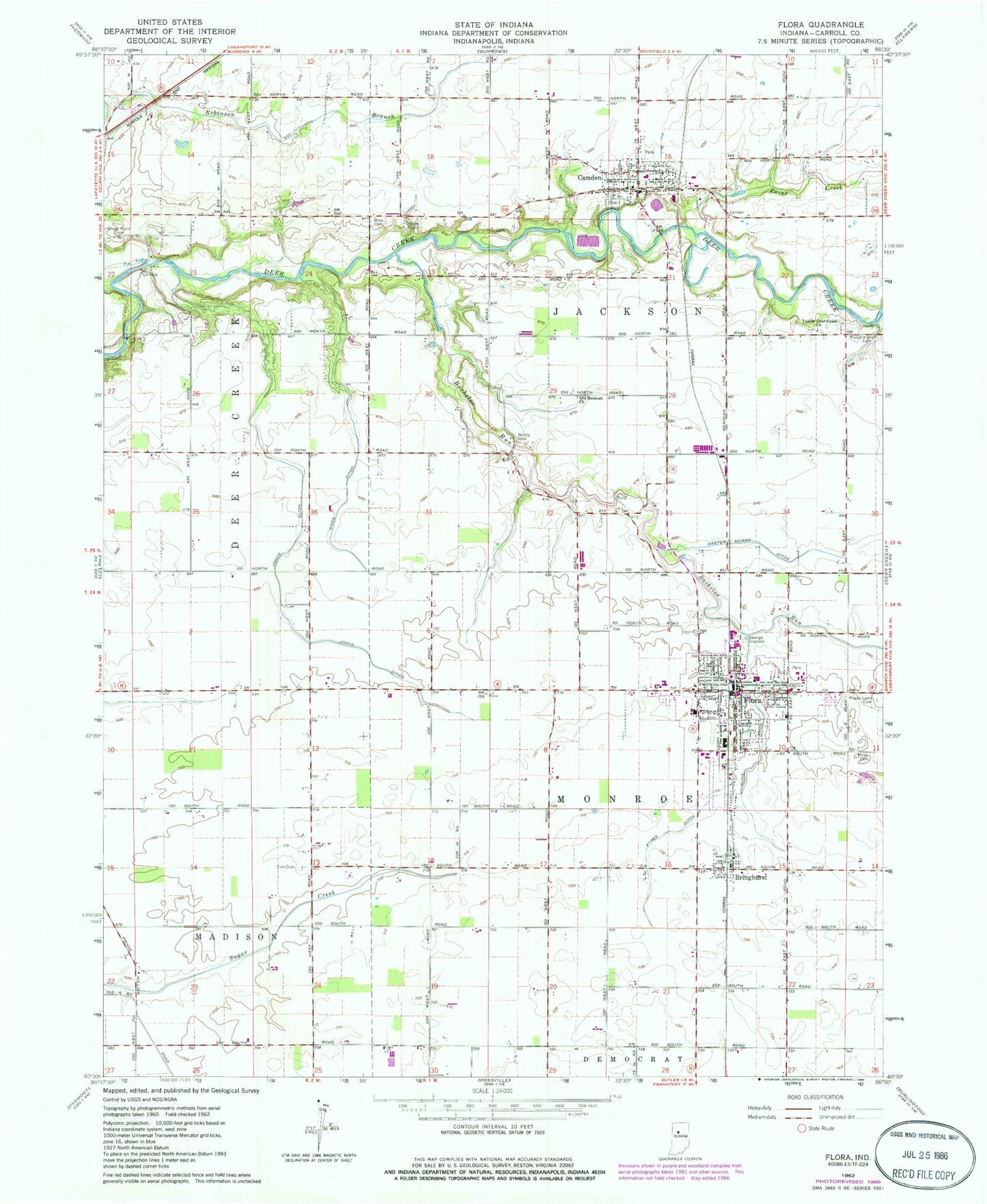
Classic USGS Flora Indiana 7.5'x7.5' Topo Map
Couldn't load pickup availability
Historical USGS topographic quad map of Flora in the state of Indiana. Map scale may vary for some years, but is generally around 1:24,000. Print size is approximately 24" x 27"
This quadrangle is in the following counties: Carroll.
The map contains contour lines, roads, rivers, towns, and lakes. Printed on high-quality waterproof paper with UV fade-resistant inks, and shipped rolled.
Contains the following named places: Ayres Ditch, Bachelor Run, Bringhurst, Bringhurst Census Designated Place, Camden, Camden - Jackson Township Volunteer Fire Department, Camden Cemetery, Camden Post Office, Carroll County, Cook Hog Farm, Flora, Flora Fire Department, Flora Municipal Airport, Flora Police Department, Flora Post Office, Johns Ditch, Kuns Ditch, Lower Deer Creek Church, Maple Lawn Cemetery, Moss Cemetery, Musselman Cemetery, Nebo Cemetery, Nettle Cemetery, Old German Church, Paint Creek, Sharp Point Cemetery, Sines Ditch, Town of Camden, Town of Flora, Township of Jackson, Township of Monroe, Wise Cemetery, Zion Cemetery, ZIP Code: 46913