MyTopo
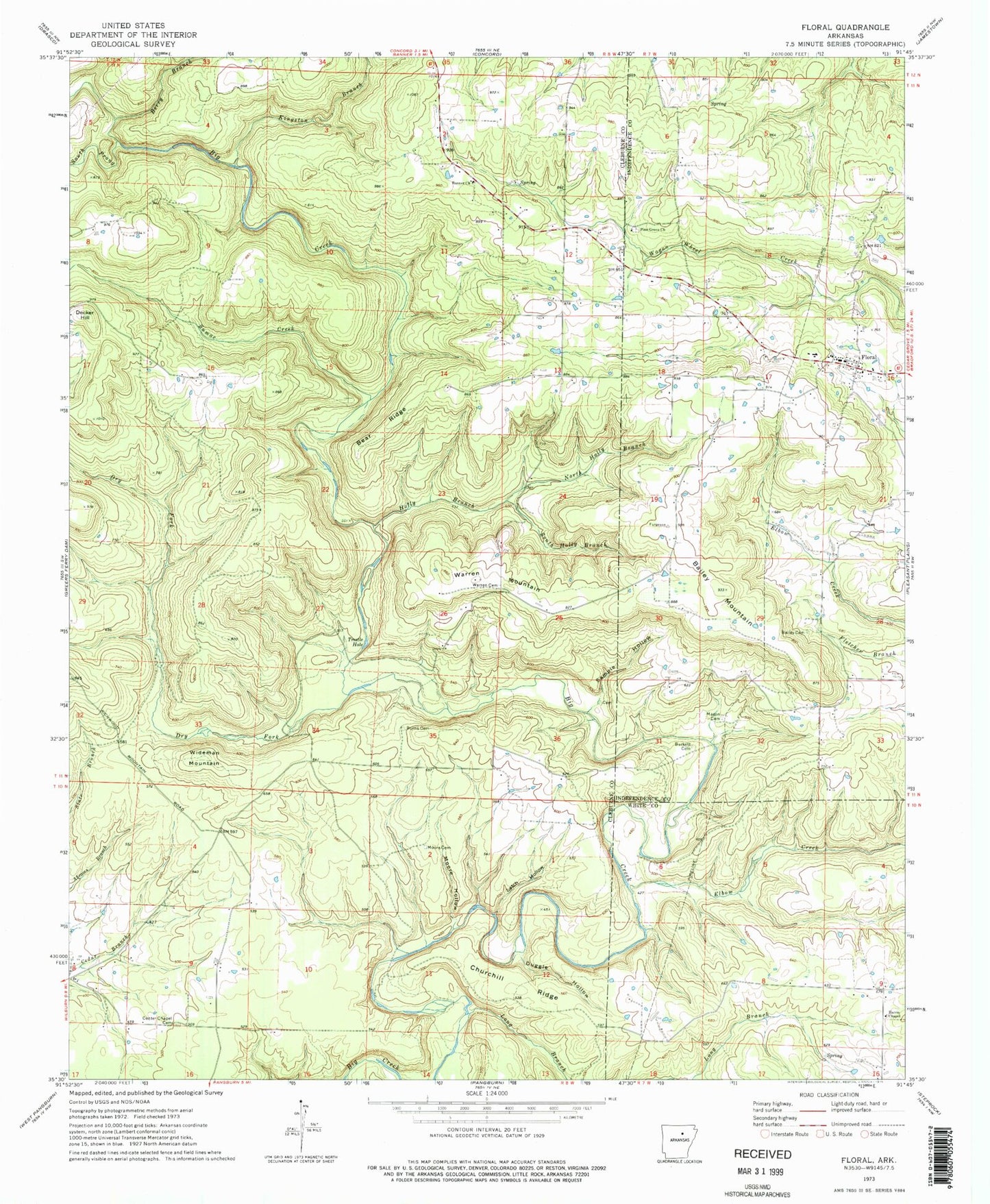
Classic USGS Floral Arkansas 7.5'x7.5' Topo Map
Couldn't load pickup availability
Historical USGS topographic quad map of Floral in the state of Arkansas. Map scale may vary for some years, but is generally around 1:24,000. Print size is approximately 24" x 27"
This quadrangle is in the following counties: Cleburne, Independence, White.
The map contains contour lines, roads, rivers, towns, and lakes. Printed on high-quality waterproof paper with UV fade-resistant inks, and shipped rolled.
Contains the following named places: Bailey Cemetery, Bailey Mountain, Banner Church, Bear Ridge, Berry Branch, Burkett Cemetery, Burns Cemetery, Center Chapel Cemetery, Center Chapel Missionary Baptist Church, Churchill Ridge, Decker Hill, Dry Fork, Duggle Hollow, Elbow Creek, Floral, Floral Baptist Church, Floral Census Designated Place, Floral Fire Station, Floral Post Office, Harris Chapel, Holly Branch, Kingston Branch, Latch Hollow, Long Branch, Mason Cemetery, Midland Elementary School, Moore Cemetery, Moore Hollow, North Holly Branch, Pine Grove Church, Sample Hollow, South Holly Branch, South Prong Big Creek, Sumac Creek, Township of Big Creek, Township of Liberty, Township of Wilburn, Trestle Hole, Tyler, Warren Cemetery, Warren Mountain, Wideman Mountain, ZIP Code: 72179