MyTopo
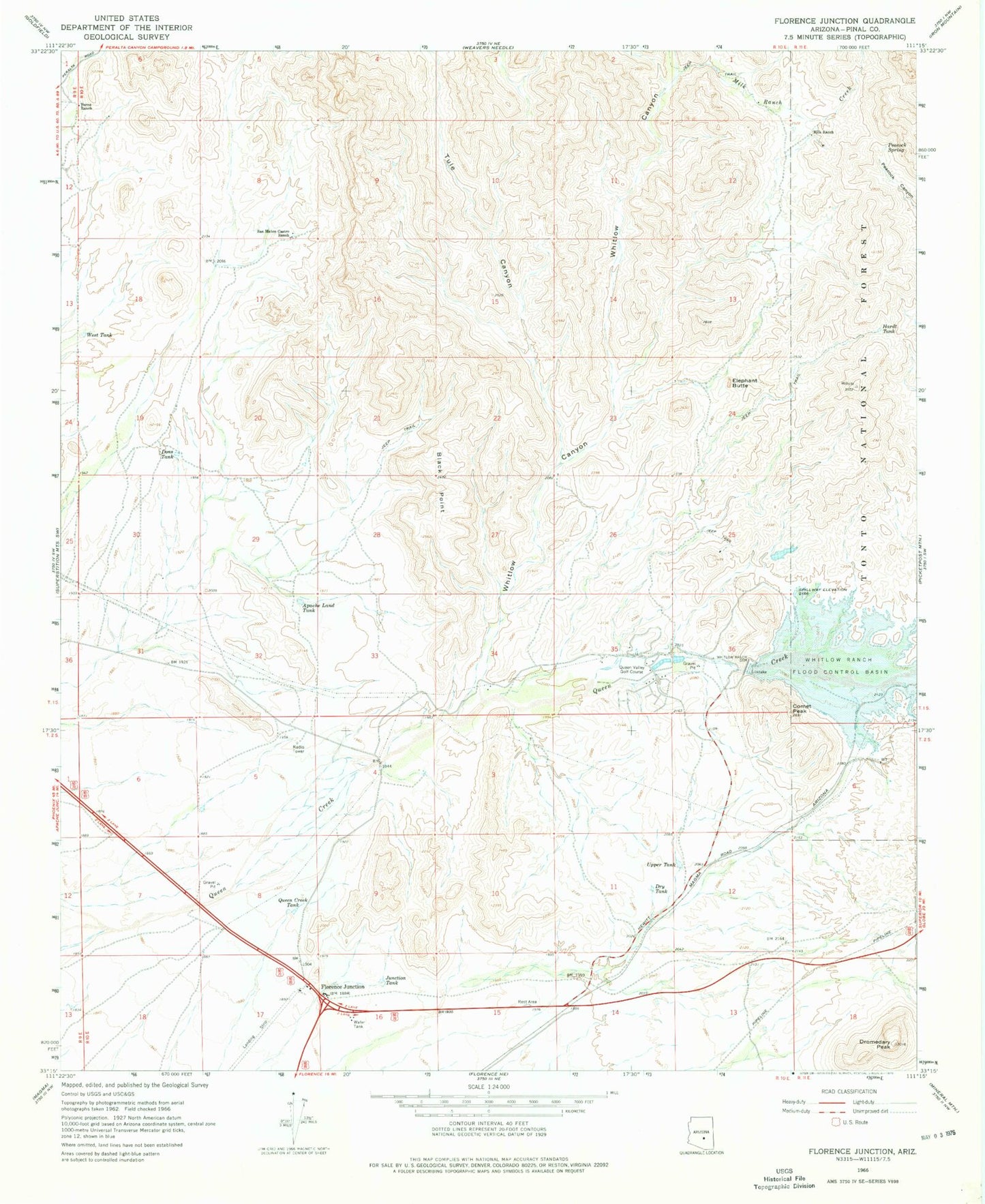
Classic USGS Florence Junction Arizona 7.5'x7.5' Topo Map
Couldn't load pickup availability
Historical USGS topographic quad map of Florence Junction in the state of Arizona. Map scale may vary for some years, but is generally around 1:24,000. Print size is approximately 24" x 27"
This quadrangle is in the following counties: Pinal.
The map contains contour lines, roads, rivers, towns, and lakes. Printed on high-quality waterproof paper with UV fade-resistant inks, and shipped rolled.
Contains the following named places: Apache Land Tank, Arizona Highway Department Florence Junction Maintenance Camp, Black Point, Burns Ranch, Comet Peak, Conley Points, Dons Tank, Dromedary Peak, Dry Tank, Elephant Butte, Florence Junction, Florence Junction Airport, Gold Camp, Hardt Tank, Junction Tank, Milk Ranch, Milk Ranch Creek, North Pinal Division, Peacock Spring, Queen Creek Tank, Queen Valley, Queen Valley Census Designated Place, Queen Valley Estates, Queen Valley Fire District, Queen Valley Golf Course, San Mateo Castro Ranch, Smelter Town, Tule Canyon, Upper Tank, West Tank, Whitlow Canyon, Whitlow Ranch Dam, Whitlow Ranch Flood Control Basin, Whitlow Tank