MyTopo
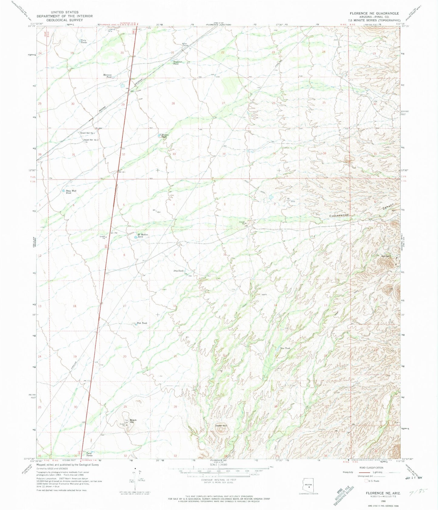
Classic USGS Florence NE Arizona 7.5'x7.5' Topo Map
Regular price
$16.95
Regular price
Sale price
$16.95
Unit price
per
Couldn't load pickup availability
Historical USGS topographic quad map of Florence NE in the state of Arizona. Map scale may vary for some years, but is generally around 1:24,000. Print size is approximately 24" x 27"
This quadrangle is in the following counties: Pinal.
The map contains contour lines, roads, rivers, towns, and lakes. Printed on high-quality waterproof paper with UV fade-resistant inks, and shipped rolled.
Contains the following named places: Arizona Highway Department Oil Storage Tanks, Black Hill, Cottonwood Canyon, Deep Well Tank, Desert Well Number One, Desert Well Number Two, Dozer Hill, Dry Tank, El Molino Tank, Magma Wash, Middle Tank, Mormon Tank, New Tank, Superior Tank, Twin Tanks, Web Tank