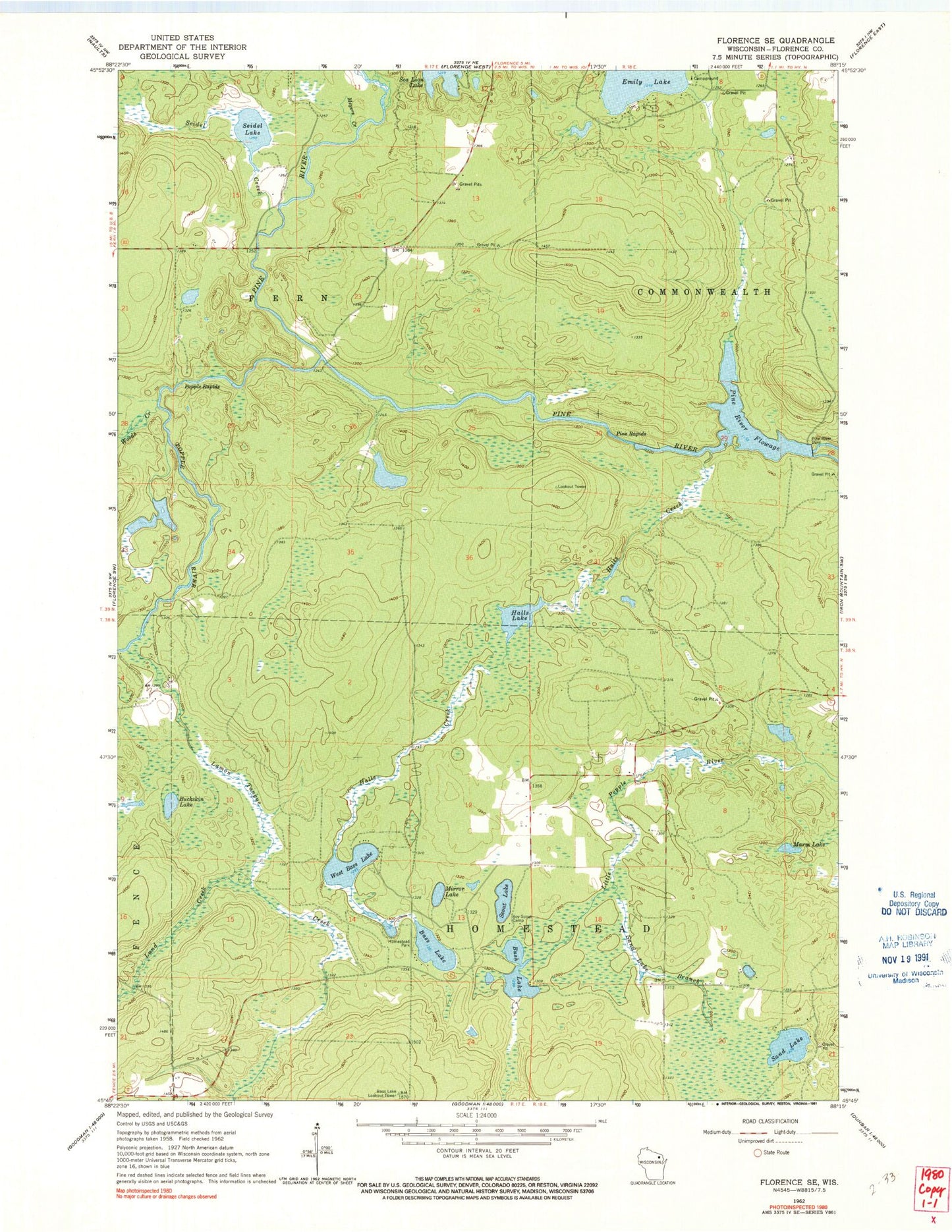
MyTopo
Classic USGS Florence SE Wisconsin 7.5'x7.5' Topo Map
Couldn't load pickup availability
Historical USGS topographic quad map of Florence SE in the state of Wisconsin. Map scale may vary for some years, but is generally around 1:24,000. Print size is approximately 24" x 27"
This quadrangle is in the following counties: Florence.
The map contains contour lines, roads, rivers, towns, and lakes. Printed on high-quality waterproof paper with UV fade-resistant inks, and shipped rolled.
Contains the following named places: Bass Lake, Bass Lake Lookout Tower, Breakwater Falls, Buckskin Lake, Bush Lake, Emily Lake, Halls Creek, Halls Creek Wildlife Flowage 3WR1799 Dam, Halls Lake, Halls Lake 4.95, Homestead Park, Jutra Lake, Lamon Tangue Creek, Little Emily Lake, Lund Creek, Marm Lake, Meyers Creek, Mirror Lake, Pine Dam, Pine Rapids, Pine River Dam, Pine River Flowage, Pine River Flowage 543, Popple Rapids, Popple River, Prairie School, Sand Lake, Sand Lake Branch, Scout Lake, Seidel Creek, Seidel Lake, Town of Fern, Town of Homestead, Township of Fern Pit, West Bass Lake, Woods Creek, ZIP Code: 54121