MyTopo
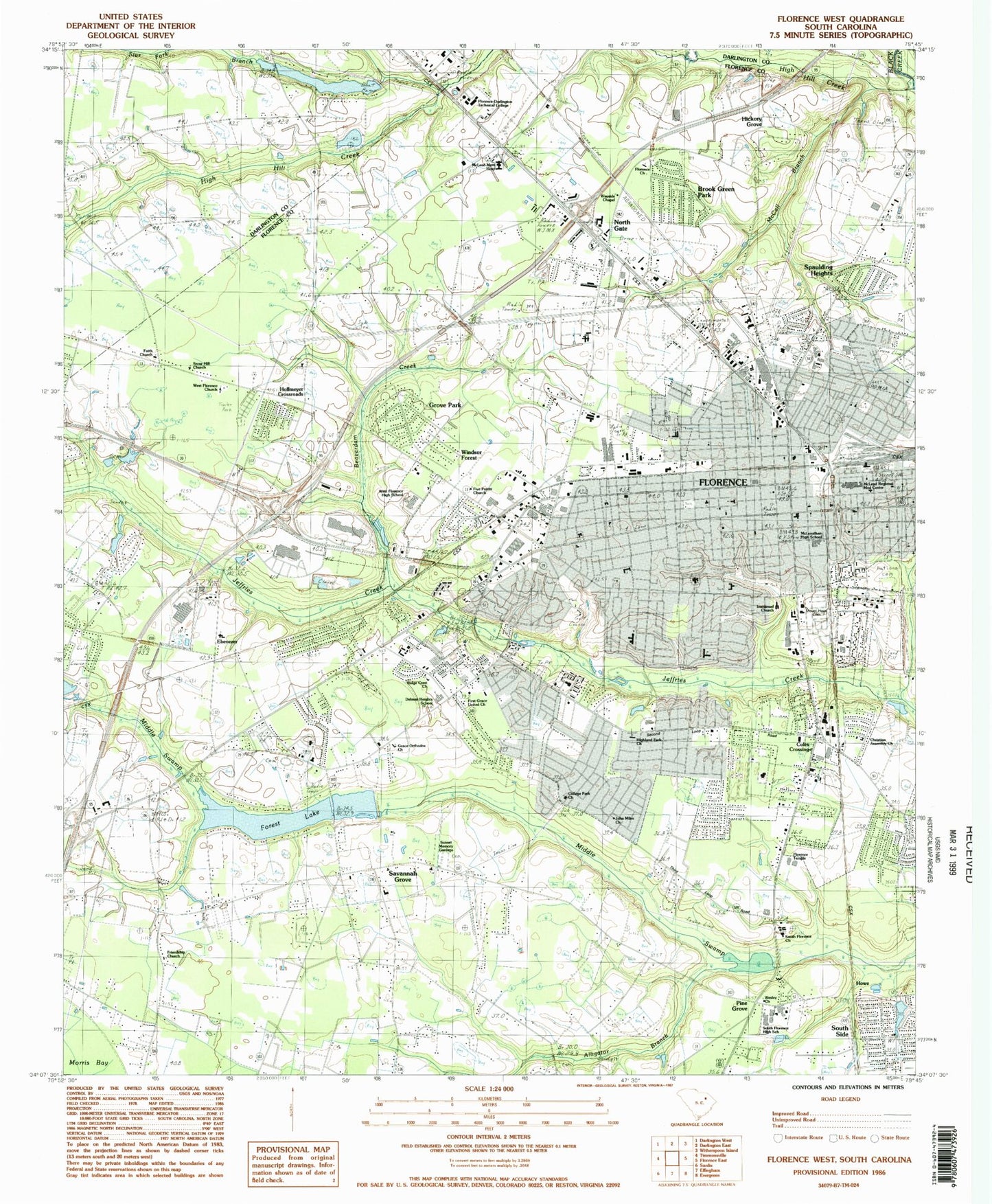
Classic USGS Florence West South Carolina 7.5'x7.5' Topo Map
Couldn't load pickup availability
Historical USGS topographic quad map of Florence West in the state of South Carolina. Map scale may vary for some years, but is generally around 1:24,000. Print size is approximately 24" x 27"
This quadrangle is in the following counties: Darlington, Florence.
The map contains contour lines, roads, rivers, towns, and lakes. Printed on high-quality waterproof paper with UV fade-resistant inks, and shipped rolled.
Contains the following named places: Alligator Branch, Alligator Lake, American Legion Stadium, Arrowood, Ashwood Estates, Bannockburn, Beaverdam Creek, Belleview, Benson Acres, Black Creek Industrial Park, Botany Acres, Briarcliff, Briggs Elementary School, Brook Green Park, Bruce Hospital, Calvary Baptist Kindergarten, Camellia Gardens, Carolina MedCare Ambulance, Carolinas Hospital System - Cedar Tower Rehabilitation Hospital, Carolinas Hospital System Medical Center, Carver Elementary School, Cashua Community Church, Central Baptist Church, Central United Methodist Church, Chase Park, Christian Assembly Church, Church of Christ, Church of Christ Holiness, Church of God by Faith Holiness, Church of Jesus, City of Florence, Clock Branch School, Cloisters, Coles Crossing, College Park, College Park Church, Colonial Forest, Country Club Estates, Country Club Forest, Crippled Childrens Home, Crossroad Center, Crownland Estates, Cumberland United Methodist Church, Cypress Point, David H McLeod Park, Deerfield, Delmar Heights, Delmar Heights School, Ebenezer, Ebenezer Baptist Church, Ebenezer Baptist Kindergarten, Ebenezer School, Elmcroft of Florence, Enchanted Meadows, Fairlane Estates, Faith Church, Federal Bureau of Investigation, Federal Florence Post Office, First Assembly of God Church, First Baptist Church, First Church of the Nazarene, First Presbyterian Church, First Southern Methodist Church, First United Pentecostal Church, Florence, Florence Business Center, Florence Career Center, Florence Christian School, Florence City Managers Office, Florence Commons, Florence Country Club, Florence County Courthouse, Florence County Emergency Medical Services, Florence County Jail, Florence Darlington Technical College Library, Florence Fire Department Station 1, Florence Fire Department Station 2, Florence Fire Department Station 3, Florence Fire Department Station 4, Florence Fire Department Station 5, Florence Industrial Park, Florence Mall Shopping Center, Florence Memorial Gardens, Florence Museum of Art Science and History, Florence National Cemetery, Florence Plaza Shopping Center, Florence Police Club House, Florence Police Department, Florence Police Department Patrol Division North Region Headquarters, Florence Police Department Patrol Division South Region Headquarters, Florence Police Neighborhood Resource Center, Florence Post Office, Florence Public Library, Florence Surgery and Laser Center, Florence Temple, Florence-Darlington Technical College, Forest Lake, Forest Lake South, Foxcroft, Freedom Florence Recreation Complex, Friendship Church, Friendship Park, Gate City Methodist Church, Grace Baptist Church, Greater Zion First African Baptist Apostolic Church, Greek Orthodox Church of Transfiguration, Grove Park, Hallmark Square Shopping Center, Harllee Natural History Museum, Harllee School, Healthsouth Rehabilitation Hospital of Florence, Hickory Grove, High Hill Creek, Highland Park, Highland Park Church, Highway Church of Christ, Hillcrest, Hoffmeyer Crossroads, Hoffmeyer Road Baptist Church, Howe, Huntington Place, Immanuel Baptist Church, Iola Jones Park, James School, Jeffries Creek Park, Kings Grant, Kirkwood, Lakeside, Lakewood, Landmark Woods, Laurelwood, Lazar Place, Lee Acres, Longleaf, Lucas Park, Magnolia Mall Shopping Center, Maple Community Center, Maple Park, Marantha Christian School, Mayfair, McCall Branch, McKenzie School, McLenalhan High School, McLeod Ambulatory Surgery Center, McLeod Infirmary, McLeod Memorial Hospital, McLeod Regional Medical Center, Medstar Ambulance Services, Moore Middle School, Mount Hope Cemetery, Muldrows Mill, Muldrows Mill Pond, Murry Pond, Murry Pond Dam D-3573, New Ebenezer Baptist Church, New Life Christian Fellowship, Nob Hill, North Gate, North Vista Cemetery, North Vista Elementary School, Northwest Community Park, Oak Forest, Palmetto Center, Palmetto School, Palmetto Shores, Palmetto Shores Lake, Peedee Agricultural Experiment Station, Physicians Surgery Center of Florence, Pine Forest Plantation, Pine Grove, Pineneedles, Pokefield School, Poynor Junior High School, Rainwater Park, Regency Hospital of South Carolina, Revell Park, Ridgecrest, Rose Hill, Royall Elementary School, Saint Anthonys School, Sandhurst, Savannah Grove, Savannah Grove Elementary School, Savannah Grove School, Siesta Village, South Carolina Industrial School, South Carolina Noname 16002 D-3556 Dam, South Carolina Noname 21002 D-3557 Dam, South Carolina Noname 21022 D-3570 Dam, South Florence High School, South Florence Post Office, South Park, South Park Shopping Center, South Point, South Side, Southside Commons, Southside Middle School, Spaulding Heights, Springdale Place, Star Fork Branch, Suburbia, Sunset Acres, Sunset Memory Gardens, Sweetbriar, Tara Hills, Tara Lake, Tara Village, Tarleton Estates, The Carolinian, Timrod Park, US Drug Enforcement Administration, US Marshal's Service, Waterford, Wesleyan School, West Florence High School, West Florence Rural Fire Department South Cashua Road Station, West Florence Volunteer Fire Department, Westside Business Center A, Westside Business Center B, Westside Business Center C, Westside Business Center D, Williams Heights, Williams Middle School, Wilson Estates, Wilson Heights, Wilson Junior High School, Windsor Forest, Wison High School, WJMX-AM (Florence), Womens Center of Carolinas Hospital System, Woodland Park, Wren Creek, WYNN-AM (Florence), WYNN-FM (Florence), ZIP Code: 29501


