MyTopo
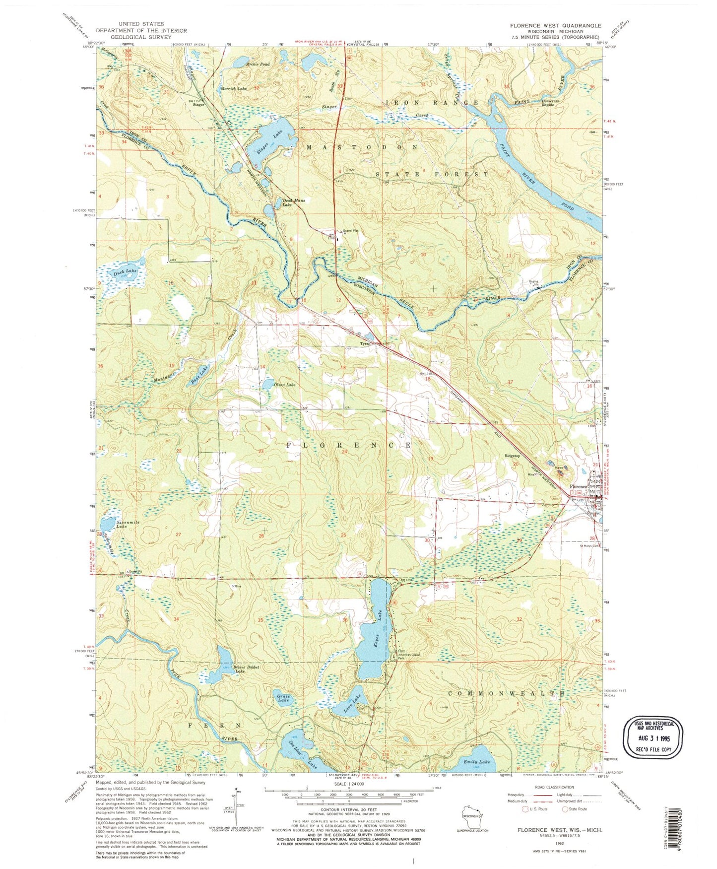
Classic USGS Florence West Wisconsin 7.5'x7.5' Topo Map
Couldn't load pickup availability
Historical USGS topographic quad map of Florence West in the states of Wisconsin, Michigan. Map scale may vary for some years, but is generally around 1:24,000. Print size is approximately 24" x 27"
This quadrangle is in the following counties: Florence, Iron.
The map contains contour lines, roads, rivers, towns, and lakes. Printed on high-quality waterproof paper with UV fade-resistant inks, and shipped rolled.
Contains the following named places: American Legion Park, Archie Pond, Bass Lake, Bessie Babbet Lake, Brule School, Dead Mans Lake, Duck Lake, Florence, Florence Fire Department, Florence Post Office, Florence Rescue Squad, Grass Lake, Horserace Rapids, Keyes Lake, Loon Lake, McGoverns Creek, Merrick Lake, Montagne Creek, Olson Lake, Paint River Pond, Ridgetop, Sea Lion Lake, Seven Springs Creek, Sevenmile Creek, Sevenmile Lake, South Slough, Stager, Stager Creek, Stager Lake, Stager Lake Park, Stager Station, Tyran