
MyTopo
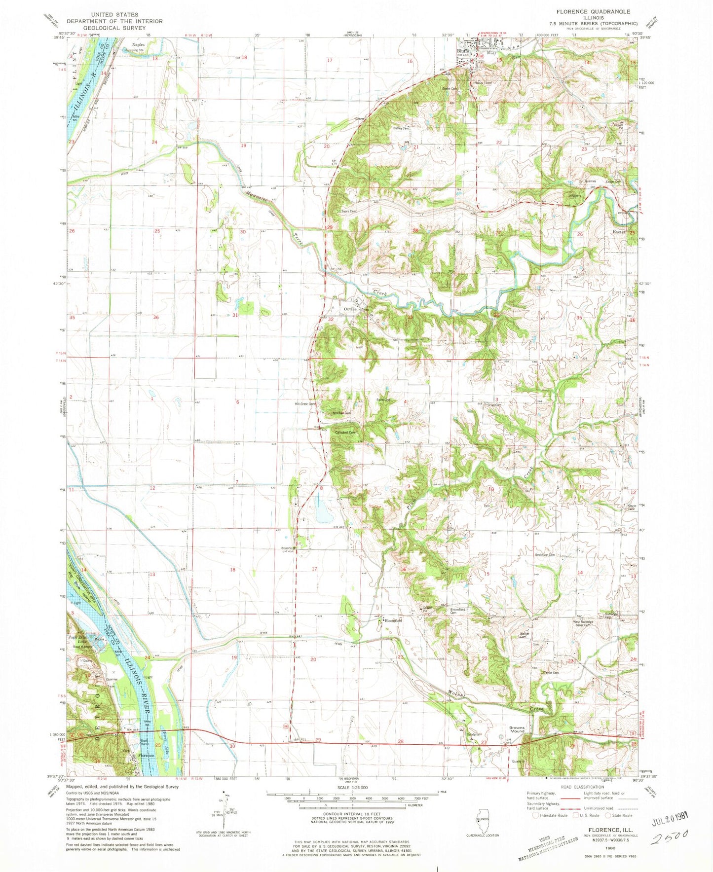
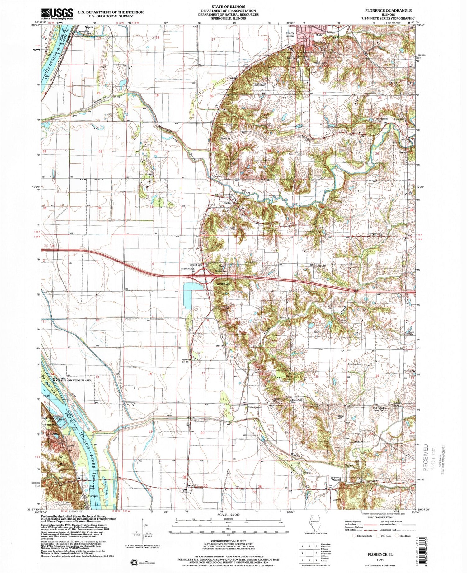
Classic USGS Florence Illinois 7.5'x7.5' Topo Map
Couldn't load pickup availability
Historical USGS topographic quad map of Florence in the state of Illinois. Map scale may vary for some years, but is generally around 1:24,000. Print size is approximately 24" x 27"
This quadrangle is in the following counties: Pike, Scott.
The map contains contour lines, roads, rivers, towns, and lakes. Printed on high-quality waterproof paper with UV fade-resistant inks, and shipped rolled.
Contains the following named places: Baird Cemetery, Baker Cemetery, Batley Cemetery, Bloomfield, Bloomfield Cemetery, Bloomfield Election Precinct, Bloomfield School, Bluffdale School, Browns Mound, Campbell Hall School, Campbell Hollow Cemetery, Crisp Cemetery, Davis Cemetery, Ellis Family Cemetery, Exeter-Bluffs Election Precinct, Ferry Lake, Florence, Florence Cemetery, Florence Quarry, Green Cemetery, Hickory School, Hillcrest Cemetery, Holloway-Walker Cemetery, Jack Ellis Lake, Knox Post Light, Maple Grove School, Mitchell Family Cemetery, Naples-Bluffs Election Precinct, North Scott Fire Protection District, Oak Hill Cemetery, Oxville, Oxville Census Designated Place, Oxville United Methodist Church, Plum Creek, Ridge School, Rutledge Cemetery, School Number 48, Sears Cemetery, Slagle Cemetery, Slim Lake, Smithson Cemetery, Taylor Cemetery, Village of Bluffs, Village of Florence, Walker Cemetery, Walnut Creek, West Hickory School, ZIP Code: 62621