MyTopo
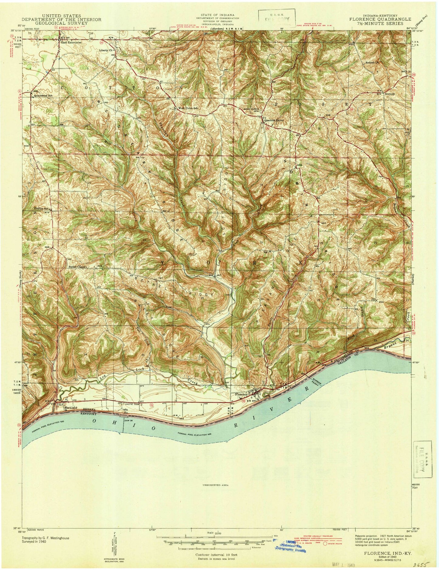
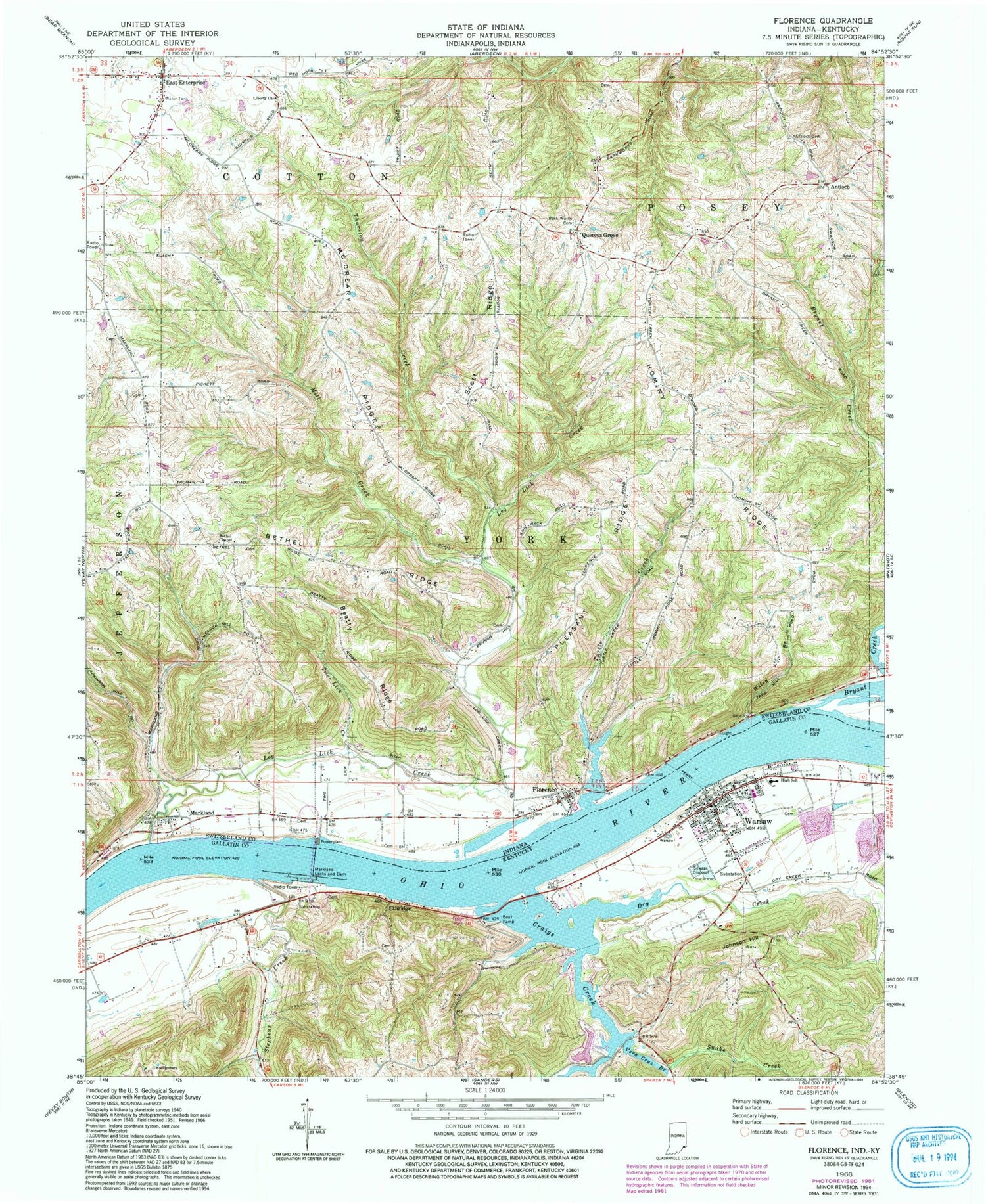
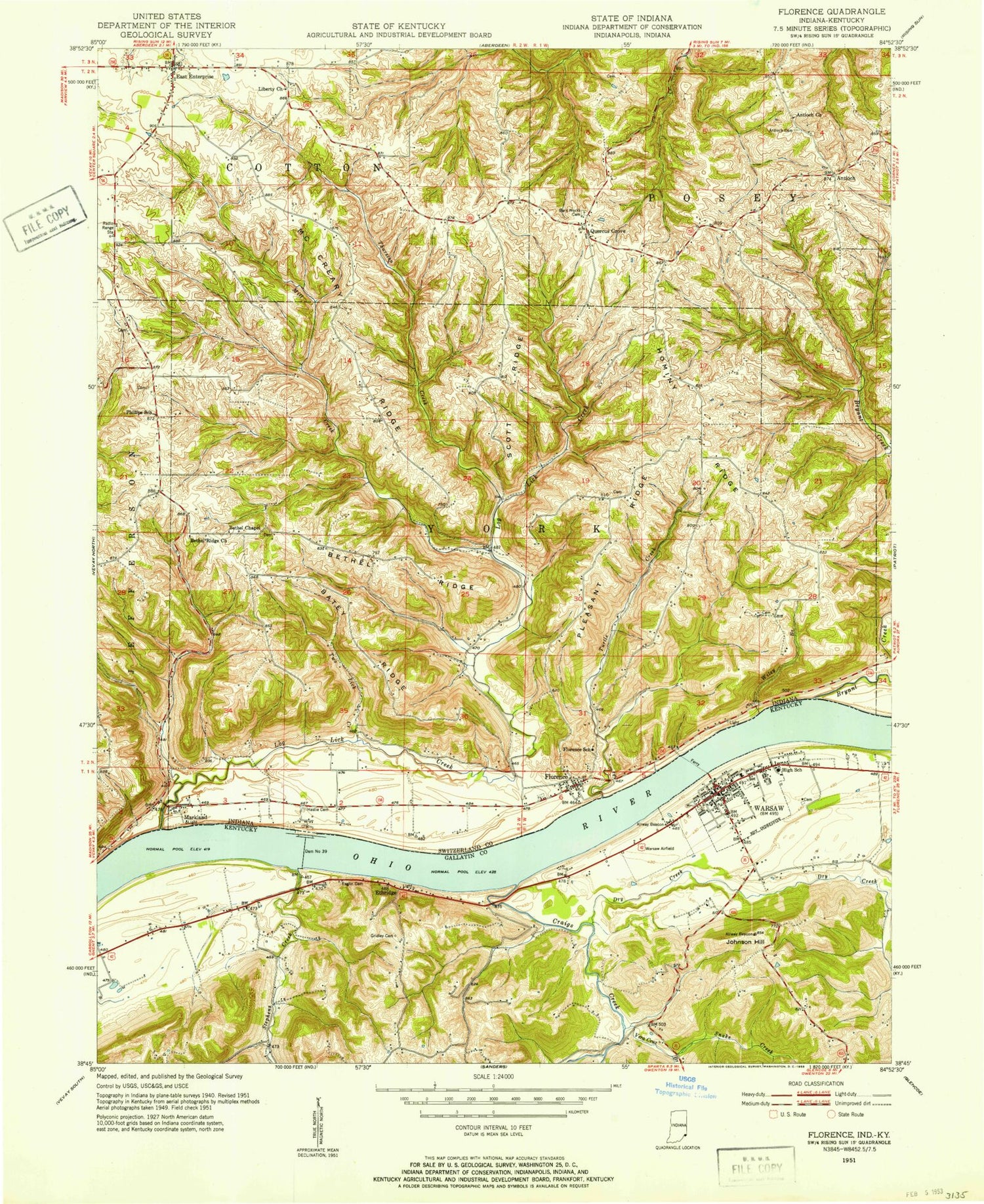
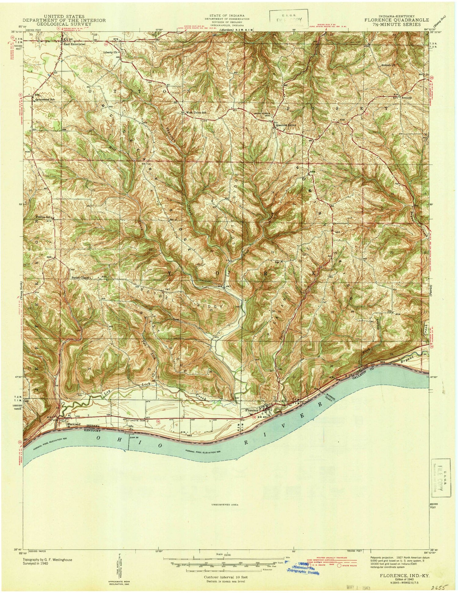
Classic USGS Florence Indiana 7.5'x7.5' Topo Map
Couldn't load pickup availability
Historical USGS topographic quad map of Florence in the states of Indiana, Kentucky. Map scale may vary for some years, but is generally around 1:24,000. Print size is approximately 24" x 27"
This quadrangle is in the following counties: Gallatin, Switzerland.
The map contains contour lines, roads, rivers, towns, and lakes. Printed on high-quality waterproof paper with UV fade-resistant inks, and shipped rolled.
Contains the following named places: Antioch, Antioch Cemetery, Beatty Ridge, Bethel Chapel, Bethel Ridge, Bryant Creek, City of Warsaw, Craigs Creek, Dry Creek, East Enterprise, East Enterprise Census Designated Place, East Enterprise Post Office, East Enterprise Volunteer Fire Department East Enterprise, East Enterprise Volunteer Fire Department Florence, East Enterprise Volunteer Fire Department Station 2, Ethridge, Florence, Florence Census Designated Place, Florence Post Office, Gallatin County Emergency Medical Services, Gallatin County Sheriff's Office, Hominy Ridge, Johnson Hill, Liberty Church, Log Lick Creek, Markland, Markland Dam, McCreary Ridge, Mill Creek, Pleasant Ridge, Quercus Grove, Quercus Grove Cemetery, Scott Ridge, Snake Creek, Stephens Creek, Thurston Creek, Township of York, Turtle Creek, Two Lick Creek, Vera Cruz Branch, Warsaw, Warsaw and Florence Ferry, Warsaw Fire Department, Warsaw Police Department, Warsaw Post Office, Wiley Branch, ZIP Code: 47020