
MyTopo
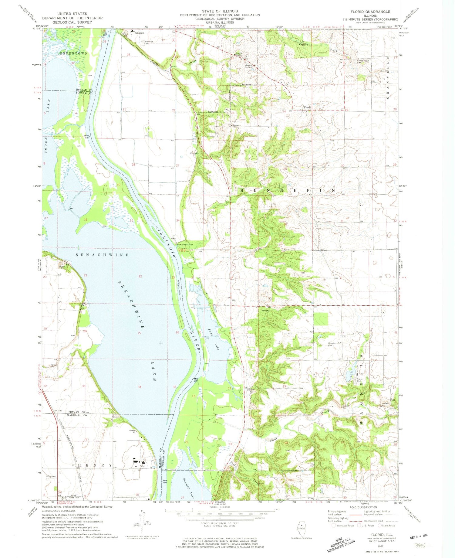
Classic USGS Florid Illinois 7.5'x7.5' Topo Map
Couldn't load pickup availability
Historical USGS topographic quad map of Florid in the state of Illinois. Map scale may vary for some years, but is generally around 1:24,000. Print size is approximately 24" x 27"
This quadrangle is in the following counties: Bureau, Marshall, Putnam.
The map contains contour lines, roads, rivers, towns, and lakes. Printed on high-quality waterproof paper with UV fade-resistant inks, and shipped rolled.
Contains the following named places: Big Bureau Creek, Clear Creek, Coffee Creek, Durley School, Fish N Fun Lake, Fish N Fun Lake Dam, Florid, Florid Cemetery, Harrison School, Hennepin Riverside Cemetery, Indian Spring, Lake Senachwine Conservation Area, Little Sister Seaplane Base, Maple Grove School, Murphy Cemetery, Poole Creek, Poole School, Putnam County, Putnam County Elementary School-Hennepin Building, Sand Prairie School, Senachwine Creek, Senachwine Lake, Sprinkleburg School, Strawn School, Swan Lake, Township of Hennepin, Undercliff, Union Grove Cemetery, Village of Hennepin, Walnut Grove, ZIP Code: 61327


