MyTopo
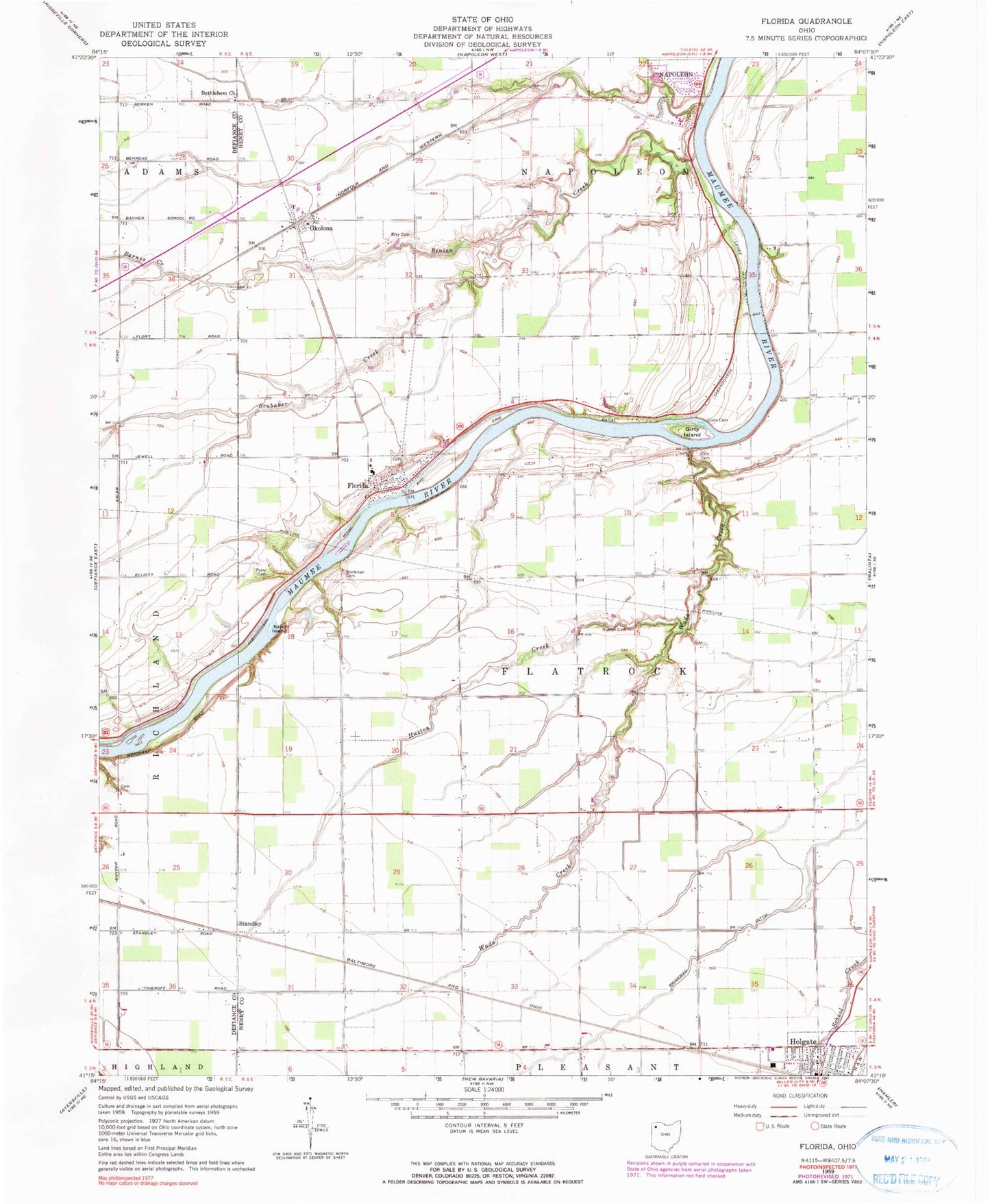
Classic USGS Florida Ohio 7.5'x7.5' Topo Map
Couldn't load pickup availability
Historical USGS topographic quad map of Florida in the state of Ohio. Map scale may vary for some years, but is generally around 1:24,000. Print size is approximately 24" x 27"
This quadrangle is in the following counties: Defiance, Henry.
The map contains contour lines, roads, rivers, towns, and lakes. Printed on high-quality waterproof paper with UV fade-resistant inks, and shipped rolled.
Contains the following named places: Barnes Creek, Benien Creek, Bethlehem Evangelical Lutheran Church, Brey Cemetery, Brinkman Cemetery, Brinkman Ditch, Brubaker Creek, Christy's Airport, Cole Cemetery, Florida, Florida - Flatrock Township Volunteer Fire Department, Florida Cemetery, Florida High School, Florida Post Office, Florida United Methodist Church, Girty Island, Gunn Cemetery, Holgate Post Office, Huston Cemetery, Huston Creek, Miami and Erie Canal, Okolona, Okolona Post Office, Parry Cemetery, Saint Peter Evangelical Lutheran Church, Saint Peters Evangelical Lutheran Church, Sand Island, Standley, Township of Flatrock, Village of Florida, Wade Creek, WNDH-FM (Napoleon)